Fraud Blocker Skip to main content

Home > Europe > Portugal > Maps

Maps Collection (page 2)

Portugal is a country located in the southwest corner of Europe, and is bordered by Spain to the north and east, and the Atlantic Ocean to the south and west

400 items

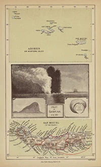
Background imageMaps Collection: Islet of Sabrina (engraving)

Islet of Sabrina (engraving)
8676227 Islet of Sabrina (engraving) by Pritchett, Robert (1828-1907); Private Collection; (add.info.: Islet of Sabrina, Azores)

Background imageMaps Collection: The itinerary of Fernand de Magellan (1480-1521, Portuguese explorer) through the Pacific Ocean

The itinerary of Fernand de Magellan (1480-1521, Portuguese explorer) through the Pacific Ocean
NWI4848537 The itinerary of Fernand de Magellan (1480-1521, Portuguese explorer) through the Pacific Ocean, during his tour of the world maritime (the first circumnavigation) from 1519 to 1522

Background imageMaps Collection: Geographic map of Spain and Portugal after the fall of the Caliphate of Cordoba in 1030

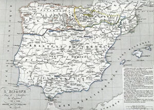
Geographic map of Spain and Portugal after the fall of the Caliphate of Cordoba in 1030
ELD4924745 Geographic map of Spain and Portugal after the fall of the Caliphate of Cordoba in 1030, the conquest Almoravide and the Battle of the Navas de Tolosa in 1212 (Al-Andalus)

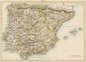
Background imageMaps Collection: Map of Spain and Portugal, circa 1870. 19th century lithography

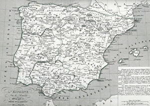
Map of Spain and Portugal, circa 1870. 19th century lithography
NWI4871948 Map of Spain and Portugal, circa 1870. 19th century lithography.; (add.info.: Map of Spain and Portugal, circa 1870. 19th century lithography.); Photo © North Wind Pictures

Background imageMaps Collection: Map of the Iberic peninsula (Spain and Portugal), 15th century

Map of the Iberic peninsula (Spain and Portugal), 15th century
NWI4871818 Map of the Iberic peninsula (Spain and Portugal), 15th century.; (add.info.: Map of the Iberic peninsula (Spain and Portugal), 15th century.); Photo © North Wind Pictures

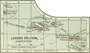
Background imageMaps Collection: Map of Azores Islands, c.1900 (engraving)

Map of Azores Islands, c.1900 (engraving)
533297 Map of Azores Islands, c.1900 (engraving); (add.info.: Map of Azores Islands (Portuguese), circa 1900, from the 10th edition of Encyclopaedia Britannica.); Encyclopaedia Britannica/UIG

Background imageMaps Collection: Map of European odds on the Atlantic Ocean, including Gibraltar, Portugal, Spain, England

Map of European odds on the Atlantic Ocean, including Gibraltar, Portugal, Spain, England, Ireland and Iceland
AIS5350370 Map of European odds on the Atlantic Ocean, including Gibraltar, Portugal, Spain, England, Ireland and Iceland, as well as North Africa

Background imageMaps Collection: Map of Spain from the Visigoths period (585) to the Arabs invasion (756), 6th-8th century

Map of Spain from the Visigoths period (585) to the Arabs invasion (756), 6th-8th century
ELD4927909 Map of Spain from the Visigoths period (585) to the Arabs invasion (756), 6th-8th century (Map of Spain from the reign of Visigoths to arab invasion (Umayyad conquest of Hispania)

Background imageMaps Collection: Portolan Map of the Mediterranean and connecting seas

Portolan Map of the Mediterranean and connecting seas
3507730 Portolan Map of the Mediterranean and connecting seas; (add.info.: Portolan Map of the Mediterranean and connecting seas)

Background imageMaps Collection: Chart of the coasts of Spain and Portugal, from Cape Pinas to the Strait of Gibraltar

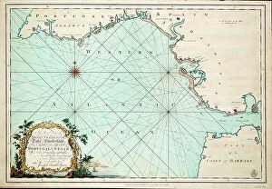
Chart of the coasts of Spain and Portugal, from Cape Pinas to the Strait of Gibraltar
7339357 Chart of the coasts of Spain and Portugal, from Cape Pinas to the Strait of Gibraltar, constructed and carefully drawn from the most recent observations made by the officers of the French

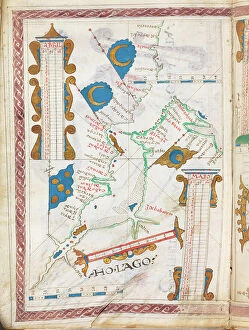
Background imageMaps Collection: Ho Lago. 1 of 24 charts of the world including several calendars and tables. 1550-60 (vellum)

Ho Lago. 1 of 24 charts of the world including several calendars and tables. 1550-60 (vellum)
7342522 Ho Lago. 1 of 24 charts of the world including several calendars and tables. 1550-60 (vellum) by Portuguese School, (16th century); 24x17 cm; National Maritime Museum, London

Background imageMaps Collection: Map of Spain with Portugal and Andorra, c.1900 (engraving)

Map of Spain with Portugal and Andorra, c.1900 (engraving)
532952 Map of Spain with Portugal and Andorra, c.1900 (engraving); (add.info.: Map of Spain with Portugal and Andorra, with insets of the Azores Islands, Canary Islands, and Madeira Island)

Background imageMaps Collection: Scale: [ca. 1:14 500 000]. Additional Places: Persian Gulf, Gulf of Oman. c.1550-60 (vellum)

Scale: [ca. 1:14 500 000]. Additional Places: Persian Gulf, Gulf of Oman. c.1550-60 (vellum)
7339614 Scale: [ca. 1:14 500 000]. Additional Places: Persian Gulf, Gulf of Oman. c.1550-60 (vellum) by Portuguese School, (16th century); 24x17 cm; National Maritime Museum, London

Background imageMaps Collection: Persia, 1554 (vellum)

Persia, 1554 (vellum)
7339640 Persia, 1554 (vellum) by Agnese, Battista (c.1500-64); 26x40 cm; National Maritime Museum, London, UK; (add.info.: Creator: Battista Agnese Bound sheet. Col. ms. Medium: Vellum. Scale: [ca)

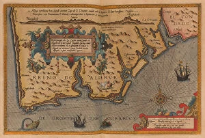
Background imageMaps Collection: A description of the sea coastes, of the land of Algarbe, and a parte of the Condado with their

A description of the sea coastes, of the land of Algarbe, and a parte of the Condado with their shew & opening
7340014 A description of the sea coastes, of the land of Algarbe, and a parte of the Condado with their shew & opening, c.1588 (drawing) by Janszoon Waghenaer

Background imageMaps Collection: Map of Spain at the times of Germanic Hispania, 409-585 (Map of Spain at the times of Germanic)

Map of Spain at the times of Germanic Hispania, 409-585 (Map of Spain at the times of Germanic Hispania)
ELD4927919 Map of Spain at the times of Germanic Hispania, 409-585 (Map of Spain at the times of Germanic Hispania) Engraving from " Atlas Universel" by Houze

Background imageMaps Collection: Chart of the coast of Portugal and Spain, from Cape St Vincent's to Gibralter, 1773 (engraving)

Chart of the coast of Portugal and Spain, from Cape St Vincent's to Gibralter, 1773 (engraving)
7339506 Chart of the coast of Portugal and Spain, from Cape St Vincent's to Gibralter, 1773 (engraving) by Speer, Joseph Smith (fl.1773); 49x71 cm; National Maritime Museum, London

Background imageMaps Collection: Map of the Iberic peninsula under the Moors (Arab Muslim domination)

Map of the Iberic peninsula under the Moors (Arab Muslim domination), at the beginning of the 13th century
NWI4871927 Map of the Iberic peninsula under the Moors (Arab Muslim domination), at the beginning of the 13th century. 19th century lithography.; (add.info)

Background imageMaps Collection: Geographic map of Spain and Portugal under the Caliphate of Cordoba between 756 and 1030

Geographic map of Spain and Portugal under the Caliphate of Cordoba between 756 and 1030 (Al-Andalus)
ELD4924771 Geographic map of Spain and Portugal under the Caliphate of Cordoba between 756 and 1030 (Al-Andalus, Iberic peninsula under Muslim domination)

Background imageMaps Collection: Map of the near east, 1570 (engraving)

Map of the near east, 1570 (engraving)
2912265 Map of the near east, 1570 (engraving); (add.info.: Map of the near east by Fern£o Vaz Dourado (c. 1520 - c. 1580), a Portuguese cartographer of the sixteenth century

Background imageMaps Collection: Chart of the harbour of Rio de Janeiro, Brazil, c.1849 (pen, ink)

Chart of the harbour of Rio de Janeiro, Brazil, c.1849 (pen, ink)
7295643 Chart of the harbour of Rio de Janeiro, Brazil, c.1849 (pen, ink) by Fanshawe, Admiral Sir Edward Gennys (1814-1906); 47.7x45.3 cm; National Maritime Museum, London

Background imageMaps Collection: Geography : map representing the Americas with the traces of the voyages of the navigator

Geography : map representing the Americas with the traces of the voyages of the navigator Christopher Columbus to
VEN5031147 Geography : map representing the Americas with the traces of the voyages of the navigator Christopher Columbus to the New World.; (add.info)

Background imageMaps Collection: Azores Corvo and Flores. Surveyed by Capt. A.T.E Vidal R.N 1844. 1849-73 (print)

Azores Corvo and Flores. Surveyed by Capt. A.T.E Vidal R.N 1844. 1849-73 (print)
7340636 Azores Corvo and Flores. Surveyed by Capt. A.T.E Vidal R.N 1844. 1849-73 (print) by Walker, J. & C. (19th century); 44.5x59 cm; National Maritime Museum, London

Background imageMaps Collection: Geographic map of Spain and Portugal under the Romans, 409 AD (Map of Spain)

Geographic map of Spain and Portugal under the Romans, 409 AD (Map of Spain)
ELD4924796 Geographic map of Spain and Portugal under the Romans, 409 AD (Map of Spain and Portugal at the times of roman reign 109 AD) Engraving from " Atlas Universel" by Houze

Background imageMaps Collection: Geographic map of Spain and Portugal at the time of the reconquista from the Battle of Las Navas

Geographic map of Spain and Portugal at the time of the reconquista from the Battle of Las Navas de Tolosa in 1212 to
ELD4924729 Geographic map of Spain and Portugal at the time of the reconquista from the Battle of Las Navas de Tolosa in 1212 to the fall of Granada in 1492 (Al-Andalus)

Background imageMaps Collection: Map of the Iberian Peninsula (Kingdom of Spain and Aragon and Portugal) in the 14th and 15th century

Map of the Iberian Peninsula (Kingdom of Spain and Aragon and Portugal) in the 14th and 15th century
NWI4869685 Map of the Iberian Peninsula (Kingdom of Spain and Aragon and Portugal) in the 14th and 15th century. Lithograph of the 19th century; (add.info)

Background imageMaps Collection: MAGELLAND, Ferdinand (1480-1521). English navigator and discoverer

MAGELLAND, Ferdinand (1480-1521). English navigator and discoverer. Portrait of Ferdinand Magellan. Litography
CUL4866747 MAGELLAND, Ferdinand (1480-1521). English navigator and discoverer. Portrait of Ferdinand Magellan. Litography.; (add.info.: MAGELLAND, Ferdinand (1480-1521)

Background imageMaps Collection: Map of Africa after the discoveries of Vasco de Gama (1469-1524)

Map of Africa after the discoveries of Vasco de Gama (1469-1524, Portuguese explorer) around Africa, around 1487
NWI4848506 Map of Africa after the discoveries of Vasco de Gama (1469-1524, Portuguese explorer) around Africa, around 1487, with the passage of the Cape of Good Esperance (South Africa)

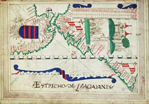
Background imageMaps Collection: Geographic map of South America, showing Brazil, Patagonia, Tierra del Fuego and Magellan Detroit

Geographic map of South America, showing Brazil, Patagonia, Tierra del Fuego and Magellan Detroit
NWI4846782 Geographic map of South America, showing Brazil, Patagonia, Tierra del Fuego and Magellan Detroit, printed in Lisbon (Portugal) in 1571

Background imageMaps Collection: Portugese Navigational Map of the North Atlantic, 1630

Portugese Navigational Map of the North Atlantic, 1630
2902820 Portugese Navigational Map of the North Atlantic, 1630; (add.info.: Portugese Navigational Map of the North Atlantic, 1630.); Buyenlarge Archive/UIG

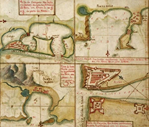
Background imageMaps Collection: Ports in the West Indies, 1630

Ports in the West Indies, 1630
2902885 Ports in the West Indies, 1630; (add.info.: Ports in the West Indies, 1630.); Buyenlarge Archive/UIG

Background imageMaps Collection: Portuguese Map of the Red Sea, The Middle east, 1630

Portuguese Map of the Red Sea, The Middle east, 1630
2902267 Portuguese Map of the Red Sea, The Middle east, 1630; (add.info.: Portuguese Map of the Red Sea, The Middle east, 1630.); Buyenlarge Archive/UIG

Background imageMaps Collection: Map of Lisbon, Portugal capital, engraving, 17th century

Map of Lisbon, Portugal capital, engraving, 17th century
1754203 Map of Lisbon, Portugal capital, engraving, 17th century; (add.info.: Map of Lisbon, Portugal capital, engraving, 17th century); Photo: Tallandier

Background imageMaps Collection: Primary cities of Europe, their population and degree of trade of individual states (print)

Primary cities of Europe, their population and degree of trade of individual states (print)
6202957 Primary cities of Europe, their population and degree of trade of individual states (print; (add.info.: CARTOGRAPHY "Primary cities of Europe)

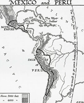
Background imageMaps Collection: Map of Mexico and Peru, showing the Aztec Empire and the Inca Empire. (print)

Map of Mexico and Peru, showing the Aztec Empire and the Inca Empire. (print)
7420055 Map of Mexico and Peru, showing the Aztec Empire and the Inca Empire. (print); (add.info.: Map of Mexico and Peru, showing the Aztec Empire and the Inca Empire)

Background imageMaps Collection: Oversize atlas titled Speculum nauticum super navigatione maris occidentalis confectu

Oversize atlas titled Speculum nauticum super navigatione maris occidentalis confectu
7342714 Oversize atlas titled Speculum nauticum super navigatione maris occidentalis confectu, continens omnes oras maritimas Galliae, Hispaniae, and praecipuarum partium Angliae'

Background imageMaps Collection: Bound in an atlas of twenty-five charts with diagrams and tables. Portuguese or Spanish

Bound in an atlas of twenty-five charts with diagrams and tables. Portuguese or Spanish. 1550-60 (bound sheet)
7339617 Bound in an atlas of twenty-five charts with diagrams and tables. Portuguese or Spanish. 1550-60 (bound sheet) by Unknown Artist, (16th century); 2.4x17 cm; National Maritime Museum, London

Background imageMaps Collection: Map of the Portuguese Colonial Dominions in India and the Malay Archipelago, 1498 -1580

Map of the Portuguese Colonial Dominions in India and the Malay Archipelago, 1498 -1580, 1923 (engraving)
2603519 Map of the Portuguese Colonial Dominions in India and the Malay Archipelago, 1498 -1580, 1923 (engraving); (add.info.: From Historical Atlas, published 1923.)

Background imageMaps Collection: Map of the island of Madere (Portuguese island of the Atlantic Ocean), circa 1870

Map of the island of Madere (Portuguese island of the Atlantic Ocean), circa 1870. 19th century lithography
NWI4871697 Map of the island of Madere (Portuguese island of the Atlantic Ocean), circa 1870. 19th century lithography.; (add.info)

Background imageMaps Collection: Magellan's boats arrived at Mactan, an island in the Philippines, where he was killed in 1521

Magellan's boats arrived at Mactan, an island in the Philippines, where he was killed in 1521. Engraving
NWI4902737 Magellan's boats arrived at Mactan, an island in the Philippines, where he was killed in 1521. Engraving. Magellan's ships landing at Mactan, an island in the Philippines

Background imageMaps Collection: Map of the world showing the colonial possessions, England, France, Portugal

Map of the world showing the colonial possessions, England, France, Portugal
ELD4932191 Map of the world showing the colonial possessions, England, France, Portugal, Spain and their colonies Engraving from "History of the world" by Ridpath 1885 Private collection;

Background imageMaps Collection: Portuguese Navigational Map of Caribbean Ports, 1630

Portuguese Navigational Map of Caribbean Ports, 1630
2902886 Portuguese Navigational Map of Caribbean Ports, 1630; (add.info.: Portuguese Navigational Map of Caribbean Ports, 1630.); Buyenlarge Archive/UIG

Background imageMaps Collection: Map of Cape Verde Islands, c.1900 (engraving)

Map of Cape Verde Islands, c.1900 (engraving)
533379 Map of Cape Verde Islands, c.1900 (engraving); (add.info.: Map of Cape Verde Islands, circa 1902, from the 10th edition of Encyclopaedia Britannica.); Encyclopaedia Britannica/UIG

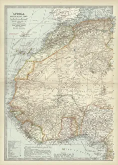
Background imageMaps Collection: Map of northwestern Africa, c.1900 (engraving)

Map of northwestern Africa, c.1900 (engraving)
533056 Map of northwestern Africa, c.1900 (engraving); (add.info.: Map of northwest Africa with Morocco, Algeria, Tunis, Sahara, Senegal, Portuguese Guinea, circa 1902)

Background imageMaps Collection: marquis of Pombal looking at the maps to rebuild Lisbon after earthquake in 1755, engraving

marquis of Pombal looking at the maps to rebuild Lisbon after earthquake in 1755, engraving, 19th century
1754204 marquis of Pombal looking at the maps to rebuild Lisbon after earthquake in 1755, engraving, 19th century; (add.info)

Background imageMaps Collection: Map, Afrique Equatoriale; L'Ouest Africain, 1914. Creator: Unknown

Map, Afrique Equatoriale; L'Ouest Africain, 1914. Creator: Unknown
Map, Afrique Equatoriale; L'Ouest Africain, 1914. From "Grande Geographie Bong Illustree", 1914

Background imageMaps Collection: Map of Afrique showing Possessions et protectorats d'Europe, 1914. Creator: Unknown

Map of Afrique showing Possessions et protectorats d'Europe, 1914. Creator: Unknown
Map of Afrique showing Possessions et protectorats d'Europe, 1914. From "Grande Geographie Bong Illustree", 1914

Background imageMaps Collection: Topographic map of Spain and Portugal, lithograph, published in 1897

Topographic map of Spain and Portugal, lithograph, published in 1897
Topographic map of Spain and Portugal. Lithograph, published in 1897


All Professionally Made to Order for Quick Shipping


-

Maps Collection

Portugal is a country located in the southwest corner of Europe, and is bordered by Spain to the north and east, and the Atlantic Ocean to the south and west. Maps of Portugal are useful for travelers who wish to explore this beautiful country. They provide an overview of Portugal's geography, including its major cities, rivers, mountain ranges, and coastal areas. Additionally they can show visitors attractions such as museums, monuments, parks, beaches and other points of interest. It also help travelers plan their route around Portugal by providing information on roads and highways as well as public transportation options like buses or trains. With a map in hand travelers can easily navigate their way around this fascinating country with ease.
+

Our beautiful Wall Art and Photo Gifts include Framed Prints, Photo Prints, Poster Prints, Canvas Prints, Jigsaw Puzzles, Metal Prints and so much more

The Maps of Portugal Europe collection is a stunning assortment of wall art and framed prints that showcase the geography, history, and culture of Portugal. This exquisite collection features a wide range of maps that depict different regions, cities, landmarks, and historical events in Portugal. From vintage maps dating back to the 16th century to modern-day cartography, our collection offers something for everyone who loves Portuguese history or wants to add an elegant touch to their home decor. Each map in our collection is carefully selected by our team of experts who ensure that only high-quality prints are included. The Maps of Portugal Europe collection includes various sizes and styles ranging from colorful antique-style maps with intricate details to minimalist black-and-white designs perfect for contemporary interiors. Whether you're looking for a unique gift or want to decorate your living room with beautiful artwork inspired by Portuguese culture and heritage, the Maps of Portugal Europe collection has something special for you.
+

What are Maps of Portugal Europe art prints?

Maps of Portugal Europe art prints are high-quality reproductions of antique and contemporary maps of Portugal, a country located in southwestern Europe. These art prints showcase the geography, topography, cities, towns and landmarks of Portugal with intricate details that make them both informative and decorative. These maps can be used to decorate homes or offices while also serving as educational tools for those interested in Portuguese history or geography. They come in various sizes and styles to suit different tastes and preferences. Some Maps of Portugal Europe art prints feature vintage designs that offer a glimpse into the past while others display modern cartographic techniques that highlight current political boundaries, transportation networks, natural resources among other features. These art prints are perfect for anyone who wants to add some sophistication to their living space or office while also celebrating the rich culture and heritage of Portugal.
+

What Maps of Portugal Europe art prints can I buy from Media Storehouse?

We offer a wide range of Maps of Portugal Europe art prints for purchase. These maps showcase the intricate details and features of Portugal, including its cities, regions, and topography. You can choose from a variety of styles and designs to suit their personal preferences or home decor. Some popular options include antique-style maps that feature hand-drawn illustrations and historical information about Portugal's past. Other contemporary designs showcase vibrant colors and modern typography for a more updated look. In addition to traditional paper prints, Media Storehouse also offers canvas prints that add texture and depth to any room. These high-quality reproductions are perfect for adding a touch of sophistication to your living space or office. Whether you're looking for a unique gift or simply want to decorate your own walls with beautiful artwork, we have plenty of Maps of Portugal Europe art prints available for purchase.
+

How do I buy Maps of Portugal Europe art prints?

To buy Maps of Portugal Europe art prints from Media Storehouse, you can browse our extensive collection of high-quality images online. Simply search for "Maps of Portugal" or "Europe art prints" on our website and select the image that catches your eye. Once you have found the perfect print, choose the size and format that suits your needs best - whether it be a canvas, framed print or poster. After selecting your preferred options, add the item to your cart and proceed to checkout. You will then be prompted to enter your payment details and shipping information before completing the purchase. We offer a wide range of beautiful artwork featuring maps of Portugal and other European countries. Their prints are perfect for adding a touch of sophistication to any room in your home or office, making them an ideal gift for friends and family who love travel or geography.
+

How much do Maps of Portugal Europe art prints cost?

We offer a wide range of Maps of Portugal Europe art prints that are available at different prices. The cost of these prints may vary depending on the size and type of print you choose. We have a selection of high-quality paper prints, canvas prints, and framed prints to suit your preferences. Our Maps of Portugal Europe art prints feature detailed maps showcasing the beautiful country's regions, cities, towns, and landmarks. These pieces make great additions to any home or office decor and can also be used as educational tools for students studying geography or history. We take pride in providing our customers with affordable yet top-notch quality products that meet their needs. Our collection is constantly updated with new designs to ensure that there is always something fresh for everyone. If you're looking for stunning Maps of Portugal Europe art prints without breaking the bank, we have got you covered.
+

How will my Maps of Portugal Europe art prints be delivered to me?

We take great care in delivering your Maps of Portugal Europe art prints to you. Your order will be carefully packaged and shipped using a reliable delivery service. We use high-quality materials to ensure that your print arrives in perfect condition. Once your order has been processed, we will send you an email confirmation with the expected delivery date. You can also track the progress of your shipment online using the tracking number provided. We offer a range of shipping options to suit your needs, including standard and express delivery services. Our team is dedicated to ensuring that your order is delivered on time and in excellent condition. If you have any questions or concerns about the delivery of your Maps of Portugal Europe art prints, please do not hesitate to contact us for assistance. We are always happy to help.