Fraud Blocker Skip to main content

Home > Europe > Malta > Maps

Maps Collection

Maps of Malta Europe are a great way to explore the island nation located in the Mediterranean Sea

Choose a picture from our Maps Collection for your Wall Art and Photo Gifts

106 items

Background imageMaps Collection: Justus Danckers's atlas: Hungary and Greece, c.1688 (coloured engraving)

Justus Danckers's atlas: Hungary and Greece, c.1688 (coloured engraving)
7340066 Justus Danckers's atlas: Hungary and Greece, c.1688 (coloured engraving) by Danckertsz, Justus (1635-1701); 50x59 cm; National Maritime Museum, London

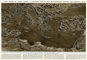
Background imageMaps Collection: Panoramic map of Mediterranean by G. H. Davis

Panoramic map of Mediterranean by G. H. Davis
A new centre of world alarm during the Second World War: a panoramic map of the Mediterranean, showing the principal bases

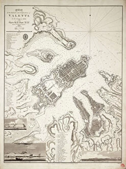
Background imageMaps Collection: Plan of the harbours and fortifications of Valetta in the island of Malta, c.1821 (engraving)

Plan of the harbours and fortifications of Valetta in the island of Malta, c.1821 (engraving)
7339531 Plan of the harbours and fortifications of Valetta in the island of Malta, c.1821 (engraving) by Smyth, William Henry (1788-1865); 62x47 cm; National Maritime Museum, London

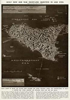
Background imageMaps Collection: Map of Sicily by G. H. Davis

Map of Sicily by G. H. Davis
A contour map of Sicily, giving the shortest air distances from Cape Bon and Malta. At this stage in the Second World War it was a British front-line objective in Axis eyes

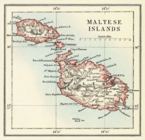
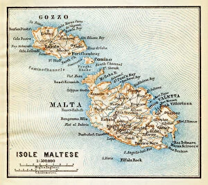
Background imageMaps Collection: Maltese islands map 1883

Maltese islands map 1883
Encyclopedia Britannica 9th Edition New York Samuel L. Hall 1883 Vol XV

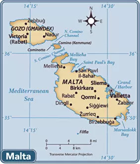
Background imageMaps Collection: Malta country map

Malta country map
2011 edition

Background imageMaps Collection: Siege of Malta, detail from the Galleria delle Carte Geografiche, 1580-83

Siege of Malta, detail from the Galleria delle Carte Geografiche, 1580-83
XIR259885 Siege of Malta, detail from the Galleria delle Carte Geografiche, 1580-83 (fresco) (see also 260199) by Italian School, (16th century); Vatican Museums and Galleries

Background imageMaps Collection: The British Channel with a part of the Atlantic Ocean and of the Coast of Ireland, 1788 (print)

The British Channel with a part of the Atlantic Ocean and of the Coast of Ireland, 1788 (print)
7340084 The British Channel with a part of the Atlantic Ocean and of the Coast of Ireland, 1788 (print) by Sayer, Robert (1724/5-94); 44.2x92.9 cm; National Maritime Museum, London

Background imageMaps Collection: Siege of Malta: Valletta (Valletta), late 16th century (oil on canvas)

Siege of Malta: Valletta (Valletta), late 16th century (oil on canvas)
MMM5457818 Siege of Malta: Valletta (Valletta), late 16th century (oil on canvas); National Maritime Museum, London, UK; (add.info.: Siege of Malta: Valletta (Valletta), September 13, 1565

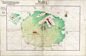
Background imageMaps Collection: Map of Malta, 1554 (vellum)

Map of Malta, 1554 (vellum)
7339642 Map of Malta, 1554 (vellum) by Agnese, Battista (c.1500-64); 60x40 cm; National Maritime Museum, London, UK; (add.info.: Creator: Battista Agnese); © National Maritime Museum, Greenwich

Background imageMaps Collection: Chart of Malta, 1801 (print)

Chart of Malta, 1801 (print)
7339256 Chart of Malta, 1801 (print) by Serres, John Thomas (1759-1825); 70x63.6 cm; National Maritime Museum, London, UK; (add.info.: Creator: R)

Background imageMaps Collection: Map of the islands of Malta and Gozo, circa 1870. 19th century lithography

Map of the islands of Malta and Gozo, circa 1870. 19th century lithography
NWI4871696 Map of the islands of Malta and Gozo, circa 1870. 19th century lithography.; (add.info.: Map of the islands of Malta and Gozo, circa 1870)

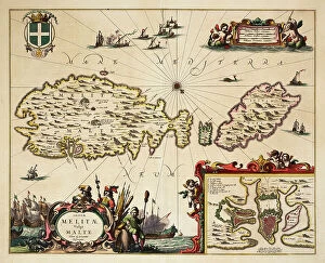
Background imageMaps Collection: Map of Malta and Gozo, c.1650 (coloured engraving)

Map of Malta and Gozo, c.1650 (coloured engraving)
7339535 Map of Malta and Gozo, c.1650 (coloured engraving) by Unknown Artist, (17th century); 46x57 cm; National Maritime Museum, London

Background imageMaps Collection: map of the city The Valetta on the island of Malta c. 1625, engraving

map of the city The Valetta on the island of Malta c. 1625, engraving
1748758 map of the city The Valetta on the island of Malta c. 1625, engraving; (add.info.: map of the city The Valetta on the island of Malta c. 1625, engraving); Photo: Tallandier

Background imageMaps Collection: Plan of the Fountain of Arethusa on Orhtygia Island, Syracuse, 1778. Creator: Louis Ducros

Plan of the Fountain of Arethusa on Orhtygia Island, Syracuse, 1778. Creator: Louis Ducros
Plan of the Fountain of Arethusa on Orhtygia Island, Syracuse, 1778. Drawing from the album Voyage to Italy, Sicily and Malta

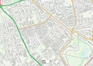
Background imageMaps Collection: Liverpool L8 8 Map

Liverpool L8 8 Map
Postcode Sector Map of Liverpool L8 8

Background imageMaps Collection: Malta island map - Lithograph Map Published 1890, Leipzig for 'Italie

Malta island map - Lithograph Map Published 1890, Leipzig for "Italie. Manuel du Voyageur" by Karl Baedeker

Background imageMaps Collection: Gibraltar, Malta, and Ionian Isles 1851

Gibraltar, Malta, and Ionian Isles 1851
A fine facimile artworked from an antique original map of Gibraltar, Malta and Ionian Isles, issued as part of the 1851 edition of John Tallis and Companys " The Illustrated Atlas

Background imageMaps Collection: Barnsley S70 4 Map

Barnsley S70 4 Map
Postcode Sector Map of Barnsley S70 4

Background imageMaps Collection: Hampshire RG24 9 Map

Hampshire RG24 9 Map
Postcode Sector Map of Hampshire RG24 9

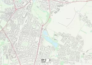
Background imageMaps Collection: Cambridge CB1 3 Map

Cambridge CB1 3 Map
Postcode Sector Map of Cambridge CB1 3

Background imageMaps Collection: Naval victory of Don Garcia de Toledo in Malta (Biccherna), 1565 (oil on panel)

Naval victory of Don Garcia de Toledo in Malta (Biccherna), 1565 (oil on panel)
885914 Naval victory of Don Garcia de Toledo in Malta (Biccherna), 1565 (oil on panel) by Italian School, (16th century); Archivio di Stato, Siena

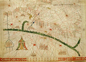
Background imageMaps Collection: North Africa, from a nautical atlas, 1520 (ink on vellum) (detail from 330916)

North Africa, from a nautical atlas, 1520 (ink on vellum) (detail from 330916)
XOT330918 North Africa, from a nautical atlas, 1520 (ink on vellum) (detail from 330916) by Giovanni Xenodocus da Corfu (fl. 16th Century); Museo Correr, Venice, Italy; Greek, out of copyright

Background imageMaps Collection: 13863147

13863147

Background imageMaps Collection: 13828431

13828431

Background imageMaps Collection: map of italy 1855

map of italy 1855
an old map of southern italy (inset showing malta) - 1855

Background imageMaps Collection: The Three Master George off Valetta Harbour, Malta, 1820 (pen, ink and w / c)

The Three Master George off Valetta Harbour, Malta, 1820 (pen, ink and w / c)
6431045 The Three Master George off Valetta Harbour, Malta, 1820 (pen, ink and w/c) by Cammillieri of Malta, Nicolas (c.1798-c.1856); Private Collection

Background imageMaps Collection: Turkish Crimean War Medal 1854-1856, Private John Connors VC

Turkish Crimean War Medal 1854-1856, Private John Connors VC, 3rd (The East Kent) Regiment of Foot (The Buffs). (metal)
5925146 Turkish Crimean War Medal 1854-1856, Private John Connors VC, 3rd (The East Kent) Regiment of Foot (The Buffs). (metal) by British School, (19th century); National Army Museum

Background imageMaps Collection: Malte (engraving)

Malte (engraving)
7158226 Malte (engraving) by French School, (19th century); Private Collection; (add.info.: Malte, Bastion de Santa-Barbara)

Background imageMaps Collection: Malta: Parade Ground, Floriana (b / w photo)

Malta: Parade Ground, Floriana (b / w photo)
7156416 Malta: Parade Ground, Floriana (b/w photo) by European Photographer, (19th century); Private Collection; (add.info.: Parade Ground, Floriana)

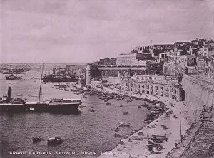
Background imageMaps Collection: Malta: Grand Harbour showing Upper Barracca (b / w photo)

Malta: Grand Harbour showing Upper Barracca (b / w photo)
7156398 Malta: Grand Harbour showing Upper Barracca (b/w photo) by European Photographer, (19th century); Private Collection; (add.info.: Grand Harbour showing Upper Barracca)

Background imageMaps Collection: The Guillaume Tell being Engaged by the H. M. S. Penelope and H

The Guillaume Tell being Engaged by the H. M. S. Penelope and H. M.s Loin of Malta during the Blockade
6431044 The Guillaume Tell being Engaged by the H.M.S.Penelope and H.M.S Loin of Malta during the Blockade, 30th March 1800 (oil on canvas) by Schetky, John Christian (1778-1874); Private Collection

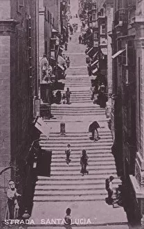
Background imageMaps Collection: Malta: Strada Santa Lucia (b / w photo)

Malta: Strada Santa Lucia (b / w photo)
7156413 Malta: Strada Santa Lucia (b/w photo) by European Photographer, (19th century); Private Collection; (add.info.: Strada Santa Lucia)

Background imageMaps Collection: Malta: Porta Reale Ditch, showing Dockyard, Creek, and Cottonera Hospital (b / w photo)

Malta: Porta Reale Ditch, showing Dockyard, Creek, and Cottonera Hospital (b / w photo)
7156406 Malta: Porta Reale Ditch, showing Dockyard, Creek, and Cottonera Hospital (b/w photo) by European Photographer, (19th century); Private Collection; (add.info.: Porta Reale Ditch)

Background imageMaps Collection: Malta: Entrance to Marsamuscetto Harbour, showing English Church (b / w photo)

Malta: Entrance to Marsamuscetto Harbour, showing English Church (b / w photo)
7156394 Malta: Entrance to Marsamuscetto Harbour, showing English Church (b/w photo) by European Photographer, (19th century); Private Collection; (add.info.: Entrance to Marsamuscetto Harbour)

Background imageMaps Collection: Malta: The Grainaries, Floriana (b / w photo)

Malta: The Grainaries, Floriana (b / w photo)
7156415 Malta: The Grainaries, Floriana (b/w photo) by European Photographer, (19th century); Private Collection; (add.info.: The Grainaries, Floriana)

Background imageMaps Collection: Malta: Marsamuscetto Landing Place (b / w photo)

Malta: Marsamuscetto Landing Place (b / w photo)
7156396 Malta: Marsamuscetto Landing Place (b/w photo) by European Photographer, (19th century); Private Collection; (add.info.: Marsamuscetto Landing Place)

Background imageMaps Collection: British Possessions in Europe (colour litho)

British Possessions in Europe (colour litho)
7169498 British Possessions in Europe (colour litho) by English School, (20th century); Private Collection; (add.info.: British Possessions in Europe)

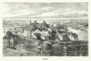
Background imageMaps Collection: Malta (engraving)

Malta (engraving)
7180814 Malta (engraving) by English School, (19th century); Private Collection; (add.info.: Malta. Illustration for Half Hours in the Holy Land by Norman Macleod (William Isbister)

Background imageMaps Collection: Malta: The Marina (b / w photo)

Malta: The Marina (b / w photo)
7156402 Malta: The Marina (b/w photo) by European Photographer, (19th century); Private Collection; (add.info.: The Marina)

Background imageMaps Collection: Malta: Entrance to Grand Harbour (b / w photo)

Malta: Entrance to Grand Harbour (b / w photo)
7156397 Malta: Entrance to Grand Harbour (b/w photo) by European Photographer, (19th century); Private Collection; (add.info.: Entrance to Grand Harbour)

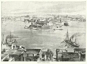
Background imageMaps Collection: Fort St Angelo, Malta (engraving)

Fort St Angelo, Malta (engraving)
7161073 Fort St Angelo, Malta (engraving) by English School, (19th century); Private Collection; (add.info.: Fort St Angelo, Malta)

Background imageMaps Collection: Malta: Maltese Lady (b / w photo)

Malta: Maltese Lady (b / w photo)
7156414 Malta: Maltese Lady (b/w photo) by European Photographer, (19th century); Private Collection; (add.info.: Maltese Lady)

Background imageMaps Collection: Map of Tarn-et-Garonne with a view of Montauban and portraits of Ingres

Map of Tarn-et-Garonne with a view of Montauban and portraits of Ingres and Jean Parisot de La Valette (colour litho)
PCT3482842 Map of Tarn-et-Garonne with a view of Montauban and portraits of Ingres and Jean Parisot de La Valette (colour litho) by French School

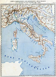
Background imageMaps Collection: Cartography Hydrographic and Orographic Map of Italy, 1853 (colour litho)

Cartography Hydrographic and Orographic Map of Italy, 1853 (colour litho)
6203313 Cartography Hydrographic and Orographic Map of Italy, 1853 (colour litho) by Italian School, (19th century); (add.info.: CARTOGRAPHY " Hydrographic and orographic map of Italy)

Background imageMaps Collection: St Paul on Malta after his shipwreck (engraving)

St Paul on Malta after his shipwreck (engraving)
7172489 St Paul on Malta after his shipwreck (engraving) by European School, (17th century); Private Collection; (add.info.: St Paul on Malta after his shipwreck (Acts 28)

Background imageMaps Collection: Malta: St Johns Church (b / w photo)

Malta: St Johns Church (b / w photo)
7156409 Malta: St Johns Church (b/w photo) by European Photographer, (19th century); Private Collection; (add.info.: St Johns Church)

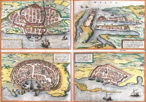
Background imageMaps Collection: Plan of Cagliari (Calaris), Sardinia (Italy), Malta (Malta)

Plan of Cagliari (Calaris), Sardinia (Italy), Malta (Malta)
LRI4708517 Plan of Cagliari (Calaris), Sardinia (Italy), Malta (Malta), Rhodes (Rhodus) and Famagusta (Famaugusta), Cyprus (etching, 1572-1617) by Hogenberg


All Professionally Made to Order for Quick Shipping


-

Maps Collection

Maps of Malta Europe are a great way to explore the island nation located in the Mediterranean Sea. The maps provide an overview of the country's geography, including its capital city Valletta, its two main islands (Malta and Gozo), and its many smaller islands. They also show major roads and highways, as well as important landmarks such as churches, fortresses, monuments, and other points of interest. Additionally, they provide information on climate zones and natural features like beaches, mountains, rivers and lakes. With these maps one can easily plan a trip to Malta or simply learn more about this fascinating country.
+

Our beautiful pictures are available as Framed Prints, Photos, Wall Art and Photo Gifts

The Maps of Malta Europe collection is a stunning array of wall art and framed prints that showcase the beauty and history of Malta. Our collection features a range of maps, including vintage maps from the 16th century to modern-day satellite imagery, all capturing the unique geography and topography of this Mediterranean island nation. Each print in our collection is expertly crafted using high-quality materials to ensure longevity and durability. The prints are available in various sizes, making them perfect for any room or space. Whether you're looking to add some character to your home or office decor or simply want to celebrate your love for Malta, these beautiful prints are sure to impress. From intricate details like street names and landmarks to sweeping views of the coastline, each map offers a glimpse into this fascinating country's rich cultural heritage. If you're looking for an eye-catching piece of wall art that celebrates one of Europe's most captivating destinations, look no further than the Maps of Malta Europe collection from Media Storehouse.
+

What are Maps of Malta Europe art prints?

Maps of Malta Europe art prints are high-quality reproductions of vintage and contemporary maps depicting the Maltese archipelago, located in the Mediterranean Sea. These prints showcase the intricate details and geographical features of Malta, including its cities, towns, villages, coastlines, harbours and landmarks. These art prints are perfect for those who have a passion for geography or history or simply want to add a touch of sophistication to their home decor. They can be framed and hung on walls or displayed on shelves as standalone pieces. Maps of Malta Europe art prints come in various sizes and styles to suit different preferences. Some feature colourful illustrations while others are more minimalist with black-and-white designs. Regardless of style, these prints offer an excellent way to appreciate the beauty and uniqueness of this small but fascinating island nation. Maps of Malta Europe art prints provide a stunning visual representation that captures both the historical significance and natural beauty of this European gem.
+

What Maps of Malta Europe art prints can I buy from Media Storehouse?

We offer a wide range of Maps of Malta Europe art prints that are perfect for anyone who loves geography or history. These maps showcase the beautiful island nation of Malta, which is located in the Mediterranean Sea and has a rich cultural heritage dating back thousands of years. Some of the most popular Maps of Malta Europe art prints available from Media Storehouse include antique maps that show the island's topography, as well as more modern maps that highlight its cities and landmarks. You can also find detailed nautical charts that depict Malta's coastline and surrounding waters. Whether you're looking to decorate your home or office with a unique piece of artwork, or simply want to add to your collection of historical maps, we have something for everyone. With high-quality printing and materials, these Maps of Malta Europe art prints are sure to impress anyone who sees them.
+

How do I buy Maps of Malta Europe art prints?

To buy Maps of Malta Europe art prints from Media Storehouse, you can browse our extensive collection online. Simply search for "Maps of Malta" in the search bar on our website and select the print that catches your eye. Once you have found a print that you like, click on it to view more details about the product. You will then be able to choose from various sizes and framing options for your chosen print. Add it to your cart and proceed to checkout where you will be prompted to enter your payment information. We offer high-quality art prints that are perfect for adding a touch of elegance and sophistication to any room in your home or office. Our easy-to-use website makes it simple for anyone to find and purchase beautiful artwork without leaving their home. So why wait? Start browsing today.
+

How much do Maps of Malta Europe art prints cost?

We offer a wide range of Maps of Malta Europe art prints that vary in price depending on the size and type of print you choose. Our collection includes high-quality prints featuring detailed maps of Malta and other parts of Europe, which are perfect for adding a touch of sophistication to any room or office space. Our prices are competitive and affordable, making it easy for anyone to purchase one or more Maps of Malta Europe art prints without breaking the bank. We take pride in providing our customers with top-notch products that are not only beautiful but also durable and long-lasting. Whether you're looking for something small to fit into a cozy corner or a large statement piece to hang above your sofa, we have just what you need. So why wait? Browse through our collection today and find the perfect Map of Malta Europe art print that suits your style and budget.
+

How will my Maps of Malta Europe art prints be delivered to me?

We take great care in ensuring that your Maps of Malta Europe art prints are delivered to you safely and securely. We use high-quality packaging materials to protect your artwork during transit, so it arrives at your doorstep in pristine condition. Your Maps of Malta Europe art prints will be shipped directly from our production facility using a reliable courier service. Once dispatched, you will receive an email notification with tracking information so that you can keep track of the delivery status. We offer worldwide shipping options for our customers, and all orders are processed promptly upon receipt. Our team is committed to providing excellent customer service and ensuring that your experience with us is as smooth and hassle-free as possible. Whether you're purchasing art prints for personal or commercial use, we guarantee that they will arrive at their destination on time and in perfect condition.