Fraud Blocker Skip to main content

Home > Europe > Germany > Maps

Maps Collection (page 3)

Germany is a country located in Central Europe, and is bordered by nine other countries, including Austria, Belgium, Czech Republic, Denmark, France

5,919 items

Background imageMaps Collection: Woodcut from 1518 third edition of Utopia by Sir Thomas More (1478-1535

Woodcut from 1518 third edition of Utopia by Sir Thomas More (1478-1535
5615729 Woodcut from 1518 third edition of Utopia by Sir Thomas More (1478-1535) published in Basel showing the author conversing with the protagonist Raphael Hythloday about the ideal society he

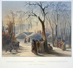
Background imageMaps Collection: Winter Villiage of the Minatarres

Winter Villiage of the Minatarres
3673658 Winter Villiage of the Minatarres by Bodmer, Karl (1809-93); Newberry Library, Chicago, Illinois, USA; (add.info.: Travels in the interior of North America / by Maximilian)

Background imageMaps Collection: Map of Cripplegate Ward, London (engraving)

Map of Cripplegate Ward, London (engraving)
983900 Map of Cripplegate Ward, London (engraving) by English School, (18th century); Private Collection; (add.info.: Map of Cripplegate Ward)

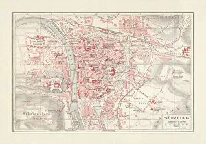
Background imageMaps Collection: City map of WAOErzburg, Bavaria, Germany, lithograph, published in 1897

City map of WAOErzburg, Bavaria, Germany, lithograph, published in 1897
City map of Wurzburg, Bavaria, Germany. Lithograph, published in 1897

Background imageMaps Collection: Map of Wurttemberg, historical German territory

Map of Wurttemberg, historical German territory
Illustration of a Map of Wurttemberg, historical German territory

Background imageMaps Collection: City map of Erfurt, Germany, lithograph, published in 1897

City map of Erfurt, Germany, lithograph, published in 1897
City map of Erfurt with street directory, Thuringia, Germany. Lithograph, published in 1897

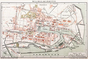
Background imageMaps Collection: Wilhelmshaven. Germany

Wilhelmshaven. Germany
Antique illustration of a Wilhelmshaven, Germany map

Background imageMaps Collection: Stralsund, c1740. Creator: Johann Georg Ringlin

Stralsund, c1740. Creator: Johann Georg Ringlin
Stralsund, c1740. The city of Stralsund (Stralesunda in Latin), on the Baltic coast of Germany, with a coat of arms in the foreground, and churches, castles, and principal landmarks indicated

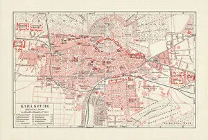
Background imageMaps Collection: City map of Karlsruhe, Baden-WAOErttemberg, Germany, lithograph, published in 1897

City map of Karlsruhe, Baden-WAOErttemberg, Germany, lithograph, published in 1897
City map of Karlsruhe, Baden-WAOErttemberg, Germany. Lithograph, published in 1897

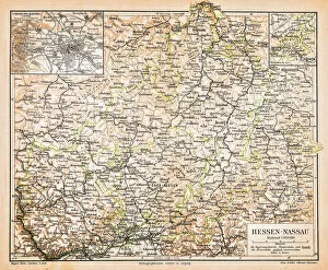
Background imageMaps Collection: Hesse-Nassau Map Illustration

Hesse-Nassau Map Illustration
Illustartion of the Province of Hesse-Nassau (German: Provinz Hessen-Nassau). It was a province of the Kingdom of Prussia from 1868 to 1918, then a province of the Free State of Prussia until 1944

Background imageMaps Collection: Map of Germany - Vector

Map of Germany - Vector illustration

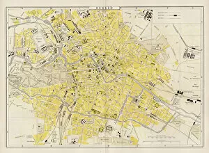
Background imageMaps Collection: Berlin city map 1893

Berlin city map 1893
Johnsonas Universal Cyclopedia - Charles Kendall - New York 1893

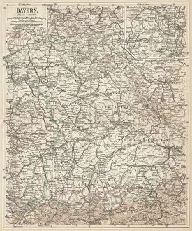
Background imageMaps Collection: German federal state of Bavaria, lithograph, published in 1874

German federal state of Bavaria, lithograph, published in 1874
Map of German federal state of Bavaria. Lithograph, published in 1874

Background imageMaps Collection: Stuttgart map 1895

Stuttgart map 1895
Meyers Konversations-Lexikon. Ein Nachschlagewerk des allgemeinen Wissens, 5th edition 17 volumes Bibliographisches Institut - Leipzig 1895-1897

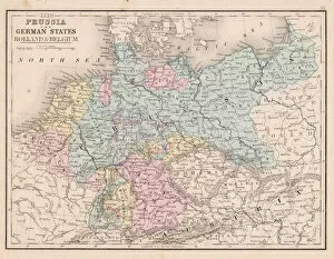
Background imageMaps Collection: Prussia and german states map 1867

Prussia and german states map 1867
Mitchellas Modern Atlas - Published by E.H. Butler and Co - Philadelphia 1867

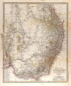
Background imageMaps Collection: Australia Map Gotha, Justus Perthes, 1872, Atlas

Australia Map Gotha, Justus Perthes, 1872, Atlas. Perthes, Johan Georg Justus 1749 aa 1816, German publisher, was born in Rudolstadt in 1749

Background imageMaps Collection: Peter I the Great (1672-1725) 1838 (oil on canvas) (see also 144528)

Peter I the Great (1672-1725) 1838 (oil on canvas) (see also 144528)
XKH144529 Peter I the Great (1672-1725) 1838 (oil on canvas) (see also 144528) by Delaroche, Hippolyte (Paul) (1797-1856); 130.6x97 cm; Hamburger Kunsthalle, Hamburg, Germany; French, out of copyright

Background imageMaps Collection: Dark matter distribution

Dark matter distribution. Image 1 of 4. Supercomputer simulation, known as the Millennium Run, showing the distribution of dark matter in the local universe

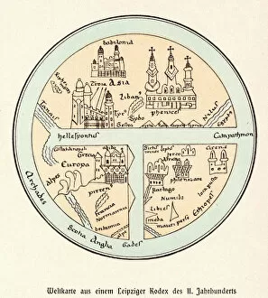
Background imageMaps Collection: World Map / Leipzig Codex

World Map / Leipzig Codex
A German map of the world, showing various cities, rivers and seas

Background imageMaps Collection: World map Universalis Cosmographia, 1507. Artist: Waldseemuller, Martin (ca 1472-1520)

World map Universalis Cosmographia, 1507. Artist: Waldseemuller, Martin (ca 1472-1520)
World map Universalis Cosmographia, 1507. Found in the collection of the Library of Congress, Washington D. C

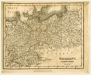
Background imageMaps Collection: Map of Germany, 1819, J. Mawman

Map of Germany, 1819, J. Mawman

Background imageMaps Collection: Australia Map Gotha, Justus Perthes, 1872, Atlas

Australia Map Gotha, Justus Perthes, 1872, Atlas. Perthes, Johan Georg Justus 1749 aa 1816, German publisher, was born in Rudolstadt in 1749

Background imageMaps Collection: Illustration shows stinkhorn mushrooms. Basimycetes

Illustration shows stinkhorn mushrooms. Basimycetes. - Schwammpilze, 1 print : photomechanical; sheet 36 x 26 cm. 1904. Ernst Haeckel 1834 a 1919 German biologist, naturalist, philosopher, physician

Background imageMaps Collection: Pair of maps of the Northern and Southern Celestial Hemispheres, 17th century (engraving)

Pair of maps of the Northern and Southern Celestial Hemispheres, 17th century (engraving)
7337557 Pair of maps of the Northern and Southern Celestial Hemispheres, 17th century (engraving) by Durer or Duerer, Albrecht (1471-1528); National Maritime Museum, London

Background imageMaps Collection: Allegory of German Unity 1871 (Germany and Prussia reunited): The Reich 1871

Allegory of German Unity 1871 (Germany and Prussia reunited): The Reich 1871
FGL5479410 Allegory of German Unity 1871 (Germany and Prussia reunited): The Reich 1871. Sadowa's victory on 03/07/1866, won by the Prussians over the Austrians

Background imageMaps Collection: Vellum chart of Africa, India and the Mediterranean, 1554 (vellum)

Vellum chart of Africa, India and the Mediterranean, 1554 (vellum)
7339652 Vellum chart of Africa, India and the Mediterranean, 1554 (vellum) by Agnese, Battista (c.1500-64); 26x40 cm; National Maritime Museum, London

Background imageMaps Collection: Map of 'Das Heilige Land' 1554 [Translation: The Holy land], 1554 (vellum)

Map of 'Das Heilige Land' 1554 [Translation: The Holy land], 1554 (vellum)
7339649 Map of 'Das Heilige Land' 1554 [Translation: The Holy land], 1554 (vellum) by Agnese, Battista (c.1500-64); 26x40 cm; National Maritime Museum, London

Background imageMaps Collection: Map of Creta 1554, 1554 (vellum)

Map of Creta 1554, 1554 (vellum)
7339647 Map of Creta 1554, 1554 (vellum) by Agnese, Battista (c.1500-64); 26x40 cm; National Maritime Museum, London, UK; (add.info.: Creator: Battista Agnese Bound sheet. Scale: [circa 1:3 000 000])

Background imageMaps Collection: Chart of Chius (Chios, Greece), 1554 (vellum)

Chart of Chius (Chios, Greece), 1554 (vellum)
7339646 Chart of Chius (Chios, Greece), 1554 (vellum) by Agnese, Battista (c.1500-64); 26x40 cm; National Maritime Museum, London, UK; (add.info.: Creator: Battista Agnese Scale circa 1:650000)

Background imageMaps Collection: Map of nerve bundles in the human brain by Paul Broca

Map of nerve bundles in the human brain by Paul Broca
5309460 Map of nerve bundles in the human brain by Paul Broca; (add.info.: Map of nerve bundles in the human brain by Paul Broca)

Background imageMaps Collection: Map showing the placings in Australia of The Tolpuddle Martyrs

Map showing the placings in Australia of The Tolpuddle Martyrs, a group of 19th-century Dorset agricultural labourers
5614433 Map showing the placings in Australia of The Tolpuddle Martyrs, a group of 19th-century Dorset agricultural labourers who were arrested for

Background imageMaps Collection: Map of Abyssinia (Ethiopia), 19th century (map)

Map of Abyssinia (Ethiopia), 19th century (map)
6317642 Map of Abyssinia (Ethiopia), 19th century (map); (add.info.: Map of Abyssinia and the Adjacent Districts. From observations taken by British traveller and artist Henry Salt in 1809 and 1810)

Background imageMaps Collection: Map of the Suez Canal (litho)

Map of the Suez Canal (litho)
8663893 Map of the Suez Canal (litho) by German School, (20th century); Private Collection; (add.info.: Map of the Suez Canal, Egypt)

Background imageMaps Collection: Kiel Canal, Germany (litho)

Kiel Canal, Germany (litho)
8663891 Kiel Canal, Germany (litho) by German School, (20th century); Private Collection; (add.info.: Map showing the route of the Kiel Canal connecting the North Sea to the Baltic, Germany)

Background imageMaps Collection: Port of Hamburg (litho)

Port of Hamburg (litho)
8663890 Port of Hamburg (litho) by German School, (20th century); Private Collection; (add.info.: Port of Hamburg, Germany)

Background imageMaps Collection: Major international telegraph cables (colour litho)

Major international telegraph cables (colour litho)
8663671 Major international telegraph cables (colour litho) by German School, (20th century); Private Collection; (add.info)

Background imageMaps Collection: Germany in the time of the Romans (colour litho)

Germany in the time of the Romans (colour litho)
8672805 Germany in the time of the Romans (colour litho) by German School, (20th century); Private Collection; (add.info.: Map of Germany in the time of the Romans)

Background imageMaps Collection: United States, South Carolina: Colonial Map of the Ashley and Cooper Rivers, Charleston Site

United States, South Carolina: Colonial Map of the Ashley and Cooper Rivers, Charleston Site, South Carolina
NWI4967326 United States, South Carolina: Colonial Map of the Ashley and Cooper Rivers, Charleston Site, South Carolina, 17th century

Background imageMaps Collection: Map of Scotland, England, Ireland in 1100 (Map of british islands, England)

Map of Scotland, England, Ireland in 1100 (Map of british islands, England)
ELD4930022 Map of Scotland, England, Ireland in 1100 (Map of british islands, England, Scotland and Ireland in 1100) Plate from Houze's Universal Atlas

Background imageMaps Collection: map of ' Hamburg and the surrounding in the year 1240, 1866 (engraving)

map of " Hamburg and the surrounding in the year 1240, 1866 (engraving)
UTD4918756 map of " Hamburg and the surrounding in the year 1240, 1866 (engraving); (add.info.: Germany, Hamburg, map " Hamburg and the surrounding in the year 1240 ")

Background imageMaps Collection: Geographic map of Germany populated with different populations before 275 BC (Map of Germania)

Geographic map of Germany populated with different populations before 275 BC (Map of Germania)
ELD4924495 Geographic map of Germany populated with different populations before 275 BC (Map of Germania, inhabited by different tribes)

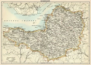
Background imageMaps Collection: Map of the Count of Sommerset (England), circa 1870. 19th century lithography

Map of the Count of Sommerset (England), circa 1870. 19th century lithography
NWI4875372 Map of the Count of Sommerset (England), circa 1870. 19th century lithography.; (add.info.: Map of the Count of Sommerset (England), circa 1870

Background imageMaps Collection: Map of the Counts of Oxford, Buckingham and Berks (England), circa 1870. 19th century lithography

Map of the Counts of Oxford, Buckingham and Berks (England), circa 1870. 19th century lithography
NWI4875323 Map of the Counts of Oxford, Buckingham and Berks (England), circa 1870. 19th century lithography.; (add.info.: Map of the Counts of Oxford, Buckingham and Berks (England), circa 1870

Background imageMaps Collection: Map of the Earl of Worcester (England), circa 1870. 19th century lithography

Map of the Earl of Worcester (England), circa 1870. 19th century lithography
NWI4875595 Map of the Earl of Worcester (England), circa 1870. 19th century lithography.; (add.info.: Map of the Earl of Worcester (England), circa 1870

Background imageMaps Collection: Map of the Earl of Sussex (England), circa 1870. 19th century lithography

Map of the Earl of Sussex (England), circa 1870. 19th century lithography
NWI4875444 Map of the Earl of Sussex (England), circa 1870. 19th century lithography.; (add.info.: Map of the Earl of Sussex (England), circa 1870

Background imageMaps Collection: Map of the Earl of Yorkshire (England), circa 1870. 19th century lithography

Map of the Earl of Yorkshire (England), circa 1870. 19th century lithography
NWI4875608 Map of the Earl of Yorkshire (England), circa 1870. 19th century lithography.; (add.info.: Map of the Earl of Yorkshire (England), circa 1870

Background imageMaps Collection: Map of the German Empire (Germany), late 19th century - Lithograph 19th century - Map of

Map of the German Empire (Germany), late 19th century - Lithograph 19th century - Map of the German Empire
NWI4872372 Map of the German Empire (Germany), late 19th century - Lithograph 19th century - Map of the German Empire, late 1800s - Color lithograph; (add.info.: Map of the German Empire (Germany)

Background imageMaps Collection: Map showing Louisbourg, a Canadian city in the province of Nova Scotia, Canada

Map showing Louisbourg, a Canadian city in the province of Nova Scotia, Canada, under the British flag, 1745
NWI4867370 Map showing Louisbourg, a Canadian city in the province of Nova Scotia, Canada, under the British flag, 1745. Colouring engraving of the 19th century.; (add.info.: Map showing Louisbourg)


All Professionally Made to Order for Quick Shipping


-

Maps Collection

Germany is a country located in Central Europe, and is bordered by nine other countries, including Austria, Belgium, Czech Republic, Denmark, France, Luxembourg, Netherlands, Poland and Switzerland. Germany has a rich history and culture that can be seen through its many maps. Maps of Germany Europe provide an overview of the country's geography as well as its political divisions and major cities. They also show the location of rivers and lakes throughout the country. Additionally, they often include information about transportation networks such as roads and railways. Maps of Germany Europe are useful for travelers who want to explore this fascinating country or for those who wish to learn more about its history and culture.
+

Our beautiful Wall Art and Photo Gifts include Framed Prints, Photo Prints, Poster Prints, Canvas Prints, Jigsaw Puzzles, Metal Prints and so much more

The Maps of Germany Europe collection from Media Storehouse is a stunning array of wall art and framed prints that showcase the rich history and geography of Germany. Our collection features an extensive range of maps, including antique maps dating back to the 16th century as well as modern-day cartography. These maps offer a unique perspective on the evolution of German territories over time, highlighting changes in borders, cities, and landmarks. Each map is beautifully reproduced using high-quality printing techniques that capture every detail with remarkable clarity. Whether you're looking for a vintage map to add character to your home decor or a contemporary piece to inspire your wanderlust, our collection has something for everyone. With its wide selection of sizes and framing options available at affordable prices, the Maps of Germany Europe collection from Media Storehouse offers an excellent opportunity to own a piece of history while enhancing your living space with beautiful artwork.
+

What are Maps of Germany Europe art prints?

Maps of Germany Europe art prints are high-quality reproductions of vintage or contemporary maps depicting the geography, topography, and political boundaries of Germany and other European countries. These art prints are created using advanced printing techniques that ensure a sharp and vivid image with accurate colors and details. Maps have always been an important tool for navigation, exploration, and education. They provide a visual representation of the world around us, helping us understand our place in it. Maps of Germany Europe art prints offer not only practical information but also aesthetic value as they can be used to decorate homes, offices or public spaces. These art prints come in various sizes and styles to suit different tastes and purposes. Some feature intricate illustrations while others focus on clear lines and labels for easy reading. Whether you're looking for a historical map to display your love for history or a modern one to plan your next trip abroad, Maps of Germany Europe art prints from Media Storehouse offer something for everyone.
+

What Maps of Germany Europe art prints can I buy from Media Storehouse?

We offer a wide range of Maps of Germany Europe art prints that are perfect for decorating your home or office. These maps come in various sizes and styles, including vintage, antique, and modern designs. You can choose from different types of maps such as political maps, physical maps, topographical maps, roadmaps and more. Our collection includes high-quality prints that capture the intricate details of these beautiful maps. Whether you're looking to add some historical charm to your space or want to display your love for geography and travel, their selection has something for everyone. Their Maps of Germany Europe art prints are printed on premium quality paper using state-of-the-art printing technology which ensures they will last a lifetime without fading or losing their vibrancy. So if you're looking for unique wall decor that is both stylish and informative then our Maps of Germany Europe art prints are definitely worth checking out.
+

How do I buy Maps of Germany Europe art prints?

To buy Maps of Germany Europe art prints from Media Storehouse, you can browse our extensive collection online. Simply search for the specific map or location you are interested in and select the print size and format that suits your needs. You can choose from a range of high-quality paper options to ensure your print looks its best. Once you have made your selection, add it to your cart and proceed to checkout. You will be prompted to enter your shipping information and payment details. We accept a variety of payment methods including credit cards, PayPal, and Apple Pay. After completing your purchase, Media Storehouse will process your order and ship it directly to you. Your Map of Germany Europe art print will arrive ready for framing or display as desired. We offer a wide selection of maps from different regions around the world so if you're looking for other locations beyond Germany Europe they may have what you need too.
+

How much do Maps of Germany Europe art prints cost?

We offer a wide range of Maps of Germany and Europe art prints at varying prices. The cost of these prints depends on various factors such as the size, quality, and type of paper used for printing. Our collection includes vintage maps, contemporary designs, and artistic interpretations that cater to different tastes and preferences. We take pride in providing high-quality art prints that are affordable yet visually appealing. Our selection is carefully curated to ensure that customers have access to unique pieces that add character to their homes or offices. We also offer framing options for those who prefer ready-to-hang artwork. The cost of our Maps of Germany and Europe art prints varies depending on several factors. However, we strive to provide our customers with value for money by offering competitive prices without compromising on quality.
+

How will my Maps of Germany Europe art prints be delivered to me?

We take great care in delivering your Maps of Germany Europe art prints to you. We use high-quality packaging materials to ensure that your artwork arrives in perfect condition. Your print will be carefully rolled and placed inside a sturdy tube for protection during transit. We work with trusted shipping partners who offer reliable and secure delivery services worldwide. Once your order is dispatched, you will receive an email notification with tracking information so that you can monitor the progress of your delivery. We understand the importance of timely delivery and strive to ensure that all orders are processed promptly. However, please note that delivery times may vary depending on your location and other factors beyond our control. Rest assured that when you order from us, you can expect a hassle-free experience from start to finish. We pride ourselves on providing excellent customer service and look forward to serving you soon.