Fraud Blocker Skip to main content

Home > Europe > France > Maps

Maps Collection (page 9)

Maps of France Europe are essential tools for travelers and tourists who want to explore the continent

13,182 items

Background imageMaps Collection: First World War: France, Propaganda map showing the use of the belt for hairy people with pun

First World War: France, Propaganda map showing the use of the belt for hairy people with pun and naked women, 1915
LUX4739905 First World War: France, Propaganda map showing the use of the belt for hairy people with pun and naked women, 1915; (add.info)

Background imageMaps Collection: First World War: France, Patriotic Map showing William II on him everything the Germans took

First World War: France, Patriotic Map showing William II on him everything the Germans took during their invasion
LUX4739840 First World War: France, Patriotic Map showing William II on him everything the Germans took during their invasion, champagne, pendulum, lace

Background imageMaps Collection: First World War: France, Patriotic Map showing hairy around a wheelchair where the chicken is put

First World War: France, Patriotic Map showing hairy around a wheelchair where the chicken is put to the pot every day
LUX4740533 First World War: France, Patriotic Map showing hairy around a wheelchair where the chicken is put to the pot every day, 1917

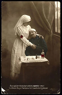
Background imageMaps Collection: First World War: France, Patriotic Map showing a Red Cross nurse serving a war wounded in a field

First World War: France, Patriotic Map showing a Red Cross nurse serving a war wounded in a field hospital, 1915
LUX4740529 First World War: France, Patriotic Map showing a Red Cross nurse serving a war wounded in a field hospital, 1915; (add.info)

Background imageMaps Collection: First World War: France, Patriotic Map showing Joffre welcoming an Alsatian

First World War: France, Patriotic Map showing Joffre welcoming an Alsatian
LUX4739721 First World War: France, Patriotic Map showing Joffre welcoming an Alsatian and her son to confirm their French nationality, entitled: 'You are French for Forevers'

Background imageMaps Collection: First World War: France, Patriotic Map showing Christmas Day a child picking up his patriotic toys

First World War: France, Patriotic Map showing Christmas Day a child picking up his patriotic toys in the path
LUX4740370 First World War: France, Patriotic Map showing Christmas Day a child picking up his patriotic toys in the path, thinking of his father at the front and titled 'Good Christmas'

Background imageMaps Collection: Universal Geography: French Department of Aube (10). Advertising images edited for the brand

Universal Geography: French Department of Aube (10). Advertising images edited for the brand Louit. Debut 20th century
DUV4218127 Universal Geography: French Department of Aube (10). Advertising images edited for the brand Louit. Debut 20th century. (lithograph); 9.5x6.5 cm; Photo © Duvallon

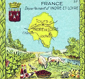
Background imageMaps Collection: Universal Geography: French department of Indre and Loire (37)

Universal Geography: French department of Indre and Loire (37). Advertising images edited for the brand Louit
DUV4218110 Universal Geography: French department of Indre and Loire (37). Advertising images edited for the brand Louit. Debut 20th century. (lithograph); 9.5x6.5 cm; Photo © Duvallon

Background imageMaps Collection: Universal Geography: French Department of Meurthe and Moselle (54)

Universal Geography: French Department of Meurthe and Moselle (54). Advertising images edited for the brand Louit
DUV4218087 Universal Geography: French Department of Meurthe and Moselle (54). Advertising images edited for the brand Louit. Debut 20th century. (lithograph); 9.5x6.5 cm; Photo © Duvallon

Background imageMaps Collection: Universal Geography: French Department of Nievre (58). Advertising images edited for the brand Louit

Universal Geography: French Department of Nievre (58). Advertising images edited for the brand Louit
DUV4218069 Universal Geography: French Department of Nievre (58). Advertising images edited for the brand Louit. First 20th century. (lithograph); 9.5x6.5 cm; Photo © Duvallon

Background imageMaps Collection: Universal Geography: French Department of Oise (60). Advertising images edited for the brand

Universal Geography: French Department of Oise (60). Advertising images edited for the brand Louit. Debut 20th century
DUV4218067 Universal Geography: French Department of Oise (60). Advertising images edited for the brand Louit. Debut 20th century. (lithograph); 9.5x6.5 cm; Photo © Duvallon

Background imageMaps Collection: Universal Geography: French Department of Pas de Calais (62)

Universal Geography: French Department of Pas de Calais (62). Advertising images edited for the brand Louit
DUV4218063 Universal Geography: French Department of Pas de Calais (62). Advertising images edited for the brand Louit. Debut 20th century. (lithograph); 9.5x6.5 cm; Photo © Duvallon

Background imageMaps Collection: Universal Geography: French Department of Vendee (85), beg of 20th century (lithograph)

Universal Geography: French Department of Vendee (85), beg of 20th century (lithograph)
DUV4218011 Universal Geography: French Department of Vendee (85), beg of 20th century (lithograph); 9.5x6.5 cm; (add.info.: Advertising images edited for the brand Louit); Photo © Duvallon

Background imageMaps Collection: Carved Map Horn Of The Posts Along The Mohawk River

Carved Map Horn Of The Posts Along The Mohawk River
3030615 Carved Map Horn Of The Posts Along The Mohawk River ; Private Collection; © Don Troiani. All Rights Reserved 2022

Background imageMaps Collection: Map illustrating the region of the First Battle of the Aisne, France during WWI (litho)

Map illustrating the region of the First Battle of the Aisne, France during WWI (litho)
3252850 Map illustrating the region of the First Battle of the Aisne, France during WWI (litho); Private Collection; (add.info.: Map illustrating the region of the First Battle of the Aisne)

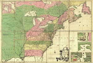
Background imageMaps Collection: British Empire in North America, 1783

British Empire in North America, 1783
2902816 British Empire in North America, 1783; (add.info.: Bowless new map of North America and the West Indies, exhibiting the British Empire therein with the limits)

Background imageMaps Collection: Vauban Defenses on the Narva, Estonia, 1700

Vauban Defenses on the Narva, Estonia, 1700
2900919 Vauban Defenses on the Narva, Estonia, 1700; (add.info.: Sabastien Le Prestre, Seigneur de Vauban and later Marquis de Vauban (15 May 1633 - 30 March 1707), commonly referred to as Vauban

Background imageMaps Collection: Fortifications at Nice, France, 1700

Fortifications at Nice, France, 1700
2900899 Fortifications at Nice, France, 1700; (add.info.: Throughout the ages the town changed hands many times. Its strategic location and port significantly contributed to its maritime strength)

Background imageMaps Collection: City Plan, Paris, 1700

City Plan, Paris, 1700
2900896 City Plan, Paris, 1700; (add.info.: City Plan, Paris, 1700.); Buyenlarge Archive/UIG

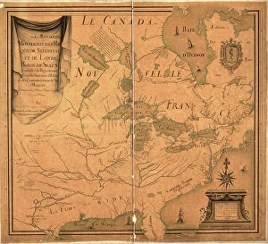
Background imageMaps Collection: Great Lakes Region During French Settlement Period, 1755

Great Lakes Region During French Settlement Period, 1755
2902819 Great Lakes Region During French Settlement Period, 1755; (add.info.: Great Lakes Region During French Settlement Period, 1755.); Buyenlarge Archive/UIG

Background imageMaps Collection: Canada - New France, 1685

Canada - New France, 1685
2902809 Canada - New France, 1685; (add.info.: Canada - New France, 1685.); Buyenlarge Archive/UIG

Background imageMaps Collection: British and French dominions in North America, 1755

British and French dominions in North America, 1755
2902800 British and French dominions in North America, 1755; (add.info.: A map of the British and French dominions in North America, with the roads, distances, limits)

Background imageMaps Collection: North America, 1758

North America, 1758
2902792 North America, 1758; (add.info.: North America. From the French of Mr. dAnville, improved with the back settlements of Virginia and course of Ohio)

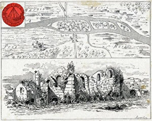
Background imageMaps Collection: Map of Luteceand ruins of the paalce of Thermes, early 20th century (illustratin)

Map of Luteceand ruins of the paalce of Thermes, early 20th century (illustratin)
1933964 Map of Luteceand ruins of the paalce of Thermes, early 20th century (illustratin); (add.info.: Map of Lutece and ruins of the palace of Thermes)

Background imageMaps Collection: Map of Saint Tropez (France), from the Atlas of Louis XIV 1683-88

Map of Saint Tropez (France), from the Atlas of Louis XIV 1683-88
1752848 Map of Saint Tropez (France), from the Atlas of Louis XIV 1683-88; (add.info.: Map of Saint Tropez (France), from the Atlas of Louis XIV 1683-88); Photo: Tallandier

Background imageMaps Collection: Map of Paris, 1300, engraving (1875)

Map of Paris, 1300, engraving (1875)
1758001 Map of Paris, 1300, engraving (1875); (add.info.: Map of Paris, 1300, engraving (1875)); Photo: Tallandier

Background imageMaps Collection: 5th map of Paris at time of with layout by Charles V (1356-1383), engraving

5th map of Paris at time of with layout by Charles V (1356-1383), engraving
1757999 5th map of Paris at time of with layout by Charles V (1356-1383), engraving; (add.info.: 5th map of Paris at time of with layout by Charles V (1356-1383), engraving); Photo: Tallandier

Background imageMaps Collection: Map of the city of Metz and the Moselle river, east of France, early 17th century, engraving

Map of the city of Metz and the Moselle river, east of France, early 17th century, engraving
1749784 Map of the city of Metz and the Moselle river, east of France, early 17th century, engraving; (add.info.: Map of the city of Metz and the Moselle river, east of France, early 17th century)

Background imageMaps Collection: Presentation to the king of France Louis XIV of the map of Royal Hotel of the Invalides, engraving

Presentation to the king of France Louis XIV of the map of Royal Hotel of the Invalides, engraving
1749853 Presentation to the king of France Louis XIV of the map of Royal Hotel of the Invalides, engraving. It was built from 1670 in Paris by Liberal Bruant then Jules Hardouin Mansart

Background imageMaps Collection: The Course of the Danube from its Source to its Mouth, based on the most recent memoires of P

The Course of the Danube from its Source to its Mouth, based on the most recent memoires of P. Coroneli and S
NUL116588 The Course of the Danube from its Source to its Mouth, based on the most recent memoires of P. Coroneli and S. Sanson, Geographer to the King (colour litho) by French School

Background imageMaps Collection: Cartouche with a dedication to Cardinal Richelieu (1585-1642)

Cartouche with a dedication to Cardinal Richelieu (1585-1642), and a map of the Low Countries at the time of the Thirty
CHT191867 Cartouche with a dedication to Cardinal Richelieu (1585-1642), and a map of the Low Countries at the time of the Thirty Years war (1618-48)

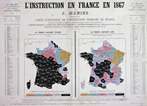
Background imageMaps Collection: Education in France in 1867 (colour litho)

Education in France in 1867 (colour litho)
CHT307492 Education in France in 1867 (colour litho) by French School, (19th century); Private Collection; (add.info.: Map showing the levels of literacy in France in 1867; left shows the extent of)

Background imageMaps Collection: L'Atlas des Vins de France: St Emilion-Pomerol Fronsac (b/w photo)

L'Atlas des Vins de France: St Emilion-Pomerol Fronsac (b/w photo)
8675205 L'Atlas des Vins de France: St Emilion-Pomerol Fronsac (b/w photo) by French Photographer, (20th century); Private Collection; (add.info.: St Emilion-Pomerol Fronsac)

Background imageMaps Collection: Map of the Earth according to Herodotus (engraving)

Map of the Earth according to Herodotus (engraving)
8635073 Map of the Earth according to Herodotus (engraving) by German School, (19th century) (after); Private Collection; (add.info)

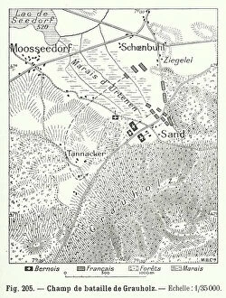
Background imageMaps Collection: Plan of the Battle of Grauholz, Switzerland, 1798 (engraving)

Plan of the Battle of Grauholz, Switzerland, 1798 (engraving)
8673025 Plan of the Battle of Grauholz, Switzerland, 1798 (engraving) by Swiss School, (19th Century); Private Collection; (add.info.: Plan of the Battle of Grauholz, Switzerland, 1798)

Background imageMaps Collection: World map showing the spread of dysentery (colour litho)

World map showing the spread of dysentery (colour litho)
8663632 World map showing the spread of dysentery (colour litho) by French School, (20th century); Private Collection; (add.info.: World map showing the spread of dysentery)

Background imageMaps Collection: Map of the Eastern and Western Riviera, 1885 (engraving)

Map of the Eastern and Western Riviera, 1885 (engraving)
8646525 Map of the Eastern and Western Riviera, 1885 (engraving) by English School, (19th century); Private Collection; (add.info.: Map of the Eastern and Western Riviera, 1885)

Background imageMaps Collection: A Map of the country of the Five Nations, belonging to the province of New York;

A Map of the country of the Five Nations, belonging to the province of New York;
8711846 A Map of the country of the Five Nations, belonging to the province of New York; and of the lakes near which the nations of far Indians live, with part of Canada, by Cadwallader Colden, 1725

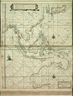
Background imageMaps Collection: 't Ooster deel van Oost Indien, streckende van Ceylon tot Japan en Hollandia Nova, 1661 (engraving)

't Ooster deel van Oost Indien, streckende van Ceylon tot Japan en Hollandia Nova, 1661 (engraving)
7340061 't Ooster deel van Oost Indien, streckende van Ceylon tot Japan en Hollandia Nova, 1661 (engraving) by Doncker, Hendrick (c.1626-99); 56.5x45 cm; National Maritime Museum, London

Background imageMaps Collection: Dover to Sandwich and Blacknerse to Gravelines - The Spanish Armada

Dover to Sandwich and Blacknerse to Gravelines - The Spanish Armada and the English Fleet off Calais, c
7340034 Dover to Sandwich and Blacknerse to Gravelines - The Spanish Armada and the English Fleet off Calais, c. 1590 (manuscript) by Adams, Robert (1540-95) (after); National Maritime Museum

Background imageMaps Collection: The route track of the Spanish Armada through the English Channel, into the North Sea

The route track of the Spanish Armada through the English Channel, into the North Sea
7340023 The route track of the Spanish Armada through the English Channel, into the North Sea, around Northern Scotland and into the Atlantic Ocean to return to Spain

Background imageMaps Collection: Chart of southern Mediterrean and Adriatic, c.1600 (manuscript)

Chart of southern Mediterrean and Adriatic, c.1600 (manuscript)
7339790 Chart of southern Mediterrean and Adriatic, c.1600 (manuscript) by Unknown Artist, (17th century); 47x35 cm; National Maritime Museum, London

Background imageMaps Collection: Adriatic chart, c.1620 (vellum)

Adriatic chart, c.1620 (vellum)
7339786 Adriatic chart, c.1620 (vellum) by Unknown Artist, (17th century); 41x60 cm; National Maritime Museum, London, UK; (add.info.: Creator)

Background imageMaps Collection: Eastern Mediterranean, 1632 (vellum)

Eastern Mediterranean, 1632 (vellum)
7339663 Eastern Mediterranean, 1632 (vellum) by Oliva, Joan (fl.16th-17th century); 26x39 cm; National Maritime Museum, London

Background imageMaps Collection: Chrso, 1590 (Manuscript)

Chrso, 1590 (Manuscript)
7339637 Chrso, 1590 (Manuscript) by Antonio, Millo (16th century); 31x205 cm; National Maritime Museum, London, UK; (add.info.: Creator: Millo, Antonio Bound sheet. Ms. Additional Places: Cres)

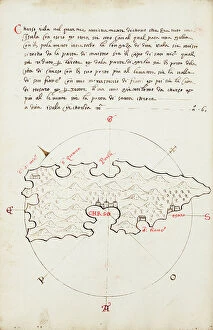
Background imageMaps Collection: Chart of Cephalonia, c.1420 (vellum)

Chart of Cephalonia, c.1420 (vellum)
7339623 Chart of Cephalonia, c.1420 (vellum) by Buondelmonti, Cristoforo (1385-1430); 25x18 cm; National Maritime Museum, London

Background imageMaps Collection: Western Mediterranean, bound in an atlas of twenty-five charts with diagrams and tables

Western Mediterranean, bound in an atlas of twenty-five charts with diagrams and tables., c.1550-60 (vellum)
7339613 Western Mediterranean, bound in an atlas of twenty-five charts with diagrams and tables., c.1550-60 (vellum) by Unknown Artist, (16th century); 24x17 cm; National Maritime Museum, London

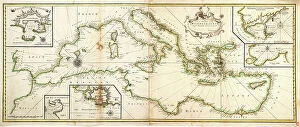
Background imageMaps Collection: Chart of the Mediterranean, 1730 (coloured engraving)

Chart of the Mediterranean, 1730 (coloured engraving)
7339543 Chart of the Mediterranean, 1730 (coloured engraving) by Price, Charles (1679?-1733); 47x118 cm; National Maritime Museum, London


All Professionally Made to Order for Quick Shipping


-

Maps Collection

Maps of France Europe are essential tools for travelers and tourists who want to explore the continent. They provide an overview of the country, its major cities, and its attractions and are show roads, rivers, mountains, lakes, and other natural features that make up the landscape. Additionally, they often include information about local customs and culture as well as points of interest such as museums or monuments, and are be found in bookstores or online in various formats including paper maps or digital versions that can be accessed on mobile devices. With a map of France Europe in hand travelers will have no trouble navigating their way around this beautiful country.
+

Our beautiful pictures are available as Framed Prints, Photos, Wall Art and Photo Gifts

The Maps of France Europe collection is a stunning assortment of wall art and framed prints that showcase the beauty and diversity of France. Our collection features an extensive range of maps, including antique maps dating back to the 16th century, as well as modern-day maps highlighting the country's cities, regions, and landmarks. Each print in our collection has been carefully curated by Media Storehouse to provide customers with a unique glimpse into French history and culture. From detailed depictions of Parisian streets to panoramic views of the Alps, these prints are sure to captivate anyone who loves France or European geography. Whether you're looking for a beautiful piece of artwork for your home or office or want to give someone special a thoughtful gift, Maps of France Europe offers something for everyone. With its high-quality printing techniques and durable framing options, our collection is sure to impress even the most discerning art enthusiasts.
+

What are Maps of France Europe art prints?

Maps of France Europe art prints are high-quality reproductions of vintage and contemporary maps showcasing the geography, topography, and landmarks of France and its neighboring European countries. These prints are perfect for those who love history, travel, or simply appreciate the beauty of cartography. The collection includes a wide range of styles, from antique maps dating back to the 16th century to modern designs featuring vibrant colors and intricate details. Some prints focus on specific regions or cities within France or Europe while others provide an overview of the entire continent. These art prints can be used to decorate any room in your home or office, adding a touch of sophistication and elegance to your space. They also make great gifts for anyone with an interest in geography or history. Whether you're looking for a unique piece to add to your personal collection or want to give someone special a thoughtful gift they'll treasure forever, Maps of France Europe art prints from Media Storehouse are sure to impress.
+

What Maps of France Europe art prints can I buy from Media Storehouse?

We offer a wide range of Maps of France Europe art prints that are perfect for those who love to travel or have an interest in geography. These maps come in various styles and designs, including vintage, antique, and modern versions. You can choose from different sizes and formats such as canvas prints, framed prints, posters or photographic prints. Some popular options include the Antique Map of France by John Speed which dates back to 1626; the Vintage Map of Paris which showcases the city's famous landmarks; and the Modern Map of Europe which highlights all major cities across the continent. Whether you're looking for a decorative piece for your home or office space or want to gift it to someone who loves history or geography- Media Storehouse has got you covered with their vast collection of Maps of France Europe art prints.
+

How do I buy Maps of France Europe art prints?

To buy Maps of France Europe art prints from Media Storehouse, you can browse through our extensive collection of maps and select the ones that interest you. Once you have made your selection, add them to your cart and proceed to checkout. You will be prompted to enter your shipping and payment information before completing the purchase. We offer a variety of sizes for their art prints, so make sure to choose the one that best fits your needs. The maps are printed on high-quality paper using state-of-the-art printing technology, ensuring that they look great in any setting. If you have any questions or concerns about purchasing Maps of France Europe art prints from Media Storehouse, our customer service team is available to assist you. They can provide additional information about the products or help with any issues that may arise during the ordering process.
+

How much do Maps of France Europe art prints cost?

We offer a wide range of Maps of France Europe art prints at varying prices. The cost of these prints depends on several factors such as the size, quality, and type of print you choose. Our standard paper prints are more affordable than our premium canvas or framed options. Additionally, some maps may be more intricate and detailed than others which can also impact the price. We strive to provide high-quality products at reasonable prices for all customers. Our Maps of France Europe art prints make great additions to any home or office decor and are perfect for history buffs or those who love travel. With a variety of sizes and styles available, there is something for everyone's taste and budget. We encourage customers to browse our selection online to find the perfect map print that fits their needs and preferences without breaking the bank.
+

How will my Maps of France Europe art prints be delivered to me?

We take great care in delivering your Maps of France Europe art prints to you. We use high-quality packaging materials to ensure that your artwork arrives in pristine condition. Your print will be carefully rolled and placed inside a sturdy tube for protection during transit. We work with trusted shipping partners who offer reliable delivery services. Once your order has been dispatched, you will receive an email notification with tracking information so that you can monitor the progress of your shipment. Our team is dedicated to providing excellent customer service, and we are always available to answer any questions or concerns you may have about the delivery process. If there are any issues with your order upon arrival, please contact us immediately so that we can resolve them as quickly as possible. You can trust Media Storehouse to deliver your Maps of France Europe art prints safely and efficiently straight to your doorstep.