Fraud Blocker Skip to main content

Home > Europe > France > Maps

Maps Collection (page 8)

Maps of France Europe are essential tools for travelers and tourists who want to explore the continent

13,077 items

Background imageMaps Collection: First World War: Patriotic map showing a young Alsatian and a young Lorraine coming out of an

First World War: Patriotic map showing a young Alsatian and a young Lorraine coming out of an Easter egg
LUX4744675 First World War: Patriotic map showing a young Alsatian and a young Lorraine coming out of an Easter egg and entitled Happy Easter

Background imageMaps Collection: First World War: Patriotic map showing in a medallion the portrait of a general Joffre in uniform

First World War: Patriotic map showing in a medallion the portrait of a general Joffre in uniform with his medals
LUX4745400 First World War: Patriotic map showing in a medallion the portrait of a general Joffre in uniform with his medals, entitled "Towards Victory"

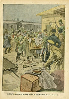
Background imageMaps Collection: Illustration of Edouard Carrier in Le Pelerin, 10/07/04 - Arrest of a Japanese spy disguise as an

Illustration of Edouard Carrier in Le Pelerin, 10/07/04 - Arrest of a Japanese spy disguise as an organ player - Music
ICA4855232 Illustration of Edouard Carrier in Le Pelerin, 10/07/04 - Arrest of a Japanese spy disguise as an organ player - Music, Russian-Japanese War, Barbary organ

Background imageMaps Collection: Geographic map of England and France after the Brittany trade in the Hundred Years War in 1360

Geographic map of England and France after the Brittany trade in the Hundred Years War in 1360
NWI4874497 Geographic map of England and France after the Brittany trade in the Hundred Years War in 1360. Lithograph of the 19th century.; (add.info)

Background imageMaps Collection: Map of Italy showing political divisions before the unification of 1797 (Risorgimento)

Map of Italy showing political divisions before the unification of 1797 (Risorgimento). Color lithography
NWI4870950 Map of Italy showing political divisions before the unification of 1797 (Risorgimento). Color lithography.; (add.info)

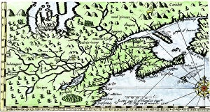
Background imageMaps Collection: Map of New France in Canada by Samuel de Champlain circa 1613. Engraving

Map of New France in Canada by Samuel de Champlain circa 1613. Engraving. Part of Samuel de Champlain's 1613 map of
NWI4902078 Map of New France in Canada by Samuel de Champlain circa 1613. Engraving. Part of Samuel de Champlain's 1613 map of New France in Canada.; (add.info)

Background imageMaps Collection: Map of Paris with fortifications and exterior forts (Vincennes, romainville, Nogent, Nogent), walls

Map of Paris with fortifications and exterior forts (Vincennes, romainville, Nogent, Nogent), walls
ELD4902514 Map of Paris with fortifications and exterior forts (Vincennes, romainville, Nogent, Nogent), walls. 19th century (engraving); Private Collection; Photo © The Holbarn Archive

Background imageMaps Collection: Metropolitan tubular railway from Vincennes to the Bois de Boulogne (Parisian metro)

Metropolitan tubular railway from Vincennes to the Bois de Boulogne (Parisian metro) - Elabore project by M
PCT4291518 Metropolitan tubular railway from Vincennes to the Bois de Boulogne (Parisian metro) - Elabore project by M. Berlier for the 1900 exhibition in Paris - map of the route

Background imageMaps Collection: Geographic atlas: detail of the portulan of Juan Oliva representing the coast near Marseille

Geographic atlas: detail of the portulan of Juan Oliva representing the coast near Marseille
JEB4874904 Geographic atlas: detail of the portulan of Juan Oliva representing the coast near Marseille, 1593 Bibliotheque municipale de Marseille.; (add.info.: Geographic atlas)

Background imageMaps Collection: Map of New Guinee and New Caledonia, years 1870. 19th century lithograph

Map of New Guinee and New Caledonia, years 1870. 19th century lithograph
NWI4879110 Map of New Guinee and New Caledonia, years 1870. 19th century lithograph.; (add.info.: Map of New Guinee and New Caledonia, years 1870)

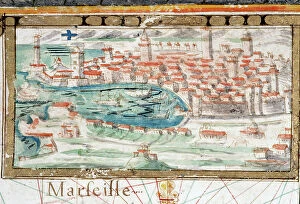
Background imageMaps Collection: View of the city Marseille. Portulan realized by Augustin Roussin (17th century)

View of the city Marseille. Portulan realized by Augustin Roussin (17th century). 1630 Municipal Library of Marseille
JEB4878410 View of the city Marseille. Portulan realized by Augustin Roussin (17th century). 1630 Municipal Library of Marseille; (add.info.: View of the city Marseille)

Background imageMaps Collection: Patriotic map showing a permissive lunch with his admiring and grateful parents, 1914

Patriotic map showing a permissive lunch with his admiring and grateful parents, 1914
LUX4743862 Patriotic map showing a permissive lunch with his admiring and grateful parents, 1914; (add.info.: Patriotic map showing a permissive lunch with his admiring and grateful parents)

Background imageMaps Collection: First World War: Patriotic map showing a soldier sleeping on the ground

First World War: Patriotic map showing a soldier sleeping on the ground, reclaiming that he has an Alsatian in his arms
LUX4744460 First World War: Patriotic map showing a soldier sleeping on the ground, reclaiming that he has an Alsatian in his arms and entitled The dream of our soldiers

Background imageMaps Collection: First World War: Patriotic Map showing a couple of a soldier and an Alsatian, 1914

First World War: Patriotic Map showing a couple of a soldier and an Alsatian, 1914
LUX4744459 First World War: Patriotic Map showing a couple of a soldier and an Alsatian, 1914; (add.info.: World War I - War 14-18 (1914-1918) - World War I (WWI or WW1)

Background imageMaps Collection: Patriotic map showing the three allied nations France, England and Russia holding hands

Patriotic map showing the three allied nations France, England and Russia holding hands and heading towards Victory
LUX4743785 Patriotic map showing the three allied nations France, England and Russia holding hands and heading towards Victory

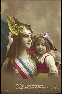
Background imageMaps Collection: First World War: Patriotic map showing France symbolized by a woman wearing a helmet holds a

First World War: Patriotic map showing France symbolized by a woman wearing a helmet holds a little girl in her arms
LUX4744348 First World War: Patriotic map showing France symbolized by a woman wearing a helmet holds a little girl in her arms with her Alsatian headdress

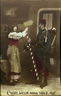
Background imageMaps Collection: First World War: Patriotic map showing an Alsatian greeting a French soldier who brings her back a

First World War: Patriotic map showing an Alsatian greeting a French soldier who brings her back a German helmet
LUX4744337 First World War: Patriotic map showing an Alsatian greeting a French soldier who brings her back a German helmet and a border post in trophee, declaring 'dear sister here'

Background imageMaps Collection: Patriotic map showing France and England contemplating a sphere titled sister nations, 1915

Patriotic map showing France and England contemplating a sphere titled sister nations, 1915
LUX4743748 Patriotic map showing France and England contemplating a sphere titled sister nations, 1915; (add.info.: Patriotic map showing France)

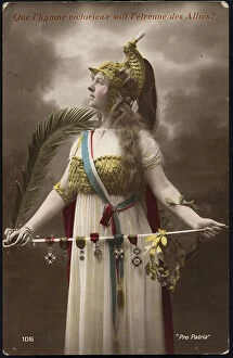
Background imageMaps Collection: Patriotic map showing France wearing muslin and a dragon helmet holding in his hands a sword

Patriotic map showing France wearing muslin and a dragon helmet holding in his hands a sword on which medals rest
LUX4743730 Patriotic map showing France wearing muslin and a dragon helmet holding in his hands a sword on which medals rest

Background imageMaps Collection: First World War: Patriotic map showing a little girl and her dog wishes the good year to their

First World War: Patriotic map showing a little girl and her dog wishes the good year to their master
LUX4744184 First World War: Patriotic map showing a little girl and her dog wishes the good year to their master and father fighting at the front

Background imageMaps Collection: First World War: Patriotic map showing the five allied armed forces represented by children in

First World War: Patriotic map showing the five allied armed forces represented by children in uniform pose under an
LUX4744153 First World War: Patriotic map showing the five allied armed forces represented by children in uniform pose under an airship balloon called Alsace and entitled Victoire et Liberte

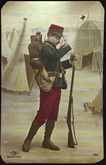
Background imageMaps Collection: First World War: Patriotic map showing a soldier in uniform guarding the door of an operette camp

First World War: Patriotic map showing a soldier in uniform guarding the door of an operette camp, 1915
LUX4744086 First World War: Patriotic map showing a soldier in uniform guarding the door of an operette camp, 1915; (add.info.: World War I - War 14-18 (1914-1918) - World War I (WWI or WW1)

Background imageMaps Collection: First World War: Patriotic map showing a grandfather driving his grandson to avenge the French

First World War: Patriotic map showing a grandfather driving his grandson to avenge the French soldiers who died in
LUX4744065 First World War: Patriotic map showing a grandfather driving his grandson to avenge the French soldiers who died in battle and titled Alons Petity Guy Vengages Them

Background imageMaps Collection: Patriotic map showing a soldier in uniform in a trench thinking of his child appearing in a star

Patriotic map showing a soldier in uniform in a trench thinking of his child appearing in a star
LUX4743425 Patriotic map showing a soldier in uniform in a trench thinking of his child appearing in a star and titled "Star of the Hairy"

Background imageMaps Collection: First World War: Patriotic map showing a French soldier and an English soldier consoling a Belgian

First World War: Patriotic map showing a French soldier and an English soldier consoling a Belgian soldier
LUX4743971 First World War: Patriotic map showing a French soldier and an English soldier consoling a Belgian soldier and titled Brother of Arms

Background imageMaps Collection: First World War: France, Patriotic Map showing a young woman representing the republic who

First World War: France, Patriotic Map showing a young woman representing the republic who encourages two French
LUX4742579 First World War: France, Patriotic Map showing a young woman representing the republic who encourages two French soldiers in uniform to fight until death, 1916

Background imageMaps Collection: First World War: France, Patriotic Map showing freshly arrived Americans thinking of his fiance

First World War: France, Patriotic Map showing freshly arrived Americans thinking of his fiance title, 1917
LUX4743134 First World War: France, Patriotic Map showing freshly arrived Americans thinking of his fiance title, 1917, ask everywhere brilliant mecano for metals and black cord for stoves;

Background imageMaps Collection: First World War: France, Patriotic Map showing freshly arrived Americans thinking of his fiance

First World War: France, Patriotic Map showing freshly arrived Americans thinking of his fiance titled " my
LUX4743123 First World War: France, Patriotic Map showing freshly arrived Americans thinking of his fiance titled " my thought is wholly yours"" ma pensee est tout a vous, 1917

Background imageMaps Collection: First World War: France, Patriotic Map showing an American thinking a his fiancee ' keep my though

First World War: France, Patriotic Map showing an American thinking a his fiancee " keep my though with you"
LUX4743119 First World War: France, Patriotic Map showing an American thinking a his fiancee " keep my though with you", 1917

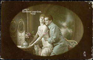
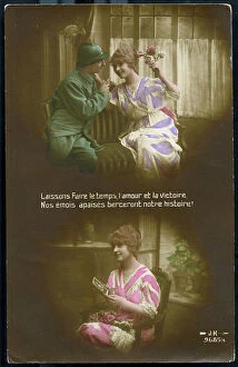
Background imageMaps Collection: First World War: France, Patriotic Map showing a soldier kissing his fiancee card entitled 'supreme

First World War: France, Patriotic Map showing a soldier kissing his fiancee card entitled "supreme
LUX4743046 First World War: France, Patriotic Map showing a soldier kissing his fiancee card entitled "supreme happiness"

Background imageMaps Collection: First World War: France, Patriotic Map showing a young woman in a Phrygian hat representing

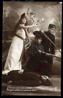
First World War: France, Patriotic Map showing a young woman in a Phrygian hat representing the republic
LUX4742433 First World War: France, Patriotic Map showing a young woman in a Phrygian hat representing the republic, encouraging soldiers to charge the German Armee

Background imageMaps Collection: First World War: France, Patriotic map showing a revolutionary soldier with a cannon of 75 ready

First World War: France, Patriotic map showing a revolutionary soldier with a cannon of 75 ready to fight
LUX4742946 First World War: France, Patriotic map showing a revolutionary soldier with a cannon of 75 ready to fight, map titled the field of the start

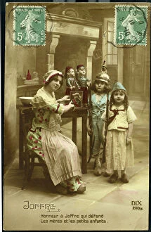
Background imageMaps Collection: First World War: France, Patriotic Map showing a mother who shows her two children as a soldier a

First World War: France, Patriotic Map showing a mother who shows her two children as a soldier a portrait of Joffre
LUX4742917 First World War: France, Patriotic Map showing a mother who shows her two children as a soldier a portrait of Joffre saying

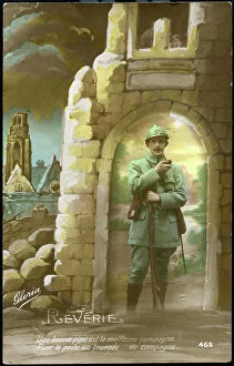
Background imageMaps Collection: First World War: France, Patriotic Map showing a soldier posing in the middle of ruin

First World War: France, Patriotic Map showing a soldier posing in the middle of ruin
LUX4742777 First World War: France, Patriotic Map showing a soldier posing in the middle of ruin and revant thanks to his pipe titled "reverie"" a good pipe

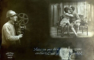
Background imageMaps Collection: First World War: France, Patriotic Map showing a soldier in uniform passing a film showing a

First World War: France, Patriotic Map showing a soldier in uniform passing a film showing a soldier finding his young
LUX4742760 First World War: France, Patriotic Map showing a soldier in uniform passing a film showing a soldier finding his young wife on leave

Background imageMaps Collection: Historical map of Roman Gaul under the reign of Emperor Gratian, divided into 17 provinces

Historical map of Roman Gaul under the reign of Emperor Gratian, divided into 17 provinces
ELD4921741 Historical map of Roman Gaul under the reign of Emperor Gratian, divided into 17 provinces, 380 AD (Map of the roman gaul under the reign of emperor Gratian)

Background imageMaps Collection: Paris, France, Map depicting the Eiffel Tower illuminated with bright multicolored, 1907

Paris, France, Map depicting the Eiffel Tower illuminated with bright multicolored, 1907
LUX4741910 Paris, France, Map depicting the Eiffel Tower illuminated with bright multicolored, 1907; (add.info.: Paris, France, Map depicting the Eiffel Tower illuminated with bright multicolored)

Background imageMaps Collection: First World War: France, Patriotic Map Showing a Caricature of the German Soldier, 1916

First World War: France, Patriotic Map Showing a Caricature of the German Soldier, 1916
LUX4741845 First World War: France, Patriotic Map Showing a Caricature of the German Soldier, 1916, Map titled: Pig's Head at the Buche; (add.info)

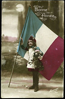
Background imageMaps Collection: First World War: France, Patriotic Map showing a little girl dressed in a cantiniere

First World War: France, Patriotic Map showing a little girl dressed in a cantiniere
LUX4741756 First World War: France, Patriotic Map showing a little girl dressed in a cantiniere, holding the French flag and wishing the happy year

Background imageMaps Collection: First World War: France, Patriotic Map showing an English soldier and a French in a green trench

First World War: France, Patriotic Map showing an English soldier and a French in a green trench, 1915
LUX4741727 First World War: France, Patriotic Map showing an English soldier and a French in a green trench, 1915, Map titled: the trench; (add.info)

Background imageMaps Collection: First World War: France, Patriotic Map showing the Queen of the Seas with a weapon

First World War: France, Patriotic Map showing the Queen of the Seas with a weapon and helmet of Neptune, 1915
LUX4741706 First World War: France, Patriotic Map showing the Queen of the Seas with a weapon and helmet of Neptune, 1915

Background imageMaps Collection: First World War: France, Patriotic Map showing a drawing of the French repelling the Germans under

First World War: France, Patriotic Map showing a drawing of the French repelling the Germans under the command of Joan
LUX4741698 First World War: France, Patriotic Map showing a drawing of the French repelling the Germans under the command of Joan of Arc, 1915

Background imageMaps Collection: First World War: France, Patriotic Map showing a woman who thinks of the next permission by

First World War: France, Patriotic Map showing a woman who thinks of the next permission by looking at the photo of her
LUX4741660 First World War: France, Patriotic Map showing a woman who thinks of the next permission by looking at the photo of her fiance at the front

Background imageMaps Collection: First World War: France, Patriotic Map showing a soldier in an airplane flies with the French flag

First World War: France, Patriotic Map showing a soldier in an airplane flies with the French flag an Alsatian waiting
LUX4741049 First World War: France, Patriotic Map showing a soldier in an airplane flies with the French flag an Alsatian waiting for him with impatience

Background imageMaps Collection: First World War: France, Patriotic Map showing a mother and two daughters sending flowers to

First World War: France, Patriotic Map showing a mother and two daughters sending flowers to husband fighting at
LUX4740976 First World War: France, Patriotic Map showing a mother and two daughters sending flowers to husband fighting at the front

Background imageMaps Collection: First World War: France, Patriotic Map showing a young woman wearing a patriotic bouquet

First World War: France, Patriotic Map showing a young woman wearing a patriotic bouquet
LUX4740850 First World War: France, Patriotic Map showing a young woman wearing a patriotic bouquet and a flag greeting through the window, soldiers leaving to the front, 1915

Background imageMaps Collection: First World War: France, Patriotic Map showing a good sister praying for France

First World War: France, Patriotic Map showing a good sister praying for France, entitled: 'Prayer for France'
LUX4739981 First World War: France, Patriotic Map showing a good sister praying for France, entitled: 'Prayer for France'

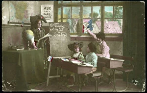
Background imageMaps Collection: First World War: France, Patriotic Map showing in a school in Strasbourg, children

First World War: France, Patriotic Map showing in a school in Strasbourg, children
LUX4740797 First World War: France, Patriotic Map showing in a school in Strasbourg, children and their mistress looking at the French flag and a painting where is written: France is our homeland


All Professionally Made to Order for Quick Shipping


-

Maps Collection

Maps of France Europe are essential tools for travelers and tourists who want to explore the continent. They provide an overview of the country, its major cities, and its attractions and are show roads, rivers, mountains, lakes, and other natural features that make up the landscape. Additionally, they often include information about local customs and culture as well as points of interest such as museums or monuments, and are be found in bookstores or online in various formats including paper maps or digital versions that can be accessed on mobile devices. With a map of France Europe in hand travelers will have no trouble navigating their way around this beautiful country.
+

Our beautiful pictures are available as Framed Prints, Photos, Wall Art and Photo Gifts

The Maps of France Europe collection is a stunning assortment of wall art and framed prints that showcase the beauty and diversity of France. Our collection features an extensive range of maps, including antique maps dating back to the 16th century, as well as modern-day maps highlighting the country's cities, regions, and landmarks. Each print in our collection has been carefully curated by Media Storehouse to provide customers with a unique glimpse into French history and culture. From detailed depictions of Parisian streets to panoramic views of the Alps, these prints are sure to captivate anyone who loves France or European geography. Whether you're looking for a beautiful piece of artwork for your home or office or want to give someone special a thoughtful gift, Maps of France Europe offers something for everyone. With its high-quality printing techniques and durable framing options, our collection is sure to impress even the most discerning art enthusiasts.
+

What are Maps of France Europe art prints?

Maps of France Europe art prints are high-quality reproductions of vintage and contemporary maps showcasing the geography, topography, and landmarks of France and its neighboring European countries. These prints are perfect for those who love history, travel, or simply appreciate the beauty of cartography. The collection includes a wide range of styles, from antique maps dating back to the 16th century to modern designs featuring vibrant colors and intricate details. Some prints focus on specific regions or cities within France or Europe while others provide an overview of the entire continent. These art prints can be used to decorate any room in your home or office, adding a touch of sophistication and elegance to your space. They also make great gifts for anyone with an interest in geography or history. Whether you're looking for a unique piece to add to your personal collection or want to give someone special a thoughtful gift they'll treasure forever, Maps of France Europe art prints from Media Storehouse are sure to impress.
+

What Maps of France Europe art prints can I buy from Media Storehouse?

We offer a wide range of Maps of France Europe art prints that are perfect for those who love to travel or have an interest in geography. These maps come in various styles and designs, including vintage, antique, and modern versions. You can choose from different sizes and formats such as canvas prints, framed prints, posters or photographic prints. Some popular options include the Antique Map of France by John Speed which dates back to 1626; the Vintage Map of Paris which showcases the city's famous landmarks; and the Modern Map of Europe which highlights all major cities across the continent. Whether you're looking for a decorative piece for your home or office space or want to gift it to someone who loves history or geography- Media Storehouse has got you covered with their vast collection of Maps of France Europe art prints.
+

How do I buy Maps of France Europe art prints?

To buy Maps of France Europe art prints from Media Storehouse, you can browse through our extensive collection of maps and select the ones that interest you. Once you have made your selection, add them to your cart and proceed to checkout. You will be prompted to enter your shipping and payment information before completing the purchase. We offer a variety of sizes for their art prints, so make sure to choose the one that best fits your needs. The maps are printed on high-quality paper using state-of-the-art printing technology, ensuring that they look great in any setting. If you have any questions or concerns about purchasing Maps of France Europe art prints from Media Storehouse, our customer service team is available to assist you. They can provide additional information about the products or help with any issues that may arise during the ordering process.
+

How much do Maps of France Europe art prints cost?

We offer a wide range of Maps of France Europe art prints at varying prices. The cost of these prints depends on several factors such as the size, quality, and type of print you choose. Our standard paper prints are more affordable than our premium canvas or framed options. Additionally, some maps may be more intricate and detailed than others which can also impact the price. We strive to provide high-quality products at reasonable prices for all customers. Our Maps of France Europe art prints make great additions to any home or office decor and are perfect for history buffs or those who love travel. With a variety of sizes and styles available, there is something for everyone's taste and budget. We encourage customers to browse our selection online to find the perfect map print that fits their needs and preferences without breaking the bank.
+

How will my Maps of France Europe art prints be delivered to me?

We take great care in delivering your Maps of France Europe art prints to you. We use high-quality packaging materials to ensure that your artwork arrives in pristine condition. Your print will be carefully rolled and placed inside a sturdy tube for protection during transit. We work with trusted shipping partners who offer reliable delivery services. Once your order has been dispatched, you will receive an email notification with tracking information so that you can monitor the progress of your shipment. Our team is dedicated to providing excellent customer service, and we are always available to answer any questions or concerns you may have about the delivery process. If there are any issues with your order upon arrival, please contact us immediately so that we can resolve them as quickly as possible. You can trust Media Storehouse to deliver your Maps of France Europe art prints safely and efficiently straight to your doorstep.