Fraud Blocker Skip to main content

Home > Europe > France > Maps

Maps Collection (page 43)

Maps of France Europe are essential tools for travelers and tourists who want to explore the continent

11,164 items

Background imageMaps Collection: Map of YMCA huts in France during WW1

Map of YMCA huts in France during WW1

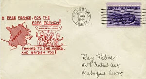
Background imageMaps Collection: Envelope, A Free France, for the Free French, WW2

Envelope, A Free France, for the Free French, WW2
WW2 envelope, A Free France, for the Free French! Thanks to the Yanks and British too! Date: 1944

Background imageMaps Collection: 13881304

13881304

Background imageMaps Collection: 13881229

13881229

Background imageMaps Collection: 13878568

13878568

Background imageMaps Collection: 13873498

13873498

Background imageMaps Collection: 13869803

13869803

Background imageMaps Collection: 13864008

13864008

Background imageMaps Collection: 13863147

13863147

Background imageMaps Collection: 13861454

13861454

Background imageMaps Collection: 13853150

13853150

Background imageMaps Collection: 13834573

13834573

Background imageMaps Collection: 13834549

13834549

Background imageMaps Collection: 13825176

13825176

Background imageMaps Collection: 13825177

13825177

Background imageMaps Collection: 13825172

13825172

Background imageMaps Collection: 13825146

13825146

Background imageMaps Collection: 13825139

13825139

Background imageMaps Collection: 13825096

13825096

Background imageMaps Collection: 13825076

13825076

Background imageMaps Collection: 13825064

13825064

Background imageMaps Collection: 13824114

13824114

Background imageMaps Collection: 13821873

13821873

Background imageMaps Collection: 13819081

13819081

Background imageMaps Collection: 13819072

13819072

Background imageMaps Collection: 13819070

13819070

Background imageMaps Collection: 13819066

13819066

Background imageMaps Collection: 13819067

13819067

Background imageMaps Collection: Sundial, Coaching inn, Launois-sur-Vence, Ardennes, France

Sundial, Coaching inn, Launois-sur-Vence, Ardennes, France
Sundial and route map for postal and courier coaches between Launois and Paris, on a stone plaque at the coaching inn, built 1654, in Launois-sur-Vence, Ardennes, Grand Est, France

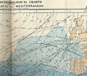
Background imageMaps Collection: RMS Titanic - shipping chart of North Atlantic

RMS Titanic - shipping chart of North Atlantic for the month of April 1912, Sheet 133, Meteorological Office, London. The chart is in colour and displays wind, sea current, sea temperature
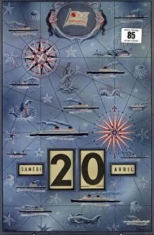
Background imageMaps Collection: Rare CGT Gerrer agent's calendar

Rare CGT Gerrer agent's calendar
Rare CGT Gerrer agent's calendar showing the ships of the line including the Ile de France. 9 x 14 inches

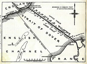
Background imageMaps Collection: Map of proposed railway Channel Tunnel

Map of proposed railway Channel Tunnel, Dover to Calais Date: circa 1850

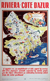
Background imageMaps Collection: Poster, French Riviera, Cote d'Azur, South of France

Poster, French Riviera, Cote d'Azur, South of France
Poster, French Riviera, Cote d'Azur, South of France Date: circa 1935

Background imageMaps Collection: Poster, Terrot Motor Cycles, Dijon, France

Poster, Terrot Motor Cycles, Dijon, France Date: 1926

Background imageMaps Collection: Antique Map of the Cinque Ports, (French: Five Ports) - 19th Century

Antique Map of the Cinque Ports, (French: Five Ports) - 19th Century
Cinque Ports, (French: Five Ports) medieval confederation of English Channel ports in southeastern England, formed to furnish ships and men for the king's service

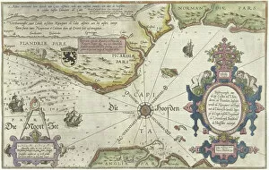
Background imageMaps Collection: Map of the Coast of Flanders, Normandy and England, 1580-81 (engraving)

Map of the Coast of Flanders, Normandy and England, 1580-81 (engraving)
7415458 Map of the Coast of Flanders, Normandy and England, 1580-81 (engraving) by Doetecum, Joannes van (1530-1605); 32 -- 51.2 cm; Rijksmuseum, Amsterdam

Background imageMaps Collection: City map of Strasbourg in 1885, France, Historic, digitally restored reproduction of a 19th

City map of Strasbourg in 1885, France, Historic, digitally restored reproduction of a 19th century original
1900s, 19th-century, accurate, alsace-champagne-ardenne-lorraine, archive, atlas, atlases, black, black-and-white, black-white, character, city maps, concept, concept image, contemporary, copy

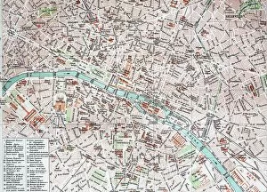
Background imageMaps Collection: Street Map of Paris, 1890, France, Historic, digitally restored reproduction of an original 19th

Street Map of Paris, 1890, France, Historic, digitally restored reproduction of an original 19th century original
1900s, 19th-century, art work, arts, artwork, artworks, black, black-and-white, black-white, card, cards, depiction, depictions, deserted, digital, digitally, drawing, drawings, drawn, early

Background imageMaps Collection: Historic greeting card, birthday card with a child and a basket of flowers, France, 1890, Historic

Historic greeting card, birthday card with a child and a basket of flowers, France, 1890, Historic
1 person, 1900s, 19th-century, art work, arts, artwork, artworks, baskets, bloom, blossoms, children, depiction, depictions, digital, digitally, drawing, drawings, drawn, flowering, flowers, genus

Background imageMaps Collection: Old chromolithograph map of French provinces claimed by Henry VIII - 1512

Old chromolithograph map of French provinces claimed by Henry VIII - 1512
Antique Illustration. Copyright has expired on this artwork. From my own archives, digitally restored

Background imageMaps Collection: Western Europe, from the series Where Our Exports Go [6321242] (colour litho)

Western Europe, from the series Where Our Exports Go [6321242] (colour litho)
MAN464497 Western Europe, from the series Where Our Exports Go [6321242] (colour litho) by Grimmond, William (1884-1952); Manchester Art Gallery, UK; (add.info.: See 6320722, 452963, 452962, 464497)

Background imageMaps Collection: Battle of Green Spring, Map of the land on the left bank of the James River opposite Jamestown in

Battle of Green Spring, Map of the land on the left bank of the James River opposite Jamestown in Virginia where
7411767 Battle of Green Spring, Map of the land on the left bank of the James River opposite Jamestown in Virginia where the battle of July 6

Background imageMaps Collection: Map of Newport and Rhode Island, 1780 (pen, ink, watercolor)

Map of Newport and Rhode Island, 1780 (pen, ink, watercolor)
7408030 Map of Newport and Rhode Island, 1780 (pen, ink, watercolor) by French School, (18th century); 48 x 98 cm; (add.info.: This was a preliminary draft for other French maps of Newport)

Background imageMaps Collection: Map of Newport, Rhode Island, 1780 (pen, ink, watercolor)

Map of Newport, Rhode Island, 1780 (pen, ink, watercolor)
7408031 Map of Newport, Rhode Island, 1780 (pen, ink, watercolor) by French School, (18th century); 58 x 61 cm; (add.info.: Map of the city, port, and harbor of Newport, with part of Rhode Island)

Background imageMaps Collection: Colbert Presenting the Members of the Royal Academy of Sciences to Louis XIV in 1667 (oil on canvas)

Colbert Presenting the Members of the Royal Academy of Sciences to Louis XIV in 1667 (oil on canvas)
JLJ4626852 Colbert Presenting the Members of the Royal Academy of Sciences to Louis XIV in 1667 (oil on canvas) by Testelin

Background imageMaps Collection: Old chromolithograph map of siege of Strasbourg, France

Old chromolithograph map of siege of Strasbourg, France
Copyright has expired on this artwork. From my own archives, digitally restored

Background imageMaps Collection: Old chromolithograph map of Paris, capital and most populous city of France

Old chromolithograph map of Paris, capital and most populous city of France
Antique Illustration, Copyright has expired on this artwork. From my own archives, digitally restored

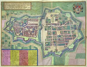
Background imageMaps Collection: Map of Nancy, from Civitates Orbis Terrarum by Georg Braun (1541-1622)

Map of Nancy, from Civitates Orbis Terrarum by Georg Braun (1541-1622) and Frans Hogenberg (1535-90) c
STC138946 Map of Nancy, from Civitates Orbis Terrarum by Georg Braun (1541-1622) and Frans Hogenberg (1535-90) c.1572-1617 (coloured engraving) by Hoefnagel


All Professionally Made to Order for Quick Shipping


-

Maps Collection

Maps of France Europe are essential tools for travelers and tourists who want to explore the continent. They provide an overview of the country, its major cities, and its attractions and are show roads, rivers, mountains, lakes, and other natural features that make up the landscape. Additionally, they often include information about local customs and culture as well as points of interest such as museums or monuments, and are be found in bookstores or online in various formats including paper maps or digital versions that can be accessed on mobile devices. With a map of France Europe in hand travelers will have no trouble navigating their way around this beautiful country.
+

Our beautiful Wall Art and Photo Gifts include Framed Prints, Photo Prints, Poster Prints, Canvas Prints, Jigsaw Puzzles, Metal Prints and so much more

The Maps of France Europe collection is a stunning assortment of wall art and framed prints that showcase the beauty and diversity of France. Our collection features an extensive range of maps, including antique maps dating back to the 16th century, as well as modern-day maps highlighting the country's cities, regions, and landmarks. Each print in our collection has been carefully curated by Media Storehouse to provide customers with a unique glimpse into French history and culture. From detailed depictions of Parisian streets to panoramic views of the Alps, these prints are sure to captivate anyone who loves France or European geography. Whether you're looking for a beautiful piece of artwork for your home or office or want to give someone special a thoughtful gift, Maps of France Europe offers something for everyone. With its high-quality printing techniques and durable framing options, our collection is sure to impress even the most discerning art enthusiasts.
+

What are Maps of France Europe art prints?

Maps of France Europe art prints are high-quality reproductions of vintage and contemporary maps showcasing the geography, topography, and landmarks of France and its neighboring European countries. These prints are perfect for those who love history, travel, or simply appreciate the beauty of cartography. The collection includes a wide range of styles, from antique maps dating back to the 16th century to modern designs featuring vibrant colors and intricate details. Some prints focus on specific regions or cities within France or Europe while others provide an overview of the entire continent. These art prints can be used to decorate any room in your home or office, adding a touch of sophistication and elegance to your space. They also make great gifts for anyone with an interest in geography or history. Whether you're looking for a unique piece to add to your personal collection or want to give someone special a thoughtful gift they'll treasure forever, Maps of France Europe art prints from Media Storehouse are sure to impress.
+

What Maps of France Europe art prints can I buy from Media Storehouse?

We offer a wide range of Maps of France Europe art prints that are perfect for those who love to travel or have an interest in geography. These maps come in various styles and designs, including vintage, antique, and modern versions. You can choose from different sizes and formats such as canvas prints, framed prints, posters or photographic prints. Some popular options include the Antique Map of France by John Speed which dates back to 1626; the Vintage Map of Paris which showcases the city's famous landmarks; and the Modern Map of Europe which highlights all major cities across the continent. Whether you're looking for a decorative piece for your home or office space or want to gift it to someone who loves history or geography- Media Storehouse has got you covered with their vast collection of Maps of France Europe art prints.
+

How do I buy Maps of France Europe art prints?

To buy Maps of France Europe art prints from Media Storehouse, you can browse through our extensive collection of maps and select the ones that interest you. Once you have made your selection, add them to your cart and proceed to checkout. You will be prompted to enter your shipping and payment information before completing the purchase. We offer a variety of sizes for their art prints, so make sure to choose the one that best fits your needs. The maps are printed on high-quality paper using state-of-the-art printing technology, ensuring that they look great in any setting. If you have any questions or concerns about purchasing Maps of France Europe art prints from Media Storehouse, our customer service team is available to assist you. They can provide additional information about the products or help with any issues that may arise during the ordering process.
+

How much do Maps of France Europe art prints cost?

We offer a wide range of Maps of France Europe art prints at varying prices. The cost of these prints depends on several factors such as the size, quality, and type of print you choose. Our standard paper prints are more affordable than our premium canvas or framed options. Additionally, some maps may be more intricate and detailed than others which can also impact the price. We strive to provide high-quality products at reasonable prices for all customers. Our Maps of France Europe art prints make great additions to any home or office decor and are perfect for history buffs or those who love travel. With a variety of sizes and styles available, there is something for everyone's taste and budget. We encourage customers to browse our selection online to find the perfect map print that fits their needs and preferences without breaking the bank.
+

How will my Maps of France Europe art prints be delivered to me?

We take great care in delivering your Maps of France Europe art prints to you. We use high-quality packaging materials to ensure that your artwork arrives in pristine condition. Your print will be carefully rolled and placed inside a sturdy tube for protection during transit. We work with trusted shipping partners who offer reliable delivery services. Once your order has been dispatched, you will receive an email notification with tracking information so that you can monitor the progress of your shipment. Our team is dedicated to providing excellent customer service, and we are always available to answer any questions or concerns you may have about the delivery process. If there are any issues with your order upon arrival, please contact us immediately so that we can resolve them as quickly as possible. You can trust Media Storehouse to deliver your Maps of France Europe art prints safely and efficiently straight to your doorstep.