Fraud Blocker Skip to main content

Home > Europe > Czech Republic > Maps

Maps Collection (page 2)

The Czech Republic is a landlocked country located in Central Europe, and is bordered by Germany, Austria, Slovakia and Poland

117 items

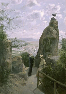
Background imageMaps Collection: Hans Heiling (The Hans Heiling Rocks), 1894 (watercolour)

Hans Heiling (The Hans Heiling Rocks), 1894 (watercolour)
7205685 Hans Heiling (The Hans Heiling Rocks), 1894 (watercolour) by Gause, Wilhelm (1853-1916); Muzeum Karlovy Vary, Czech Republic; (add.info)

Background imageMaps Collection: Findlaters Tempel (Findlaters Temple), 1895 (watercolour)

Findlaters Tempel (Findlaters Temple), 1895 (watercolour)
7205684 Findlaters Tempel (Findlaters Temple), 1895 (watercolour) by Gause, Wilhelm (1853-1916); Muzeum Karlovy Vary, Czech Republic; (add.info)

Background imageMaps Collection: Kaiserbad (Imperial Baths), 1896 (watercolour)

Kaiserbad (Imperial Baths), 1896 (watercolour)
7205680 Kaiserbad (Imperial Baths), 1896 (watercolour) by Gause, Wilhelm (1853-1916); Muzeum Karlovy Vary, Czech Republic; (add.info)

Background imageMaps Collection: An der Tepl (Along the Tepla River), 1894 (watercolour)

An der Tepl (Along the Tepla River), 1894 (watercolour)
7205678 An der Tepl (Along the Tepla River), 1894 (watercolour) by Gause, Wilhelm (1853-1916); Muzeum Karlovy Vary, Czech Republic; (add.info)

Background imageMaps Collection: Denkmal Peters des Groszen (Monument of Peter the Great), 1895 (watercolour)

Denkmal Peters des Groszen (Monument of Peter the Great), 1895 (watercolour)
7205677 Denkmal Peters des Groszen (Monument of Peter the Great), 1895 (watercolour) by Gause, Wilhelm (1853-1916); Muzeum Karlovy Vary

Background imageMaps Collection: The Sprudel-Colonnade (watercolour)

The Sprudel-Colonnade (watercolour)
7205589 The Sprudel-Colonnade (watercolour) by Gause, Wilhelm (1853-1916); Muzeum Karlovy Vary, Czech Republic; (add.info)

Background imageMaps Collection: Karlsbad / Carlsbad / Karlovy Vary: Stefaniewarte

Karlsbad / Carlsbad / Karlovy Vary: Stefaniewarte
7191525 Karlsbad / Carlsbad / Karlovy Vary: Stefaniewarte by European School, (19th century); Private Collection; (add.info.: Stefaniewarte. Illustration for Album von Karlsbad (np, c 1890)

Background imageMaps Collection: Karlsbad / Carlsbad / Karlovy Vary: Stadtpark

Karlsbad / Carlsbad / Karlovy Vary: Stadtpark
7191504 Karlsbad / Carlsbad / Karlovy Vary: Stadtpark by European School, (19th century); Private Collection; (add.info.: Stadtpark. Illustration for Album von Karlsbad (np, c 1890)

Background imageMaps Collection: Karlsbad / Carlsbad / Karlovy Vary: Egerstrasse

Karlsbad / Carlsbad / Karlovy Vary: Egerstrasse
7191489 Karlsbad / Carlsbad / Karlovy Vary: Egerstrasse by European School, (19th century); Private Collection; (add.info.: Egerstrasse. Illustration for Album von Karlsbad (np, c 1890)

Background imageMaps Collection: Rote oder weisze Rosen? (Red or white roses, Sir?), 1895 (watercolour)

Rote oder weisze Rosen? (Red or white roses, Sir?), 1895 (watercolour)
7205676 Rote oder weisze Rosen? (Red or white roses, Sir?), 1895 (watercolour) by Gause, Wilhelm (1853-1916); Muzeum Karlovy Vary

Background imageMaps Collection: Muhlbrunn-Colonnade (The Mill Spring Colonnade), 1895 (watercolour)

Muhlbrunn-Colonnade (The Mill Spring Colonnade), 1895 (watercolour)
7205595 Muhlbrunn-Colonnade (The Mill Spring Colonnade), 1895 (watercolour) by Gause, Wilhelm (1853-1916); Muzeum Karlovy Vary

Background imageMaps Collection: Der Sprudel (Hot Spring), 1894 (watercolour)

Der Sprudel (Hot Spring), 1894 (watercolour)
7205591 Der Sprudel (Hot Spring), 1894 (watercolour) by Gause, Wilhelm (1853-1916); Muzeum Karlovy Vary, Czech Republic; (add.info)

Background imageMaps Collection: Gemse am Hirschensprung (The Chamois on Stags Leap), 1895 (watercolour)

Gemse am Hirschensprung (The Chamois on Stags Leap), 1895 (watercolour)
7205586 Gemse am Hirschensprung (The Chamois on Stags Leap), 1895 (watercolour) by Gause, Wilhelm (1853-1916); Muzeum Karlovy Vary

Background imageMaps Collection: Karlsbad / Carlsbad / Karlovy Vary: Elbogen

Karlsbad / Carlsbad / Karlovy Vary: Elbogen
7191531 Karlsbad / Carlsbad / Karlovy Vary: Elbogen by European School, (19th century); Private Collection; (add.info.: Elbogen. Illustration for Album von Karlsbad (np, c 1890)

Background imageMaps Collection: Karlsbad / Carlsbad / Karlovy Vary: Synagoge

Karlsbad / Carlsbad / Karlovy Vary: Synagoge
7191514 Karlsbad / Carlsbad / Karlovy Vary: Synagoge by European School, (19th century); Private Collection; (add.info.: Synagoge. Illustration for Album von Karlsbad (np, c 1890)

Background imageMaps Collection: Karlsbad / Carlsbad / Karlovy Vary: Curhaus

Karlsbad / Carlsbad / Karlovy Vary: Curhaus
7191501 Karlsbad / Carlsbad / Karlovy Vary: Curhaus by European School, (19th century); Private Collection; (add.info.: Curhaus. Illustration for Album von Karlsbad (np, c 1890)

Background imageMaps Collection: Karlsbad / Carlsbad / Karlovy Vary: Sprudel

Karlsbad / Carlsbad / Karlovy Vary: Sprudel
7191497 Karlsbad / Carlsbad / Karlovy Vary: Sprudel by European School, (19th century); Private Collection; (add.info.: Sprudel. Illustration for Album von Karlsbad (np, c 1890)

Background imageMaps Collection: Karlsbad / Carlsbad / Karlovy Vary: Marktplatz

Karlsbad / Carlsbad / Karlovy Vary: Marktplatz
7191496 Karlsbad / Carlsbad / Karlovy Vary: Marktplatz by European School, (19th century); Private Collection; (add.info.: Marktplatz. Illustration for Album von Karlsbad (np, c 1890)

Background imageMaps Collection: Karlsbad / Carlsbad / Karlovy Vary: Gartenzeile

Karlsbad / Carlsbad / Karlovy Vary: Gartenzeile
7191488 Karlsbad / Carlsbad / Karlovy Vary: Gartenzeile by European School, (19th century); Private Collection; (add.info.: Gartenzeile. Illustration for Album von Karlsbad (np, c 1890)

Background imageMaps Collection: Karlsbad / Carlsbad / Karlovy Vary: Cafe Elefant, Alte Wiese

Karlsbad / Carlsbad / Karlovy Vary: Cafe Elefant, Alte Wiese
7191515 Karlsbad / Carlsbad / Karlovy Vary: Cafe Elefant, Alte Wiese by European School, (19th century); Private Collection; (add.info.: Cafe Elefant, Alte Wiese)

Background imageMaps Collection: Karlsbad / Carlsbad / Karlovy Vary: Cafe Pupp

Karlsbad / Carlsbad / Karlovy Vary: Cafe Pupp
7191506 Karlsbad / Carlsbad / Karlovy Vary: Cafe Pupp by European School, (19th century); Private Collection; (add.info.: Cafe Pupp. Illustration for Album von Karlsbad (np, c 1890)

Background imageMaps Collection: Karlsbad / Carlsbad / Karlovy Vary: Posthof

Karlsbad / Carlsbad / Karlovy Vary: Posthof
7191505 Karlsbad / Carlsbad / Karlovy Vary: Posthof by European School, (19th century); Private Collection; (add.info.: Posthof. Illustration for Album von Karlsbad (np, c 1890)

Background imageMaps Collection: Karlsbad / Carlsbad / Karlovy Vary: Freundschaftssaal

Karlsbad / Carlsbad / Karlovy Vary: Freundschaftssaal
7191503 Karlsbad / Carlsbad / Karlovy Vary: Freundschaftssaal by European School, (19th century); Private Collection; (add.info.: Freundschaftssaal. Illustration for Album von Karlsbad (np, c 1890)

Background imageMaps Collection: Karlsbad / Carlsbad / Karlovy Vary: Sprudel-Colonnade

Karlsbad / Carlsbad / Karlovy Vary: Sprudel-Colonnade
7191498 Karlsbad / Carlsbad / Karlovy Vary: Sprudel-Colonnade by European School, (19th century); Private Collection; (add.info.: Sprudel-Colonnade. Illustration for Album von Karlsbad (np, c 1890)

Background imageMaps Collection: Karlsbad / Carlsbad / Karlovy Vary: Karlsbad von der Nordseite

Karlsbad / Carlsbad / Karlovy Vary: Karlsbad von der Nordseite
7191486 Karlsbad / Carlsbad / Karlovy Vary: Karlsbad von der Nordseite by European School, (19th century); Private Collection; (add.info.: Karlsbad von der Nordseite)

Background imageMaps Collection: Theater-Vestibul (The Vestibule of the Theatre), 1895 (watercolour)

Theater-Vestibul (The Vestibule of the Theatre), 1895 (watercolour)
7205682 Theater-Vestibul (The Vestibule of the Theatre), 1895 (watercolour) by Gause, Wilhelm (1853-1916); Muzeum Karlovy Vary

Background imageMaps Collection: Das Vestibul des Kaiserbads (The Vestibule of the Imperial Baths), 1896 (watercolour)

Das Vestibul des Kaiserbads (The Vestibule of the Imperial Baths), 1896 (watercolour)
7205679 Das Vestibul des Kaiserbads (The Vestibule of the Imperial Baths), 1896 (watercolour) by Gause, Wilhelm (1853-1916); Muzeum Karlovy Vary

Background imageMaps Collection: Schloszbrunnen (The Castle Spring), 1895 (watercolour)

Schloszbrunnen (The Castle Spring), 1895 (watercolour)
7205592 Schloszbrunnen (The Castle Spring), 1895 (watercolour) by Gause, Wilhelm (1853-1916); Muzeum Karlovy Vary, Czech Republic; (add.info)

Background imageMaps Collection: Carlsbad, 1895 (watercolour)

Carlsbad, 1895 (watercolour)
7205588 Carlsbad, 1895 (watercolour) by Gause, Wilhelm (1853-1916); Muzeum Karlovy Vary, Czech Republic; (add.info.: Wilhelm Gause was a German-Austrian portrait)

Background imageMaps Collection: Abend-Konzert im Stadtpark (Night Concert in the Municipal Park), 1895 (watercolour)

Abend-Konzert im Stadtpark (Night Concert in the Municipal Park), 1895 (watercolour)
7205585 Abend-Konzert im Stadtpark (Night Concert in the Municipal Park), 1895 (watercolour) by Gause, Wilhelm (1853-1916); Muzeum Karlovy Vary

Background imageMaps Collection: Weiszer Schwan (The Schiller House), 1895 (watercolour)

Weiszer Schwan (The Schiller House), 1895 (watercolour)
7205593 Weiszer Schwan (The Schiller House), 1895 (watercolour) by Gause, Wilhelm (1853-1916); Muzeum Karlovy Vary, Czech Republic; (add.info)

Background imageMaps Collection: Czech Republic Reference Map

Czech Republic Reference Map

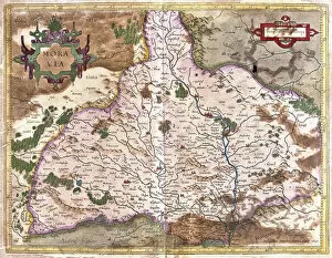
Background imageMaps Collection: Moravia, Czech Republic (engraving, 1596)

Moravia, Czech Republic (engraving, 1596)
LRI4718120 Moravia, Czech Republic (engraving, 1596) by Mercator, Gerardus (1512-94); Private Collection; (add.info.: Moravia, 1630: Moravia (Moravia)

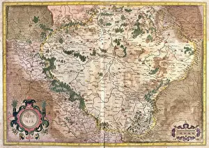
Background imageMaps Collection: Prague, Czech Republic (engraving, 1596)

Prague, Czech Republic (engraving, 1596)
LRI4718102 Prague, Czech Republic (engraving, 1596) by Mercator, Gerardus (1512-94); Private Collection; (add.info.: Bohemia, 1634: Prague)

Background imageMaps Collection: Map of Moravian Wallachia (Czech Republic) (Engraving, 1717)

Map of Moravian Wallachia (Czech Republic) (Engraving, 1717)
LRI4712593 Map of Moravian Wallachia (Czech Republic) (Engraving, 1717) by Nolin, Jean-Baptiste (c.1657-1708); Private Collection; (add.info)

Background imageMaps Collection: Map of the Kingdom of Bohemia (Czech Republic) (Engraving, 1717)

Map of the Kingdom of Bohemia (Czech Republic) (Engraving, 1717)
LRI4712483 Map of the Kingdom of Bohemia (Czech Republic) (Engraving, 1717) by Nolin, Jean-Baptiste (c.1657-1708); Private Collection; (add.info)

Background imageMaps Collection: PanGermanic and AntiGermanic plans for the division of Europe after the Great War of 1914

PanGermanic and AntiGermanic plans for the division of Europe after the Great War of 1914
CHT411553 PanGermanic and AntiGermanic plans for the division of Europe after the Great War of 1914, c.1917 (colour litho) by Czech School

Background imageMaps Collection: Map of Prague, from Civitates Orbis Terrarum by Georg Braun (1541-1622

Map of Prague, from Civitates Orbis Terrarum by Georg Braun (1541-1622
STC121014 Map of Prague, from Civitates Orbis Terrarum by Georg Braun (1541-1622) and Frans Hogenberg (1535-90), c.1572 (coloured engraving) by Hoefnagel

Background imageMaps Collection: Map showing the new frontiers of Central Europe following the removal of

Map showing the new frontiers of Central Europe following the removal of
XEE4188271 Map showing the new frontiers of Central Europe following the removal of the Austro-Hungarian Empire (Austro-Hungarian) during the Treaty of Saint Germain en Laye

Background imageMaps Collection: Map of Boheme (Czech Republic) (etching, 1671)

Map of Boheme (Czech Republic) (etching, 1671)
LRI4710089 Map of Boheme (Czech Republic) (etching, 1671) by Wit, Frederick de (1630-1706); Private Collection; (add.info)

Background imageMaps Collection: Map of the Duche of Silesia (Germany and the Czech Republic) (etching, 1671)

Map of the Duche of Silesia (Germany and the Czech Republic) (etching, 1671)
LRI4710109 Map of the Duche of Silesia (Germany and the Czech Republic) (etching, 1671) by Wit, Frederick de (1630-1706); Private Collection; (add.info)

Background imageMaps Collection: Map of Moravia (Czech Republic) (etching, 1671)

Map of Moravia (Czech Republic) (etching, 1671)
LRI4710096 Map of Moravia (Czech Republic) (etching, 1671) by Wit, Frederick de (1630-1706); Private Collection; (add.info)

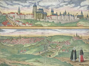
Background imageMaps Collection: Views of Prague (Praga) and Egra, Czech Republic (etching, 1572-1617)

Views of Prague (Praga) and Egra, Czech Republic (etching, 1572-1617)
LRI4708112 Views of Prague (Praga) and Egra, Czech Republic (etching, 1572-1617) by Hogenberg, Franz (1540-c.1590); Private Collection; (add.info.: Views of Prague (Praga) and Egra

Background imageMaps Collection: Christophe Colomb decouvre l Amerique - Christopher Columbus Discovers America

Christophe Colomb decouvre l Amerique - Christopher Columbus Discovers America
FIA5407149 Christophe Colomb decouvre l Amerique - Christopher Columbus Discovers America - painting by Ruben, Christian (1805-1875) - Oil on canvas - National Gallery, Prague by Ruben

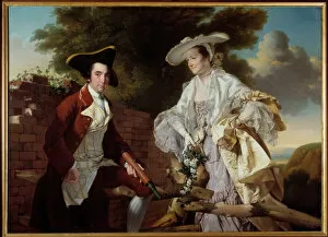
Background imageMaps Collection: Portrait of the cartographer Peter Perez Burdett (1735-1793

Portrait of the cartographer Peter Perez Burdett (1735-1793
JLJ4657567 Portrait of the cartographer Peter Perez Burdett (1735-1793) and his wife Hannah Painting by Joseph Wright Of Derby (1734-1797) 1765 Prague, National Gallery by Wright of Derby

Background imageMaps Collection: Map of the City of Florence (engraving)

Map of the City of Florence (engraving)
BAT100303 Map of the City of Florence (engraving) by Hollar, Wenceslaus (1607-77); Museo di Firenze Com era, Florence, Italy; Photo eNicol Orsi Battaglini; Czech, out of copyright

Background imageMaps Collection: Olomouc, c1740. Creator: Johann Georg Ringlin

Olomouc, c1740. Creator: Johann Georg Ringlin
Olomouc, c1740. The city of Olomouc in Moravia, (Czech Republic), with a coat of arms in the foreground, and churches, castles, and principal landmarks indicated

Background imageMaps Collection: Brno, c1740. Creator: Johann Georg Ringlin

Brno, c1740. Creator: Johann Georg Ringlin
Brno, c1740. The city of Brno in Moravia (Czech Republic), with churches and principal landmarks indicated, and Spilberk Castle beyond


All Professionally Made to Order for Quick Shipping


-

Maps Collection

The Czech Republic is a landlocked country located in Central Europe, and is bordered by Germany, Austria, Slovakia and Poland. The country has a rich history and culture that can be explored through its many maps. Maps of the Czech Republic show its major cities, rivers, lakes, mountains and forests. They also show the country's road network and rail system as well as its national parks and protected areas. In addition to physical features, maps of the Czech Republic also provide information about its population density, political divisions and economic activity. With so much to explore in this small but fascinating country, maps of the Czech Republic are essential for travelers looking to get off the beaten path or just learn more about this unique corner of Europe.
+

Our beautiful Wall Art and Photo Gifts include Framed Prints, Photo Prints, Poster Prints, Canvas Prints, Jigsaw Puzzles, Metal Prints and so much more

Media Storehouse offers a stunning collection of Maps of Czech Republic Europe, which includes a wide range of wall art and framed prints. Our collection features various maps that showcase the beautiful country of Czech Republic in detail. The maps are designed to provide an accurate representation of the geography and topography of the region, including its cities, towns, rivers, mountains, and other landmarks. The Maps of Czech Republic Europe collection is perfect for anyone who loves history or geography or wants to add some unique decor to their home or office space. These high-quality prints are available in different sizes and styles to suit every taste and budget. Whether you're looking for a vintage-style map or a modern interpretation, Media Storehouse has something for everyone. With its exceptional quality and attention to detail, our collection is sure to impress anyone who appreciates fine art and design. So why not explore this fantastic selection today?
+

What are Maps of Czech Republic Europe art prints?

Maps of Czech Republic Europe art prints are high-quality reproductions of maps that depict the geography and topography of the Czech Republic. These prints are designed to be visually appealing, with vibrant colors and intricate details that make them ideal for display in homes, offices, or other settings. These art prints can serve a variety of purposes. For example, they may be used as educational tools for students studying geography or history. They may also be used by travelers who want to better understand the layout of cities and regions within the Czech Republic. In addition to their practical uses, Maps of Czech Republic Europe art prints can also be appreciated for their aesthetic value. Many people enjoy displaying these prints simply because they find them beautiful or interesting. Maps of Czech Republic Europe art prints offer a unique way to explore and appreciate this fascinating country's landscape and culture.
+

What Maps of Czech Republic Europe art prints can I buy from Media Storehouse?

We offer a wide range of Maps of Czech Republic Europe art prints that you can purchase. These maps are available in different sizes and styles, including vintage, modern, and artistic designs. You can choose from various formats such as canvas prints, framed prints, or photographic prints to suit your preferences. Some popular options include detailed street maps of Prague or the entire country with landmarks and attractions marked out. There are also topographical maps showing mountain ranges and rivers for those interested in outdoor activities like hiking or kayaking. Additionally, we have political maps that illustrate the administrative regions within the Czech Republic as well as its neighboring countries. These would be ideal for students studying geography or history. Whether you're looking for practical navigation tools or decorative wall art pieces showcasing this beautiful European nation's landscape and culture – Media Storehouse has something to offer everyone.
+

How do I buy Maps of Czech Republic Europe art prints?

To purchase Maps of Czech Republic Europe art prints from Media Storehouse, you can browse our extensive collection online. We offer a wide range of maps in various styles and sizes to suit your preferences. Once you have found the map that you like, simply add it to your cart and proceed to checkout. During the checkout process, you will be prompted to provide your shipping information and payment details. We accept all major credit cards as well as PayPal for added convenience. Once your order has been processed, your Maps of Czech Republic Europe art print will be carefully packaged and shipped directly to your door. You can expect high-quality printing on premium paper stock that is sure to impress. Whether you are looking for a unique piece of wall art or a thoughtful gift for someone special, we have everything you need to bring the beauty of Czech Republic's maps into your home or office space.
+

How much do Maps of Czech Republic Europe art prints cost?

We offer a wide range of Maps of Czech Republic Europe art prints that vary in price depending on the size and type of print. Our collection includes vintage maps, modern maps, and artistic interpretations of the country's geography. We have options for every budget and taste, from affordable poster prints to high-quality canvas prints. Our Maps of Czech Republic Europe art prints are perfect for anyone who loves travel or has an interest in geography. They make great gifts for friends and family members who have visited or plan to visit the country. We take pride in offering top-quality products at competitive prices. All our art prints are made using premium materials to ensure they look stunning on your wall for years to come. Browse our selection today to find the perfect map print for your home or office.
+

How will my Maps of Czech Republic Europe art prints be delivered to me?

We take great care in ensuring that your Maps of Czech Republic Europe art prints are delivered to you safely and securely. We use high-quality packaging materials to protect your print during transit and ensure it arrives in pristine condition. Your art print will be carefully rolled up and placed inside a sturdy cardboard tube for shipping. This ensures that the print is protected from any damage or creases during transport. The tube will then be sealed with tape to prevent any moisture or dust from entering. Once your order has been dispatched, you will receive an email confirmation with tracking information so you can keep track of its progress until it arrives at your doorstep. We pride ourselves on providing excellent customer service, so if you have any questions about the delivery process or need assistance with anything else, please don't hesitate to contact us.