Fraud Blocker Skip to main content

Home > Design Pics > Vintage Maps

Vintage Maps Collection (page 2)

452 items

We are proud to offer this selection in partnership with Design Pics

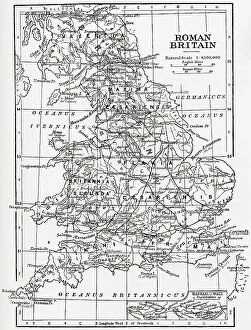
Background imageVintage Maps Collection: Map Roman Britain Area Island Ruled Governed

Map Roman Britain Area Island Ruled Governed
Map of Roman Britain showing the area of the island of Great Britain that was ruled by the Roman Empire, 43 - 410 AD

Background imageVintage Maps Collection: na

na
The Battle of Sedan 1 - 2 September 1870 during the Franco-Prussian War 1870 - 1871. Map of the disposition of forces at approximately midday 2 September 1870 only hours before the surounded French

Background imageVintage Maps Collection: Map Of Britain Angles Saxons Early Middle Ages

Map Of Britain Angles Saxons Early Middle Ages
Map of Britain under the Angles and Saxons. From History of England, 55B.C. to the present time, published 1907

Background imageVintage Maps Collection: Globes Balancing on Wire

Globes Balancing on Wire

Background imageVintage Maps Collection: Close-Up of Eye with World Map

Close-Up of Eye with World Map

Background imageVintage Maps Collection: Mosaic Map of North and South America

Mosaic Map of North and South America

Background imageVintage Maps Collection: Map of Asia Minor, c. 86 BC. From Cassells Illustrated Universal History, published 1883

Map of Asia Minor, c. 86 BC. From Cassells Illustrated Universal History, published 1883
Map of Asia Minor, c.86 BC. From Cassells Illustrated Universal History, published 1883

Background imageVintage Maps Collection: Map of the Americas, Americae Mappa Generalis, by cartographer Johan Baptist Homann, 1664 - 1724

Map of the Americas, Americae Mappa Generalis, by cartographer Johan Baptist Homann, 1664 - 1724, and re-published in 1746 by Homann Heirs, a company formed by Johanns son and others

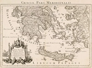
Background imageVintage Maps Collection: Graeciae pars meridionalis. Graeciae antiquae tabula nova. Southern Greece

Graeciae pars meridionalis. Graeciae antiquae tabula nova. Southern Greece. A New Map of Ancient Greece. Parts of Asian Turkey are also shown

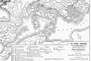
Background imageVintage Maps Collection: Map of the Roman Dominions in the 2nd century BC, with the dates of the chief aquisitions

Map of the Roman Dominions in the 2nd century BC, with the dates of the chief aquisitions. From Cassells Illustrated Universal History, published 1883

Background imageVintage Maps Collection: Map of Ancient Sicily and southern Italy, c. 278 BC. From Cassells Illustrated Universal History

Map of Ancient Sicily and southern Italy, c. 278 BC. From Cassells Illustrated Universal History, published 1883
Map of Ancient Sicily and southern Italy, c.278 BC. From Cassells Illustrated Universal History, published 1883

Background imageVintage Maps Collection: Map of Gaul and part of Britain, c. 58 BC. From Cassells Illustrated Universal History

Map of Gaul and part of Britain, c. 58 BC. From Cassells Illustrated Universal History, published 1883
Map of Gaul and part of Britain, c.58 BC. From Cassells Illustrated Universal History, published 1883

Background imageVintage Maps Collection: Map of northern and central Italy in ancient times. From Cassells Illustrated Universal History

Map of northern and central Italy in ancient times. From Cassells Illustrated Universal History, published 1883

Background imageVintage Maps Collection: Map of Ancient Greece, northern part. From Historical Atlas, published 1923

Map of Ancient Greece, northern part. From Historical Atlas, published 1923

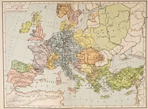
Background imageVintage Maps Collection: Map of Europe and the Byzantine Empire, c. 1000. From Historical Atlas, published 1923

Map of Europe and the Byzantine Empire, c. 1000. From Historical Atlas, published 1923
Map of Europe and the Byzantine Empire, c.1000. From Historical Atlas, published 1923

Background imageVintage Maps Collection: Map of Ancient Greece, southern part. From Historical Atlas, published 1923

Map of Ancient Greece, southern part. From Historical Atlas, published 1923

Background imageVintage Maps Collection: Map showing the partitiion of Africa, 1912. From Historical Atlas, published 1923

Map showing the partitiion of Africa, 1912. From Historical Atlas, published 1923

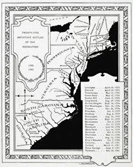
Background imageVintage Maps Collection: 25 Important Battles of the Revolution. Map published 1897 of major battles of the American

25 Important Battles of the Revolution. Map published 1897 of major battles of the American Revolutionary War

Background imageVintage Maps Collection: Map showing Overseas Empires of European Powers, January 1914

Map showing Overseas Empires of European Powers, January 1914. From A Short History of the World, published c. 1936
Map showing Overseas Empires of European Powers, January 1914. From A Short History of the World, published c.1936

Background imageVintage Maps Collection: Map of the British Empire in 1815. From A Short History of the World, published c. 1936

Map of the British Empire in 1815. From A Short History of the World, published c. 1936
Map of the British Empire in 1815. From A Short History of the World, published c.1936

Background imageVintage Maps Collection: Map of the United Staes showing extent of settlement in 1790

Map of the United Staes showing extent of settlement in 1790. From A Short History of the World, published c. 1936
Map of the United Staes showing extent of settlement in 1790. From A Short History of the World, published c.1936

Background imageVintage Maps Collection: Map of Europe at the death of Charlemagne, 814 AD. From A Short History of the World, published c

Map of Europe at the death of Charlemagne, 814 AD. From A Short History of the World, published c. 1936
Map of Europe at the death of Charlemagne, 814 AD. From A Short History of the World, published c.1936

Background imageVintage Maps Collection: Map showing Britain, France and Spain in America, 1750. From A Short History of the World

Map showing Britain, France and Spain in America, 1750. From A Short History of the World, published c. 1936
Map showing Britain, France and Spain in America, 1750. From A Short History of the World, published c.1936

Background imageVintage Maps Collection: Map of Central Europe after the Peace of Westphalia, 1648. From A Short History of the World

Map of Central Europe after the Peace of Westphalia, 1648. From A Short History of the World, published c. 1936
Map of Central Europe after the Peace of Westphalia, 1648. From A Short History of the World, published c.1936

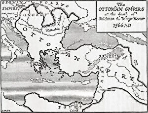
Background imageVintage Maps Collection: Map showing the Ottoman Empire at the death of Suleiman the Magnificent, 1566

Map showing the Ottoman Empire at the death of Suleiman the Magnificent, 1566. From A Short History of the World, published c.1936

Background imageVintage Maps Collection: Map showing the Empire of Jengis Khan, or Genghis Khan, at his death, 1227

Map showing the Empire of Jengis Khan, or Genghis Khan, at his death, 1227. From A Short History of the World, published c.1936

Background imageVintage Maps Collection: Map showing the area more or less under Frankish dominion in the time of Charles Martel, 8th century

Map showing the area more or less under Frankish dominion in the time of Charles Martel, 8th century. From A Short History of the World, published c.1936

Background imageVintage Maps Collection: Map showing the growth of the Moslem power in 25 years from 632 - 656

Map showing the growth of the Moslem power in 25 years from 632 - 656. From A Short History of the World, published c.1936

Background imageVintage Maps Collection: Map showing the Roman Empire and the Barbarians. From A Short History of the World, published c

Map showing the Roman Empire and the Barbarians. From A Short History of the World, published c. 1936
Map showing the Roman Empire and the Barbarians. From A Short History of the World, published c.1936

Background imageVintage Maps Collection: Map showing the extent of the Roman power and its alliances, c

Map showing the extent of the Roman power and its alliances, c. 150 BC, ie on the eve of the Third Punic War. From A Short History of the World, published c.1936

Background imageVintage Maps Collection: Map showing the land of the Hebrews. From A Short History of the World, published c. 1936

Map showing the land of the Hebrews. From A Short History of the World, published c. 1936
Map showing the land of the Hebrews. From A Short History of the World, published c.1936

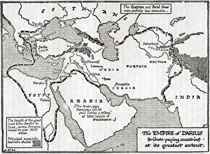
Background imageVintage Maps Collection: Map of the empire of Darius (tribute paying countries) at its greatest extent. Darius I, c

Map of the empire of Darius (tribute paying countries) at its greatest extent. Darius I, c. 550 - 486 BC, aka Darius the Great. Third Iranian King of Kings of the Achaemenid Empire

Background imageVintage Maps Collection: Map showing the relation of the Median and second Babylonian (Chaldaean) Empires

Map showing the relation of the Median and second Babylonian (Chaldaean) Empires. From A Short History of the World, published c.1936

Background imageVintage Maps Collection: Map of the possible outline of Europe and Western Asia at the maximum of the fourth ice age

Map of the possible outline of Europe and Western Asia at the maximum of the fourth ice age. From A Short History of the World, published c.1936

Background imageVintage Maps Collection: A diagrammatic summary of current ideas of the relationship of human races

A diagrammatic summary of current ideas of the relationship of human races. From A Short History of the World, published c.1936

Background imageVintage Maps Collection: Carte de la Barbarie de la Nigritie et de la Guinee. Map of the Barbary and of the Nigritie

Carte de la Barbarie de la Nigritie et de la Guinee. Map of the Barbary and of the Nigritie and of Guinea. An early 18th century map by Guillaume de L Isle, also known as Guillaume Delisle

Background imageVintage Maps Collection: Map of Ancient Italy, southern part. From Historical Atlas, published 1923

Map of Ancient Italy, southern part. From Historical Atlas, published 1923

Background imageVintage Maps Collection: Map illustrating the campaigns and marches of Alexander the Great

Map illustrating the campaigns and marches of Alexander the Great. From Cassells Universal History, published 1888

Background imageVintage Maps Collection: Map of the world according to Herodotus. From Cassells Universal History, published 1888

Map of the world according to Herodotus. From Cassells Universal History, published 1888

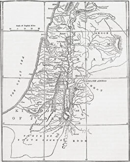
Background imageVintage Maps Collection: Map of the kingdoms of Judah and Israel. From Cassells Universal History, published 1888

Map of the kingdoms of Judah and Israel. From Cassells Universal History, published 1888

Background imageVintage Maps Collection: Map of Gaul in the later empire, showing the provinces and the 5th century settlements of Foedarati

Map of Gaul in the later empire, showing the provinces and the 5th century settlements of Foedarati. After an illustration by Edgar Holloway

Background imageVintage Maps Collection: Layout of the ancient city of Trier, Germany, showing the early bridge, the late bridge

Layout of the ancient city of Trier, Germany, showing the early bridge, the late bridge, Barbara Baths, House of Victorinus and some city houses

Background imageVintage Maps Collection: Layout of the ancient Gallo-Roman town Arelate (Arles), showing the Forum

Layout of the ancient Gallo-Roman town Arelate (Arles), showing the Forum, Theatre and Temple of Bona Dea. After an illustration by Edgar Holloway

Background imageVintage Maps Collection: Map of northern and central Greece. From Cassells Universal History, published 1888

Map of northern and central Greece. From Cassells Universal History, published 1888

Background imageVintage Maps Collection: Map of Macedonia and adjacent districts. From Cassells Universal History, published 1888

Map of Macedonia and adjacent districts. From Cassells Universal History, published 1888

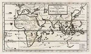
Background imageVintage Maps Collection: Map showing the route taken by William Dampier on his expedition which reached the shores of New

Map showing the route taken by William Dampier on his expedition which reached the shores of New Holland, now Western Australia, in 1699. From a contemporary map

Background imageVintage Maps Collection: Map of ancient Egypt. From Cassells Universal History, published 1888; Illustration

Map of ancient Egypt. From Cassells Universal History, published 1888; Illustration

Background imageVintage Maps Collection: Layout of the ancient Gallo-Roman town Massilia, (Marseilles) showing the old Phocaean harbour

Layout of the ancient Gallo-Roman town Massilia, (Marseilles) showing the old Phocaean harbour, the Lacydon. After an illustration by Edgar Holloway


All Professionally Made to Order for Quick Shipping


-

Why Choose Us?

We are a leading provider of Art Prints and Photo Gifts since 2003, working in partnership with a range of Sporting Clubs, Charities, Museums and Picture Libraries. A large share of profits from any of their images will go directly towards supporting that charity or club. Our archive of images is carefully curated to bring you a wide range of subjects, including landscapes, wildlife, architecture, and more. We ship from our partner labs in the UK, USA, EU (Netherlands) and Australia.
+

How do I place an order?

Ordering is quick & easy - Just follow 5 Simple Steps:
  1. Find your image: Use our search box or browse our online photo Collections to find the image you want.

  2. Choose your print format: Select your desired product and add it to your cart.

  3. Enter your details: If you're a returning customer, simply enter your email address and password, and we'll fill in your billing and shipping address details. All personal details are held securely and are fully GDPR compliant. As standard, we remove all Personally Identifiable Information after 12 months.

  4. Pay for your purchase: We use state-of-the-art security for online shopping and do not have access to your card details.

  5. Sit back and relax: We'll email you confirmation of your order and when it's dispatched. Registered customers can also track orders in the 'My Account' area.

+

How do I pay for an order?

You can pay for your order with most of the major credit and debit cards, or PayPal. For added security, major financial institutions process payment details separately and securely on our behalf. We do not have access to your online payment card details. Online payments are preferred however we do take phone orders. For UK customers only we accept cheques issued against a UK bank.
+

Is my data safe?

We take data security very seriously. We do not have access to your full card details and all payments are requested over a fully secure connection. Additionally, we fully comply with current European and GDPR legislation, and automatically remove all personal data after at most 12 months (unless you have an account with us and have signed in recently). We also have a strict opt-in policy and would never sell your personal details. Your data is only used to fulfill your order promptly and efficiently.
+

Is wall art ready to hang?

For quick and easy installation all wall art, including framed prints, canvas prints and metal prints are supplied with a ready to hang solution on the back. Generally, saw tooth hangers are applied as they allow wall art to hang flush against the wall. The serrated edge of the hanger prevents the frame from shifting or tilting when hung.
+

Are the photo prints fade resistant?

Yes, we use archival quality photo paper photographic paper for vivid reproduction Prints are an accurate representations of the original artwork, which is preserved for artistic character and authenticity. We guarantee they match previews shown on our web site