
Maps Collection
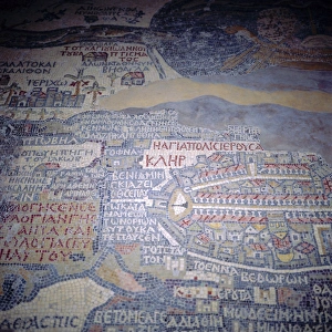
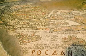
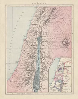
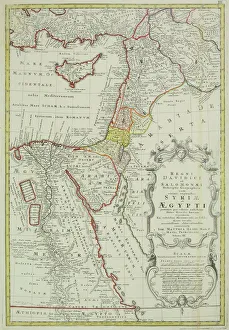
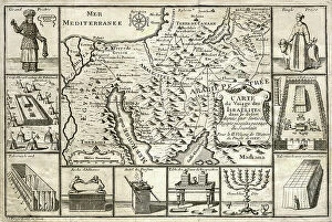
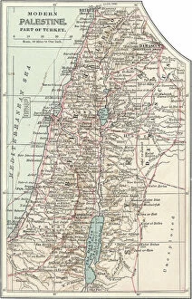
Maps of Jordan Asia are maps that depict the country of Jordan, located in the Middle East
Choose a picture from our Maps Collection for your Wall Art and Photo Gifts
181 items


All Professionally Made to Order for Quick Shipping
-
Maps Collection
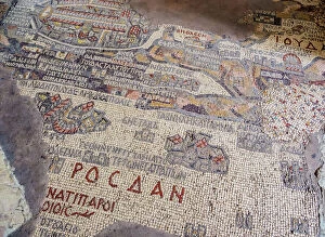
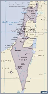
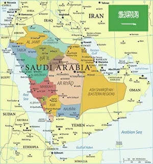
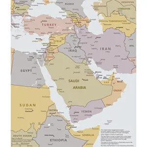
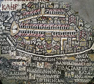
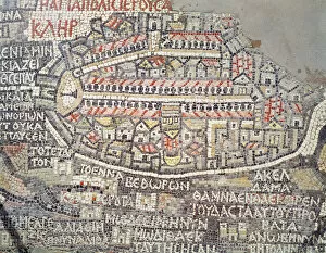
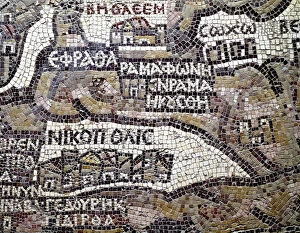
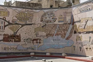
Maps of Jordan Asia are maps that depict the country of Jordan, located in the Middle East. These maps show the physical features of the region, such as its mountains, rivers, and deserts. They also display major cities and towns, as well as roads and other transportation networks. Additionally, these maps provide information on local resources like water sources and mineral deposits. They also indicate areas of cultural significance like religious sites or archaeological ruins. Maps of Jordan Asia can be used to plan trips or explore the area’s history and culture, and are an invaluable resource for anyone interested in learning more about this fascinating region.
+
Our beautiful pictures are available as Framed Prints, Photos, Wall Art and Photo Gifts
Media Storehouse offers a collection of Maps of Jordan Asia, which includes a range of wall art and framed prints. Our collection features maps that showcase the geography and topography of Jordan, as well as its cities and regions. These maps are not only visually appealing but also provide valuable information about the country's history, culture, and landmarks. The Maps of Jordan Asia collection is an excellent choice for those who love to travel or have an interest in geography. They can be used to decorate homes or offices with a unique touch that reflects one's personality and interests. The high-quality prints ensure that every detail is captured accurately, making them ideal for educational purposes as well. Our Maps of Jordan Asia collection provides customers with an opportunity to own beautiful pieces of art while learning more about this fascinating country in the Middle East.
+
What are Maps of Jordan Asia art prints?
Maps of Jordan Asia art prints are high-quality reproductions of maps depicting the geography, topography and landmarks of Jordan, a country located in Western Asia. These prints showcase the intricate details and features that make up this beautiful country, including its cities, roads, rivers and mountains. These art prints are perfect for those who have an interest in history or geography, as they provide a unique perspective on the region's past and present. They can also be used as decorative pieces to add character to any room or office space. We offer a wide range of Maps of Jordan Asia art prints that cater to different tastes and preferences. Whether you're looking for vintage-style maps or modern interpretations with bold colors, there is something for everyone. These art prints offer a fascinating glimpse into one of the most culturally rich countries in the world and make great gifts for anyone interested in exploring new places.
+
What Maps of Jordan Asia art prints can I buy from Media Storehouse?
We offer a wide range of Maps of Jordan Asia art prints that are perfect for those who love to explore and learn about different cultures. These maps showcase the intricate details of Jordan's geography, including its cities, towns, rivers, mountains, and other natural features. Some popular options include vintage-style maps that provide a glimpse into the country's history and evolution over time. Others feature colorful illustrations that highlight important landmarks or cultural sites in Jordan. Whether you're looking for something to decorate your home or office space with or want to gift it to someone who loves travel and adventure, we have plenty of options to choose from. With high-quality printing techniques used on premium materials such as canvas or fine art paper, these maps are sure to impress anyone who sees them.
+
How do I buy Maps of Jordan Asia art prints?
To purchase Maps of Jordan Asia art prints from Media Storehouse, you can browse our extensive collection online and select the print that catches your eye. Once you have found the perfect piece, simply add it to your cart and proceed to checkout. During this process, you will be prompted to enter your shipping and payment information. We offer a variety of sizes for their art prints, so make sure to choose the size that best fits your needs. Additionally, we offer framing options if you would like your print ready-to-hang upon arrival. If you have any questions or concerns about purchasing a Maps of Jordan Asia art print from Media Storehouse, our customer service team is available to assist you via email or phone. They are committed to providing high-quality products and excellent customer service throughout the buying process.
+
How much do Maps of Jordan Asia art prints cost?
We offer a wide range of Maps of Jordan Asia art prints that cater to different tastes and preferences. The cost of these prints may vary depending on the size, quality, and type of print you choose. We have a variety of options available including canvas prints, framed prints, photographic prints, and more. Our Maps of Jordan Asia art prints are created using high-quality materials to ensure that they last for many years without fading or losing their vibrancy. Whether you're looking for a small print to add some character to your home or office space or a large statement piece for your living room wall, we have something that will suit your needs. We take pride in offering affordable prices without compromising on quality so that everyone can enjoy beautiful artwork in their homes. Our team is dedicated to providing excellent customer service and ensuring that our customers are satisfied with their purchases.
+
How will my Maps of Jordan Asia art prints be delivered to me?
We take great care in ensuring that your Maps of Jordan Asia art prints are delivered to you safely and securely. We use high-quality packaging materials to protect your artwork during transit and ensure it arrives in pristine condition. Your Maps of Jordan Asia art prints will be carefully rolled and placed into a sturdy cardboard tube for delivery. This method ensures that the print is protected from any damage or creases during transportation. We work with trusted courier partners who offer reliable delivery services to our customers worldwide. Once your order has been dispatched, you will receive a tracking number so you can keep an eye on its progress until it reaches your doorstep. We pride ourselves on providing excellent customer service and delivering high-quality products to our customers. If you have any questions about the delivery process or need assistance with your order, please don't hesitate to contact us.