
Maps Collection
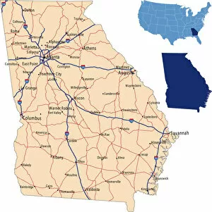
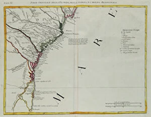
Maps of Georgia Asia are maps that show the physical features and political boundaries of the country
Choose a picture from our Maps Collection for your Wall Art and Photo Gifts
459 items


All Professionally Made to Order for Quick Shipping
-
Maps Collection
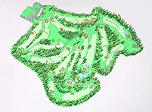
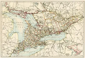
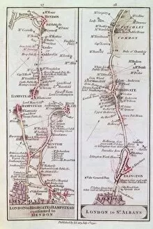
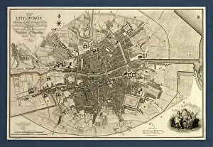
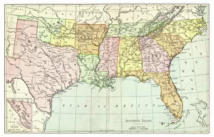
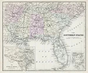
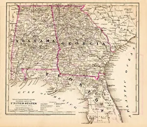
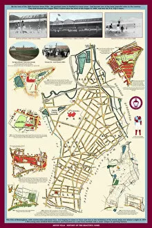
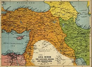
Maps of Georgia Asia are maps that show the physical features and political boundaries of the country. The maps include rivers, mountains, lakes, cities, towns and villages. They also show roads and other transportation routes as well as national parks and protected areas. They can useful for travelers who want to explore the country or for those who need to plan a route or find a specific location and can also be used by businesses to identify potential markets or sources of raw materials. Maps of Georgia Asia provide an invaluable resource for anyone interested in learning more about this fascinating region of the world.
+
Our beautiful pictures are available as Framed Prints, Photos, Wall Art and Photo Gifts
The Maps of Georgia Asia collection is a stunning assortment of wall art and framed prints available at Media Storehouse. Our collection showcases the beauty and intricacy of maps depicting the country of Georgia in Asia, featuring various regions, cities, and landmarks. The maps are created using high-quality printing techniques that capture every detail with precision and clarity. Each piece in our collection is unique, offering a glimpse into the rich history and culture of Georgia. From ancient cartography to modern-day satellite imagery, these maps provide an excellent opportunity for anyone interested in geography or travel to explore this fascinating region. Whether you're looking for a decorative addition to your home or office or searching for an educational tool to teach children about geography, the Maps of Georgia Asia collection has something for everyone. With its exceptional quality and attention to detail, it's no wonder why our collection remains popular among customers worldwide.
+
What are Maps of Georgia Asia art prints?
Maps of Georgia Asia art prints are a collection of high-quality reproductions of antique and contemporary maps that depict the region of Georgia in Asia. These maps showcase the intricate details and unique features of this beautiful country, including its cities, towns, rivers, mountains, and other geographical landmarks. The Maps of Georgia Asia art prints are perfect for anyone who loves history or geography or wants to add a touch of sophistication to their home or office decor. They come in various sizes and styles to suit different tastes and preferences. Whether you're looking for a vintage map from the 19th century or a modern-day satellite image, we have an extensive selection that will meet your needs. Each print is carefully crafted using premium materials to ensure it lasts for years without fading or losing its vibrancy. Maps of Georgia Asia art prints are an excellent investment for anyone who appreciates fine art and wants to celebrate the beauty and diversity of this fascinating region.
+
What Maps of Georgia Asia art prints can I buy from Media Storehouse?
We offer a wide range of Maps of Georgia Asia art prints that you can purchase. These maps showcase the geography, topography, and landmarks of Georgia in intricate detail. You can choose from antique or modern styles, depending on your preference. Some popular options include vintage maps that depict the country's historical borders and cities, as well as contemporary maps that highlight its current infrastructure and transportation networks. Additionally, there are detailed satellite images available that provide an aerial view of Georgia's terrain. These art prints come in various sizes to fit any space in your home or office. They make excellent gifts for anyone interested in cartography, history, or travel. Whether you're looking to decorate your living room with a unique piece of artwork or add some character to your workspace with a map print, we have something for everyone who loves exploring the world through cartography.
+
How do I buy Maps of Georgia Asia art prints?
To buy Maps of Georgia Asia art prints from Media Storehouse, you can browse our extensive collection online. Simply search for "Maps of Georgia Asia" in the search bar on our website and select the print that catches your eye. Once you have found a print that you like, click on it to view more details about the product. From there, you will be able to choose the size and format of your print. You may also have options for framing or mounting your artwork if desired. Once you have made all necessary selections, simply add the item to your cart and proceed to checkout. We accept various payment methods including credit card and PayPal. After completing your purchase, they will process your order promptly so that it can be shipped out as soon as possible. Buying Maps of Georgia Asia art prints from Media Storehouse is a simple and straightforward process that allows you to easily acquire beautiful pieces of artwork for display in your home or office.
+
How much do Maps of Georgia Asia art prints cost?
We offer a wide range of Maps of Georgia Asia art prints that vary in price depending on the size and type of print you choose. Our collection includes vintage maps, modern designs, and everything in between. We strive to provide high-quality prints at affordable prices so that everyone can enjoy beautiful artwork in their home or office. Whether you're looking for a small print to add some color to your space or a large statement piece, we have options for every budget. Our team is dedicated to providing excellent customer service and ensuring that our customers are satisfied with their purchases. If you're interested in purchasing one of our Maps of Georgia Asia art prints, please browse our selection online or contact us for more information.
+
How will my Maps of Georgia Asia art prints be delivered to me?
Your Maps of Georgia Asia art prints will be delivered to you with utmost care and attention. We use high-quality packaging materials to ensure that your artwork arrives in pristine condition. Our team of experts carefully inspects each print before it is shipped out, so you can rest assured that you are receiving a product of the highest quality. We work with trusted shipping partners who provide reliable and efficient delivery services. Your order will be dispatched promptly, and we will keep you informed every step of the way regarding its progress. We take great pride in our customer service, and we strive to make sure that every aspect of your experience with us is positive. If for any reason you are not completely satisfied with your purchase or have any questions about the delivery process, please do not hesitate to contact us – our friendly team is always happy to help.