
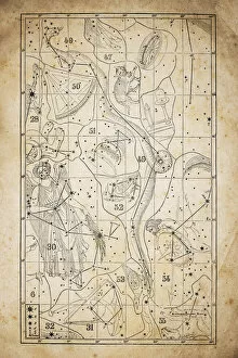
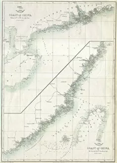
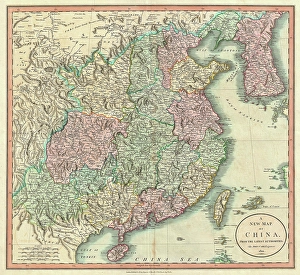
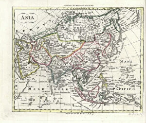
Maps Collection
Maps of Cyprus Asia are a collection that show the geography and political boundaries of the island nation
Choose a picture from our Maps Collection for your Wall Art and Photo Gifts
669 items


All Professionally Made to Order for Quick Shipping
-
Maps Collection
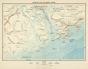
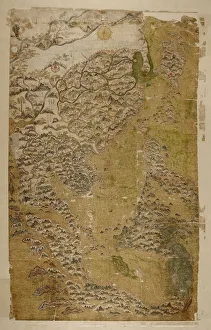
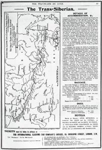
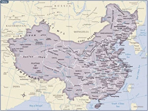
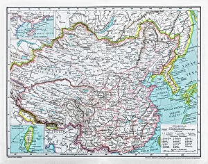
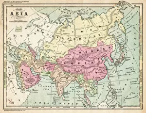
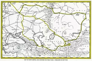
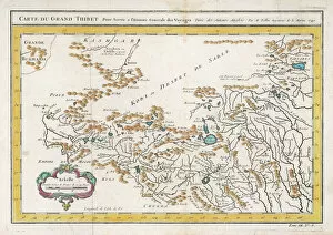
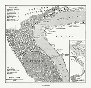
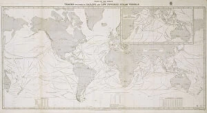
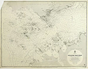
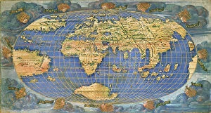
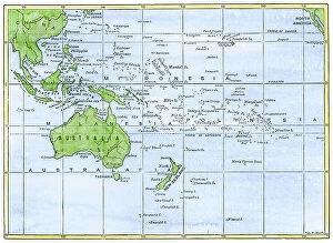
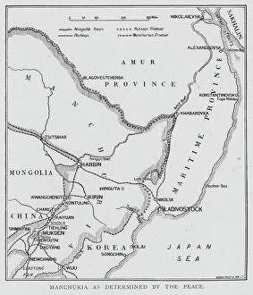
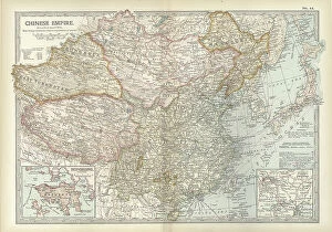
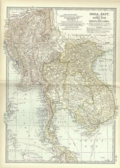
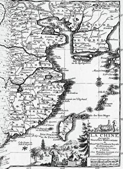
Maps of Cyprus Asia are a collection that show the geography and political boundaries of the island nation. The maps include physical features such as mountains, rivers, lakes, and coastlines. They also show major cities and towns, roads, airports, ports, archaeological sites and other points of interest. They are be used for planning trips or just to get an overview of the country's geography, and are available in both digital and paper formats for easy access. Maps of Cyprus Asia provide an invaluable resource for anyone interested in learning more about this beautiful Mediterranean island nation.
+
Our beautiful pictures are available as Framed Prints, Photos, Wall Art and Photo Gifts
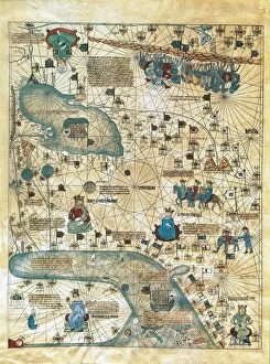
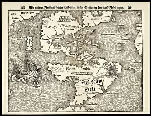
The Maps of Cyprus Asia collection offered by Media Storehouse is a unique and fascinating assortment of vintage maps that showcase the historical significance of the island nation. Our collection features an array of beautifully crafted maps dating back to the 16th century, highlighting various aspects such as topography, political boundaries, and cultural landmarks. These maps provide insight into how Cyprus has evolved over time and offer a glimpse into its rich history. They also serve as decorative pieces for those interested in adding some character to their living spaces or offices. The Maps of Cyprus Asia collection includes prints from renowned cartographers such as Abraham Ortelius, Gerard Mercator, and Jodocus Hondius. These high-quality reproductions are available in different sizes and formats including framed prints and canvas art. Our collection is perfect for anyone who appreciates history or wants to add a touch of elegance to their home or office decor.
+
What are Maps of Cyprus Asia art prints?
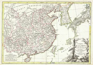
Maps of Cyprus Asia art prints are high-quality reproductions of vintage maps that depict the island nation of Cyprus and its surrounding regions in Asia. These prints showcase intricate details such as topography, landmarks, and borders, providing a unique glimpse into the historical geography of this area. These art prints are perfect for those who appreciate history or have an interest in cartography. They can be used to decorate homes, offices, or classrooms and make great gifts for anyone with a passion for travel or culture. We offer a wide selection of Maps of Cyprus Asia art prints to choose from. Each print is carefully crafted using state-of-the-art printing technology to ensure vibrant colors and sharp detail. The prints come in various sizes and can be framed to match any decor style. Maps of Cyprus Asia art prints offer a beautiful way to explore the rich history and geography of this fascinating region.
+
What Maps of Cyprus Asia art prints can I buy from Media Storehouse?
We offer a wide range of Maps of Cyprus Asia art prints that are perfect for those who love to explore the world through art. These maps showcase the beautiful island nation of Cyprus, located in the eastern Mediterranean Sea and its surrounding regions in Asia. You can choose from vintage or modern style maps, each with their own unique features and designs. Some maps may include detailed topography, landmarks, cities and towns while others may focus on political boundaries or historical events. Our collection also includes different sizes and formats such as canvas prints, framed prints or posters so you can find the perfect piece to suit your home decor needs. Whether you're looking for a stunning addition to your living room wall or an educational tool for your classroom, we have got you covered with their diverse selection of Maps of Cyprus Asia art prints.
+
How do I buy Maps of Cyprus Asia art prints?
To purchase Maps of Cyprus Asia art prints from Media Storehouse, you can browse our extensive collection online. Simply search for "Maps of Cyprus Asia" in the search bar on our website and select the print that catches your eye. Once you have found a print you like, click on it to view more details about the artwork. From there, add the print to your cart and proceed to checkout. You will be prompted to enter your shipping information and payment details. We accept various forms of payment including credit cards and PayPal. Once your order is processed, Media Storehouse will begin preparing your Maps of Cyprus Asia art print for shipment. Your order will then be shipped directly to you without any hassle or fuss. Buying Maps of Cyprus Asia art prints from Media Storehouse is an easy process that allows you to enjoy beautiful artwork in no time.
+
How much do Maps of Cyprus Asia art prints cost?
We offer a wide range of Maps of Cyprus Asia art prints for purchase. The cost of these prints varies depending on the size and type of print that you choose. We have options ranging from small to large sizes, as well as different finishes such as canvas or framed prints. Our prices are competitive and affordable, ensuring that you can find the perfect piece to fit your budget. Our Maps of Cyprus Asia art prints are high-quality reproductions that capture every detail and nuance of the original artwork. They make excellent additions to any home or office decor, adding a touch of sophistication and elegance to any space. Whether you're looking for a unique gift for someone special or simply want to treat yourself to some beautiful artwork, our selection of Maps of Cyprus Asia art prints is sure to impress. Browse our collection today and discover the perfect piece for your needs.
+
How will my Maps of Cyprus Asia art prints be delivered to me?
We take great care in ensuring that your Maps of Cyprus Asia art prints are delivered to you safely and securely. We use high-quality packaging materials to protect your artwork during transit and ensure that it arrives at your doorstep in pristine condition. Your art print will be carefully rolled and placed inside a sturdy cardboard tube for shipping. The tube is then sealed with tape to prevent any damage or moisture from entering the package. We work with trusted courier services who offer reliable delivery options worldwide. Once your order has been dispatched, you will receive an email confirmation containing tracking information so that you can keep track of its progress. We understand the importance of delivering your artwork promptly and efficiently. That's why we strive to provide fast and reliable delivery services without compromising on quality or safety.