Fraud Blocker Skip to main content

Poster Print > Africa > South Africa > Maps

Maps Poster Print Collection (#7)

Discover the wonders of South Africa with our exquisite Maps of South Africa collection from Media Storehouse. These beautifully designed poster prints showcase the diverse geography and intricate details of this fascinating African country. Whether you're an armchair explorer, a student, or a travel enthusiast, these maps make for a stunning addition to any room. Explore the breathtaking landscapes, vibrant cities, and rich cultural heritage of South Africa with our high-quality, printed maps. Order yours today and ignite your curiosity.

South Africa is a large and diverse country, with many different landscapes

397 Poster Prints

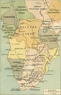
Background imageMaps Poster Print Collection: Map of Mid. And South Africa, 1919. Creator: George Philip & Son Ltd

Map of Mid. And South Africa, 1919. Creator: George Philip & Son Ltd
Map of Mid. And South Africa, 1919. Showing European possessions at outbreak of war, [the First World, 1914]. From " The History of the Great European War: its causes and effects", Vol

Background imageMaps Poster Print Collection: Map Showing the Lines of Advance from Bloemfontein to Pretoria, 1901. Creator: Unknown

Map Showing the Lines of Advance from Bloemfontein to Pretoria, 1901. Creator: Unknown
Map Showing the Lines of Advance from Bloemfontein to Pretoria, 1901. Positions and lines of advance of British forces c1900

Background imageMaps Poster Print Collection: Map Illustrating the Movements for the Relief of Kimberley and the Capture of Bloemfontein, 1901

Map Illustrating the Movements for the Relief of Kimberley and the Capture of Bloemfontein, 1901. The key indicates the movements of Major General Frenchs cavalry and of the infantry

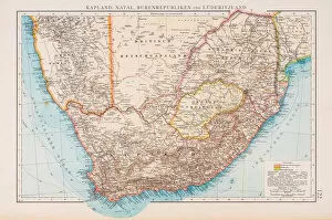
Background imageMaps Poster Print Collection: Map of South Africa 1896

Map of South Africa 1896
Andres Allgemeiner Handatlas - Bielefeld und Leipzig 1896

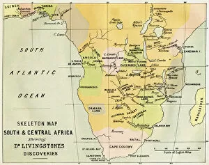
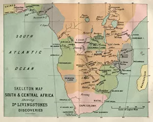
Background imageMaps Poster Print Collection: Skeleton Map Of South And Central Africa Showing David Livingstones Discoveries

Skeleton Map Of South And Central Africa Showing David Livingstones Discoveries. From The Life And Explorations Of Dr. Livingstone Published C.1875

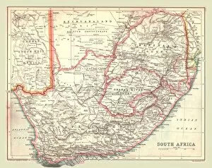
Background imageMaps Poster Print Collection: Map of South Africa, 1902. Creator: Unknown

Map of South Africa, 1902. Creator: Unknown
Map of South Africa, 1902. Showing the Cape Colony, Transvaal, Orange River Colony, and other colonial possessions including the British Protectorate of Bechuanaland, German South West Africa

Background imageMaps Poster Print Collection: British, Dutch, French, Spanish, Portuguese, Italian, Danish colonies, lithograph, 1897

British, Dutch, French, Spanish, Portuguese, Italian, Danish colonies, lithograph, 1897
British, Dutch, French, Spanish, Portuguese, Italian and Danish colonies at the end of the 19th century. Lithograph, published in 1897

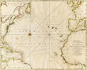
Background imageMaps Poster Print Collection: direction, antique, atlantic ocean, close-up, crossing, europe, geography, guidance

direction, antique, atlantic ocean, close-up, crossing, europe, geography, guidance, historic, history, horizontal, map, no people, north africa, north america, paper, physical geography, planning

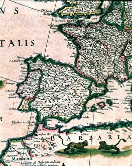
Background imageMaps Poster Print Collection: 2686897

2686897

Background imageMaps Poster Print Collection: 2685216

2685216

Background imageMaps Poster Print Collection: Map of South (Southern) Africa, c1910. Artist: Gull Engraving Company

Map of South (Southern) Africa, c1910. Artist: Gull Engraving Company
Map of South (Southern) Africa, c1910. [Encyclopedia Britannica Co]

Background imageMaps Poster Print Collection: Plan of the Summit of Majuba Hill, (February 27, 1881), c1880s

Plan of the Summit of Majuba Hill, (February 27, 1881), c1880s. Episode of the First Boer War (1880-1881). From British Battles on Land and Sea, Vol. IV, by James Grant

Background imageMaps Poster Print Collection: Plan of the March to Majuba Hill, (February 26, 1881), c1880s

Plan of the March to Majuba Hill, (February 26, 1881), c1880s. From British Battles on Land and Sea, Vol. IV, by James Grant. [Cassell Petter & Galpin, London, Paris & Melbourne, c1880]
Background imageMaps Poster Print Collection: Plan of the Action on the Ingogo, (February 8, 1881), c1880s

Plan of the Action on the Ingogo, (February 8, 1881), c1880s, . Episode of the First Boer War (1880-1881). From British Battles on Land and Sea, Vol. IV, by James Grant

Background imageMaps Poster Print Collection: Plan of the Battle of Laings Nek (January 28, 1881), c1880s

Plan of the Battle of Laings Nek (January 28, 1881), c1880s. Episode of the First Boer War (1880-1881). From British Battles on Land and Sea, Vol. IV, by James Grant

Background imageMaps Poster Print Collection: Map of the Theatre of War in the Transvaal, c1880

Map of the Theatre of War in the Transvaal, c1880. Episode of the First Boer War (1880-1881). From British Battles on Land and Sea, Vol. IV, by James Grant

Background imageMaps Poster Print Collection: Map of the Country between Newcastle and the Transvaal, c1880

Map of the Country between Newcastle and the Transvaal, c1880. From British Battles on Land and Sea, Vol. IV, by James Grant. [Cassell Petter & Galpin, London, Paris & Melbourne, c1880]

Background imageMaps Poster Print Collection: Sketch Map of Sekukunis Country, c1880

Sketch Map of Sekukunis Country, c1880. From British Battles on Land and Sea, Vol. IV, by James Grant. [Cassell Petter & Galpin, London, Paris & Melbourne, c1880]

Background imageMaps Poster Print Collection: Plan of the ground where Cetewayo was captured, c1880

Plan of the ground where Cetewayo was captured, c1880. From British Battles on Land and Sea, Vol. IV, by James Grant. [Cassell Petter & Galpin, London, Paris & Melbourne, c1880]

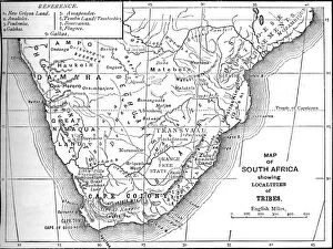
Background imageMaps Poster Print Collection: Tribal Map of South Africa, c1880

Tribal Map of South Africa, c1880. From British Battles on Land and Sea, Vol. IV, by James Grant. [Cassell Petter & Galpin, London, Paris & Melbourne, c1880]

Background imageMaps Poster Print Collection: Plan of the Battle of Ulundi, (July 4, 1879), c1880

Plan of the Battle of Ulundi, (July 4, 1879), c1880. From British Battles on Land and Sea, Vol. IV, by James Grant. [Cassell Petter & Galpin, London, Paris & Melbourne, c1880]

Background imageMaps Poster Print Collection: Dispositions in the Square at Ulundi, (July 4, 1879), c1880

Dispositions in the Square at Ulundi, (July 4, 1879), c1880. Episode of the Anglo-Zulu Wars (1879-1896). From British Battles on Land and Sea, Vol. IV, by James Grant

Background imageMaps Poster Print Collection: Plan of Laagers on the March to Ulundi, (July 4, 1879), c1880

Plan of Laagers on the March to Ulundi, (July 4, 1879), c1880. From British Battles on Land and Sea, Vol. IV, by James Grant. [Cassell Petter & Galpin, London, Paris & Melbourne, c1880]

Background imageMaps Poster Print Collection: The Siege of Ladysmith, c1899, (1902)

The Siege of Ladysmith, c1899, (1902). The Second Boer War (1899-1902), South Africa. From Battles of the Nineteenth Century, Vol. III

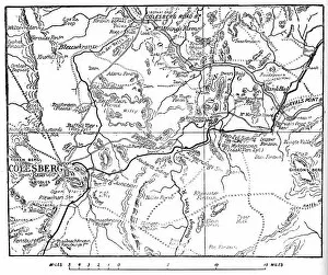
Background imageMaps Poster Print Collection: Map to Illustrate the Operations Round Colesberg, 1902

Map to Illustrate the Operations Round Colesberg, 1902. The Second Boer War (1899-1902), South Africa. From Battles of the Nineteenth Century, Vol. III

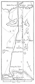
Background imageMaps Poster Print Collection: Lord Methuens Line of Advance to the Modder River, 1902

Lord Methuens Line of Advance to the Modder River, 1902. The Second Boer War (1899-1902), South Africa. From Battles of the Nineteenth Century, Vol. III

Background imageMaps Poster Print Collection: The New Pretoria, 1900. Artist: Maurice Denis

The New Pretoria, 1900. Artist: Maurice Denis
The New Pretoria, 1900. From Black & White Budget, Vol. III. [The Black and White Publishing Company, J P. Monckton, Leeds, Manchester, Glasgow, Edinburgh, London, 1900]

Background imageMaps Poster Print Collection: Plan of the Ground Where Prince Louis Napoleon was killed, (June 1, 1879), c1880

Plan of the Ground Where Prince Louis Napoleon was killed, (June 1, 1879), c1880. From British Battles on Land and Sea, Vol. IV, by James Grant

Background imageMaps Poster Print Collection: Plan of the Battle of Kambula, (March 29, 1879), c1880

Plan of the Battle of Kambula, (March 29, 1879), c1880
Plan of the Battle of Kambula (March 29, 1879), c1880. From British Battles on Land and Sea, Vol. IV, by James Grant. [Cassell Petter & Galpin, London, Paris & Melbourne, c1880]

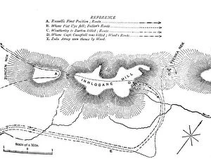
Background imageMaps Poster Print Collection: Plan of the Fight on the Inhlobane Mountain, (March 28, 1979), c1880

Plan of the Fight on the Inhlobane Mountain, (March 28, 1979), c1880. Episode of the Anglo-Zulu Wars (1879-1896). From British Battles on Land and Sea, Vol. IV, by James Grant

Background imageMaps Poster Print Collection: Plan of the Battle of Ghingilovo, c1880

Plan of the Battle of Ghingilovo, c1880. From British Battles on Land and Sea, Vol. IV, by James Grant. [Cassell Petter & Galpin, London, Paris & Melbourne, c1880]

Background imageMaps Poster Print Collection: Plan of the Marches of Pearson (Jan. 1879) and of Chelmsford (April, 1879) to Etschowe, c1880

Plan of the Marches of Pearson (Jan. 1879) and of Chelmsford (April, 1879) to Etschowe, c1880. Episode of the Anglo-Zulu Wars (1879-1896). From British Battles on Land and Sea, Vol

Background imageMaps Poster Print Collection: Plan of the Fort at Etschowe, c1880

Plan of the Fort at Etschowe, c1880. From British Battles on Land and Sea, Vol. IV, by James Grant. [Cassell Petter & Galpin, London, Paris & Melbourne, c1880]

Background imageMaps Poster Print Collection: Plan of the Fight at Inyezane, (Jan. 22, 1879), c1880

Plan of the Fight at Inyezane, (Jan. 22, 1879), c1880. From British Battles on Land and Sea, Vol. IV, by James Grant. [Cassell Petter & Galpin, London, Paris & Melbourne, c1880]

Background imageMaps Poster Print Collection: General Plan of the Operations in Zululand, 1879, c1880

General Plan of the Operations in Zululand, 1879, c1880. Episode of the Anglo-Zulu Wars (1879-1896). From British Battles on Land and Sea, Vol. IV, by James Grant

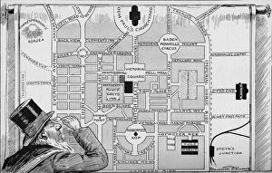
Background imageMaps Poster Print Collection: President Kruger looking at a plan of the New Pretoria, 1900

President Kruger looking at a plan of the New Pretoria, 1900. Satirical cartoon showing Boer leader Paul Kruger, President of the South African Republic (Transvaal)

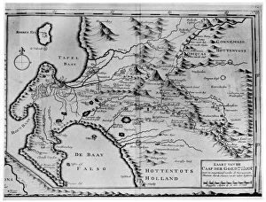
Background imageMaps Poster Print Collection: A map of the Cape of Good Hope in the time of the van der Stels, South Africa, 18th century (1931)

A map of the Cape of Good Hope in the time of the van der Stels, South Africa, 18th century (1931)

Background imageMaps Poster Print Collection: A map of the Cape of Good Hope, South Africa, 1719 (1931)

A map of the Cape of Good Hope, South Africa, 1719 (1931). Plate taken from Historic Farms of South Africa, by Dorothea Fairbridge, published by Oxford University Press (London, 1931)

Background imageMaps Poster Print Collection: Advert for winter tours of South Africa, 1928

Advert for winter tours of South Africa, 1928. A print from the Illustrated London News, Christmas number 1928

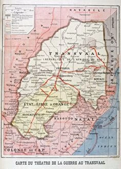
Background imageMaps Poster Print Collection: Map of the Theatre of the War in the Transvaal, 1899

Map of the Theatre of the War in the Transvaal, 1899. An illustration from Le Petit Journal, 26th November 1899

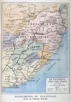
Background imageMaps Poster Print Collection: Events in the Transvaal, Africa, 1899

Events in the Transvaal, Africa, 1899. An illustration from Le Petit Journal, 22nd October 1899

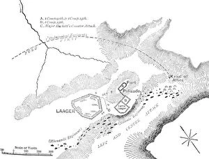
Background imageMaps Poster Print Collection: Plan of the Battle of Elandslaagte, 2nd Boer War, 21 November 1899

Plan of the Battle of Elandslaagte, 2nd Boer War, 21 November 1899. British forces were under the command of Major-General John French and Brigadier Ian Hamilton

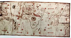
Background imageMaps Poster Print Collection: Double-Hemisphere Map 1542

Double-Hemisphere Map 1542

Background imageMaps Poster Print Collection: Map of Africa 1895

Map of Africa 1895
The Rand-McNally Grammar School Geography 1895 - Chicago & New York

Background imageMaps Poster Print Collection: Map of Africa 1877

Map of Africa 1877
Warrens Common School Geography 1877

Background imageMaps Poster Print Collection: Map South and Central Africa, Livingstones discoveries

Map South and Central Africa, Livingstones discoveries
Vintage engraving of Map South and Central Africa, Livingstones discoveries

Background imageMaps Poster Print Collection: South Africa Cartoon Map

South Africa Cartoon Map

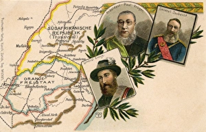
Background imageMaps Poster Print Collection: Kruger, Joubert and Cronje with map of South Africa

Kruger, Joubert and Cronje with map of South Africa
President Paul Kruger, General Piet Joubert and General Piet Cronje with a map of the Transvaal, South Africa. Date: circa 1900


All Professionally Made to Order for Quick Shipping


-

Maps Poster Print Collection

South Africa is a large and diverse country, with many different landscapes. Maps of South Africa are essential for navigating the country and understanding its geography. Maps of South Africa typically include physical features such as rivers, mountains, deserts, and coastlines. They also show major cities and towns, roads, railways, airports, national parks and other points of interest, and are be used to plan trips or explore new areas in the country and can also help visitors find their way around unfamiliar places or get an overview of the entire region at once. With so much to see in South Africa, they can an invaluable tool for discovering all it has to offer.
+

Our beautiful Wall Art and Photo Gifts include Framed Prints, Photo Prints, Poster Prints, Canvas Prints, Jigsaw Puzzles, Metal Prints and so much more

The Maps of South Africa collection from Media Storehouse is a stunning assortment of wall art and framed prints that showcase the diverse geography, history, and culture of South Africa. Our collection features an array of maps dating back to the 17th century, including antique maps depicting the Cape Colony and Natal region. Our collection also includes contemporary topographical maps that highlight the country's natural wonders such as Kruger National Park and Table Mountain. Each print in our collection is carefully crafted using high-quality materials to ensure longevity and durability. These prints are perfect for adding a touch of elegance to any room or office space while providing a glimpse into South Africa's rich history. Whether you're looking for a unique gift or simply want to add some character to your home decor, the Maps of South Africa collection from Media Storehouse offers something for everyone. With its beautiful designs and exceptional quality, our collection is sure to impress anyone who appreciates fine artistry.
+

What are Maps of South Africa Africa art prints?

Maps of South Africa art prints are beautiful and informative pieces of artwork that showcase the geography, topography, and landmarks of South Africa. These maps can be used for educational purposes or as decorative pieces in homes, offices, or public spaces. They come in a variety of styles and sizes to suit different tastes and preferences. Some Maps of South Africa art prints feature detailed illustrations that highlight the country's diverse flora and fauna, while others focus on its major cities, highways, and tourist attractions. Some also include historical information about the country's past struggles with apartheid. These art prints are created using high-quality printing techniques that ensure their longevity and vibrancy over time. They make great gifts for anyone who loves travel or has an interest in African culture. Whether you're looking to decorate your home or office space with a unique piece of artwork or want to give a thoughtful gift to someone special, Maps of South Africa art prints are an excellent choice.
+

What Maps of South Africa Africa art prints can I buy from Media Storehouse?

We offer a wide range of South Africa art prints that showcase the beauty and diversity of this stunning country. From detailed maps highlighting its various regions, cities and landmarks to breathtaking landscape photographs capturing its natural wonders, there is something for everyone. You can choose from vintage-style maps that evoke a sense of nostalgia or contemporary designs that reflect modern-day South Africa. Some popular options include maps featuring Cape Town, Johannesburg, Durban and Pretoria as well as prints showcasing iconic attractions such as Table Mountain, Kruger National Park and the Garden Route. Whether you are looking to decorate your home or office with unique wall art or searching for a special gift for someone who loves South Africa, we have an extensive collection of high-quality prints available in different sizes and formats to suit your needs.
+

How do I buy Maps of South Africa Africa art prints?

To buy maps of South Africa and African art prints from Media Storehouse, you can browse our extensive collection online. We offer a wide range of options to choose from, including vintage maps, contemporary designs, and artwork inspired by the natural beauty of Africa. Once you have found the print that you like, simply add it to your cart and proceed to checkout. You will need to provide your shipping information and payment details at this stage. We offer high-quality prints on a variety of materials such as canvas or paper. You can also select different sizes depending on your preferences. If you are looking for something specific but cannot find it in their collection, they may be able to source it for you through their network of photographers and artists. Buying maps of South Africa and African art prints from Media Storehouse is easy and convenient with plenty of options available to suit all tastes.
+

How much do Maps of South Africa Africa art prints cost?

We offer a wide range of Maps of South Africa art prints that vary in price depending on the size and type of print. Our collection includes vintage maps, modern designs, and detailed topographical maps. We understand that our customers have different preferences when it comes to artwork, which is why we provide various options to choose from. Our Maps of South Africa art prints are available in different sizes ranging from small to large formats. Additionally, you can select your preferred print type such as canvas or framed prints. Each option has its unique features and benefits. We take pride in providing high-quality products at affordable prices without compromising on quality. Our team ensures that every order is carefully packaged for safe delivery to your doorstep. The cost of our Maps of South Africa art prints varies based on several factors such as size and print type but rest assured that we offer competitive pricing for all our products.
+

How will my Maps of South Africa Africa art prints be delivered to me?

We take great care in ensuring that your Maps of South Africa art prints are delivered to you safely and securely. We use high-quality packaging materials to protect your artwork during transit, including sturdy cardboard tubes for rolled prints and flat boxes for framed prints. All our deliveries are fulfilled by trusted courier partners who provide a reliable service across the globe. You will receive a tracking number once your order has been dispatched so that you can monitor its progress and ensure someone is available to sign for it upon delivery. We understand how important it is for your artwork to arrive in perfect condition, which is why we offer a no-quibble guarantee on all our products. If there are any issues with your order, please don't hesitate to get in touch with us and we'll do everything we can to put things right.