
Maps Collection (page 2)
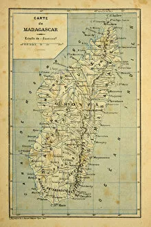
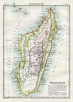
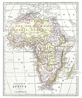
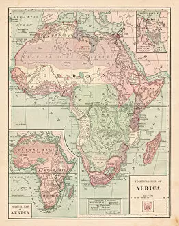
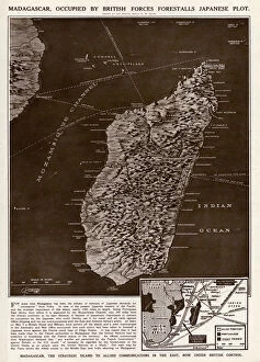
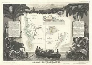
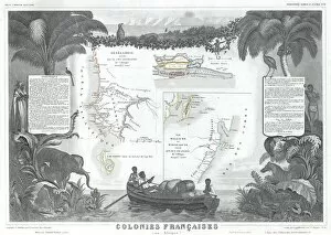
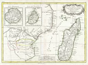
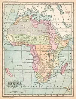
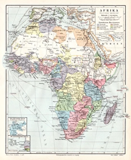
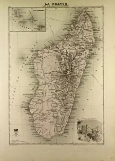
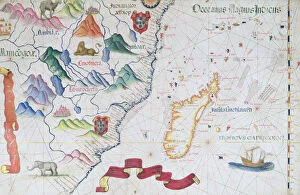
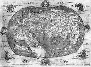
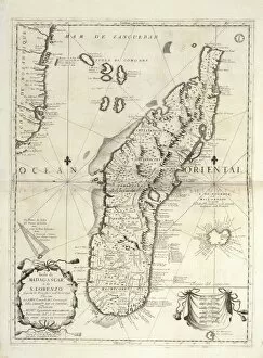
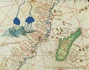
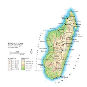
Madagascar is an island nation located off the coast of East Africa in the Indian Ocean
96 items


All Professionally Made to Order for Quick Shipping
-
Maps Collection
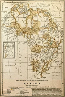
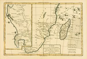
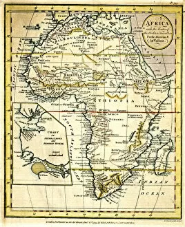
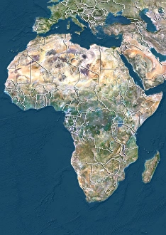
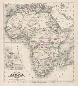
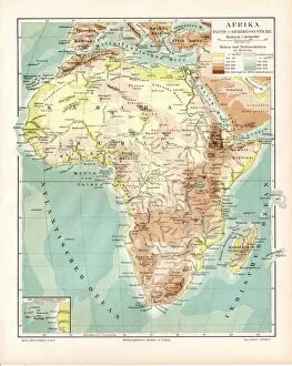
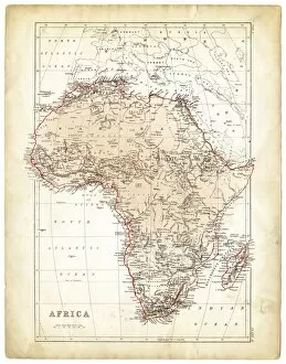
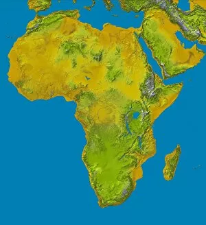
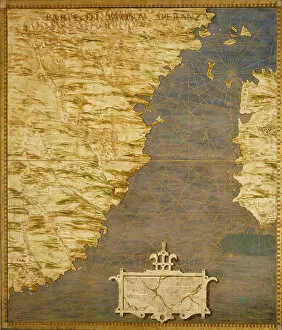
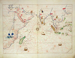
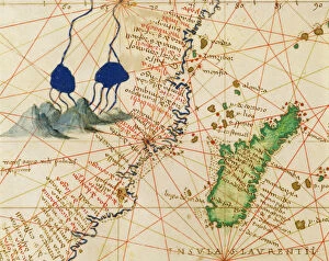
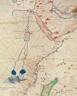
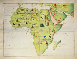
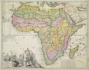
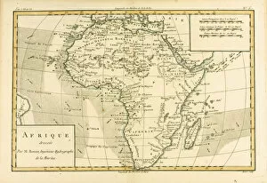
Madagascar is an island nation located off the coast of East Africa in the Indian Ocean, and is the fourth largest island in the world and home to some of the most unique wildlife on Earth. The geography of Madagascar is varied, with highlands, rainforests, deserts and beaches all present on this diverse landmass. Maps of Madagascar are essential for understanding its complex topography and for navigating its many regions. These maps show major cities, roads, rivers and other features that are important to know when travelling around this fascinating country. They also provide a visual representation of Madagascar’s unique flora and fauna, allowing visitors to appreciate its natural beauty from afar. With so much to explore in this remarkable place, they can invaluable tools for any traveler looking to make the most out of their visit to Madagascar Africa.
+
Our beautiful pictures are available as Framed Prints, Photos, Wall Art and Photo Gifts
The Maps of Madagascar Africa collection from Media Storehouse is a stunning selection of wall art and framed prints that showcase the beauty and diversity of this unique African island nation. Featuring a range of vintage maps, illustrations, and satellite images, our collection offers a fascinating glimpse into the geography, history, and culture of Madagascar. From detailed topographical maps to colorful artistic renderings, each print in our collection captures the essence of Madagascar's landscapes and landmarks. Whether you're looking for an eye-catching centerpiece for your living room or a thoughtful gift for a travel enthusiast or geography buff, these high-quality prints are sure to impress. With options ranging from small unframed prints to large canvas artworks, there's something here for every taste and budget. So why not explore the Maps of Madagascar Africa collection today and discover the magic of this enchanting country?
+
What are Maps of Madagascar Africa art prints?
Maps of Madagascar Africa art prints are high-quality reproductions of maps that depict the island nation of Madagascar, located off the southeastern coast of Africa. These maps showcase the unique geography and topography of this diverse country, including its mountain ranges, rivers, and coastline. These art prints are perfect for anyone interested in African geography or history, as well as those who appreciate beautiful cartography. They can be used to decorate homes or offices with a touch of sophistication and elegance. We offer a wide variety of Maps of Madagascar Africa art prints in different sizes and styles to suit any taste or decor. Whether you prefer vintage-style maps or more modern designs, there is something for everyone in our collection. Our high-quality printing process ensures that these art prints will look stunning on any wall for years to come. So why not add some exotic flair to your home with one of our Maps of Madagascar Africa art prints today?
+
What Maps of Madagascar Africa art prints can I buy from Media Storehouse?
We offer a wide range of art prints featuring maps of Madagascar, Africa. These prints showcase the stunning landscapes and diverse cultures found on this beautiful island nation. Some of the available options include vintage maps that highlight the country's topography and natural features, as well as modern designs that incorporate vibrant colors and intricate details. In addition to traditional paper prints, Media Storehouse also offers canvas prints that are perfect for adding a touch of elegance to any room in your home or office. Whether you're looking for a unique gift for someone special or simply want to decorate your own space with beautiful artwork, there is sure to be a map print from Madagascar that will suit your needs. So why not explore our collection today and discover all the amazing options available? With so many different styles and sizes to choose from, you're sure to find something that captures the essence of this incredible country in just the right way.
+
How do I buy Maps of Madagascar Africa art prints?
To buy Maps of Madagascar Africa art prints from Media Storehouse, you can browse our extensive collection of artwork online. Once you have found the print that you would like to purchase, simply add it to your cart and proceed to checkout. At this point, you will be prompted to enter your payment and shipping information. We offer a variety of sizes and framing options for their art prints, so be sure to select the option that best suits your needs. Additionally, we offer a range of other products featuring Maps of Madagascar Africa artwork such as canvas prints or posters. If you have any questions about purchasing Maps of Madagascar Africa art prints from Media Storehouse, our customer service team is available via email or phone to assist with any inquiries or concerns that may arise during the ordering process.
+
How much do Maps of Madagascar Africa art prints cost?
We offer a wide range of Maps of Madagascar Africa art prints for purchase. The cost of these prints can vary depending on the size and type of print you choose. We have a variety of options available, including canvas prints, framed prints, and poster prints. Our Maps of Madagascar Africa art prints are created using high-quality materials to ensure that they are long-lasting and visually stunning. Each print is carefully crafted to capture the intricate details and beauty of this unique location. Whether you're looking for a small poster or a large canvas print, we have something to suit every budget. Our prices are competitive without compromising on quality, so you can be sure that you're getting great value for your money. Our Maps of Madagascar Africa art prints offer an affordable way to bring some culture and beauty into your home or office space.
+
How will my Maps of Madagascar Africa art prints be delivered to me?
Your Maps of Madagascar Africa art prints will be delivered to you in a safe and secure manner. We take great care in packaging our products so that they arrive at your doorstep undamaged. Our standard delivery method is via postal service, but we also offer express delivery options for those who need their prints sooner. Once your order has been processed, we will send you an email confirmation with tracking information so that you can keep track of your package's progress. If there are any issues with the delivery or if you have any questions about your order, please do not hesitate to contact our customer service team who will be happy to assist you. We want to ensure that you receive your Maps of Madagascar Africa art prints in perfect condition and enjoy them for years to come. Thank you for choosing Media Storehouse as your source for high-quality artwork.