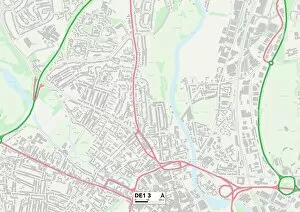
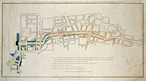
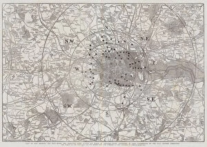
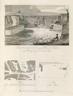
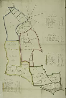
Fraud Blocker Skip to main content

Home > Africa > Chad > Maps

Maps Collection

Chad is a landlocked country in Central Africa, bordered by Libya to the north, Sudan to the east, Cameroon and Nigeria to the south, and Niger to the west

Choose a picture from our Maps Collection for your Wall Art and Photo Gifts

110 items

Background imageMaps Collection: Map of Bonnie Prince Charlies Wanderings

Map of Bonnie Prince Charlies Wanderings
Vintage caricature of Map of Bonnie Prince Charlies Wanderings after his defeat at the Battle of Culloden in 1746

Background imageMaps Collection: Map of London Underground railway, Hampstead Tube

Map of London Underground railway, Hampstead Tube
Map of London Underground railway extension, highlighting the recently opened Hampstead Tube (Charing Cross, Euston & Hampstead Railway), branching out to Golders Green and Highgate. Date: 1907

Background imageMaps Collection: Map of the Pall Mall area of London

Map of the Pall Mall area of London
Map of the Charing Cross, Pall Mall and Pimlico area of central London showing, the famous thoroughfare of Pall Mall with its numerous club houses

Background imageMaps Collection: A Chart of the Atlantic or Western Ocean, showing the track of Nelsons fleet

A Chart of the Atlantic or Western Ocean, showing the track of Nelsons fleet
3244750 A Chart of the Atlantic or Western Ocean, showing the track of Nelsons fleet, 12th May-15th August 1805, 1807 (engraving) by Faden, William (1750-1836); National Museum of the Royal Navy

Background imageMaps Collection: Old Charing-Cross, from Aggas's plan of London, 1864. Creator: Unknown

Old Charing-Cross, from Aggas's plan of London, 1864. Creator: Unknown
Old Charing-Cross, from Aggas's plan of London, 1864. 'Charing-cross, the large area at the meeting of the Strand, Whitehall, and Cockspur-street, with Trafalgar-square on the north

Background imageMaps Collection: Relative position of the proposed India Museum and other public institutions, 1876. Creator: Unknown

Relative position of the proposed India Museum and other public institutions, 1876. Creator: Unknown
Relative position of the proposed India Museum and other public institutions, 1876. 1. Proposed Site for the India and Colonial Museums; 2. Government Offices; 3. India Office; 4

Background imageMaps Collection: Map of London in the 17th Century

Map of London in the 17th Century
Vintage Map of London in the 17th Century

Background imageMaps Collection: Westminster WC2N 5 Map

Westminster WC2N 5 Map
Postcode Sector Map of Westminster WC2N 5

Background imageMaps Collection: Derby DE1 3 Map

Derby DE1 3 Map
Postcode Sector Map of Derby DE1 3

Background imageMaps Collection: Walks of London - The Strand From Charing Cross ?

Walks of London - The Strand From Charing Cross ?
Walks of London - The Strand From Charing Cross To Fleet Street

Background imageMaps Collection: Walks of London - Charing Cross Through Whitehall ?

Walks of London - Charing Cross Through Whitehall ?
Walks of London - Charing Cross Through Whitehall To Westminster

Background imageMaps Collection: Walks of London - Charing Cross To Pimlico

Walks of London - Charing Cross To Pimlico

Background imageMaps Collection: On Duty in a London Signal-Box (engraving)

On Duty in a London Signal-Box (engraving)
7188338 On Duty in a London Signal-Box (engraving) by Lanos, Henri (1859-1929); Private Collection; (add.info.: On Duty in a London Signal-Box)

Background imageMaps Collection: Page from Sun Electrical catalogue of electrical goods, 1926 (litho)

Page from Sun Electrical catalogue of electrical goods, 1926 (litho)
7158371 Page from Sun Electrical catalogue of electrical goods, 1926 (litho) by English School, (20th century); Private Collection; (add.info.: Page from Catalogue of Electrical Supplies)

Background imageMaps Collection: Page from Sun Electrical catalogue of electrical goods, 1926 (litho)

Page from Sun Electrical catalogue of electrical goods, 1926 (litho)
7158364 Page from Sun Electrical catalogue of electrical goods, 1926 (litho) by English School, (20th century); Private Collection; (add.info.: Page from Catalogue of Electrical Supplies)

Background imageMaps Collection: The Charing Cross Region about 1592 (litho)

The Charing Cross Region about 1592 (litho)
7179951 The Charing Cross Region about 1592 (litho) by English School, (19th century); Private Collection; (add.info.: The Charing Cross Region about 1592)

Background imageMaps Collection: London in 1888: From Charing Cross through Pall Mall to Pimlico (engraving)

London in 1888: From Charing Cross through Pall Mall to Pimlico (engraving)
7188732 London in 1888: From Charing Cross through Pall Mall to Pimlico (engraving) by English School, (19th century); Private Collection; (add.info.: From Charing Cross through Pall Mall to Pimlico)

Background imageMaps Collection: Architectural drawing of the Garrick Theatre, Charing Cross Road, London (litho)

Architectural drawing of the Garrick Theatre, Charing Cross Road, London (litho)
7200448 Architectural drawing of the Garrick Theatre, Charing Cross Road, London (litho) by English School, (20th century); Private Collection; (add.info)

Background imageMaps Collection: Northumberland House, Charing Cross (litho)

Northumberland House, Charing Cross (litho)
7155918 Northumberland House, Charing Cross (litho) by English School, (20th century); Private Collection; (add.info.: Northumberland House, Charing Cross. From an old engraving)

Background imageMaps Collection: Page from Sun Electrical catalogue of electrical goods, 1926 (litho)

Page from Sun Electrical catalogue of electrical goods, 1926 (litho)
7158365 Page from Sun Electrical catalogue of electrical goods, 1926 (litho) by English School, (20th century); Private Collection; (add.info.: Page from Catalogue of Electrical Supplies)

Background imageMaps Collection: Heralds proclaiming King George I at Charing Cross, London, 1714 (engraving)

Heralds proclaiming King George I at Charing Cross, London, 1714 (engraving)
7149426 Heralds proclaiming King George I at Charing Cross, London, 1714 (engraving) by English School, (19th century); Private Collection; (add.info)

Background imageMaps Collection: Le Vocabulaire Illustre: Char a boeufs; Cart drawn by oxen; Ochsenwagen (engraving)

Le Vocabulaire Illustre: Char a boeufs; Cart drawn by oxen; Ochsenwagen (engraving)
7195285 Le Vocabulaire Illustre: Char a boeufs; Cart drawn by oxen; Ochsenwagen (engraving) by European School, (19th century); Private Collection; (add.info)

Background imageMaps Collection: London in 1888: From Charing Cross to Fleet Street (engraving)

London in 1888: From Charing Cross to Fleet Street (engraving)
7188728 London in 1888: From Charing Cross to Fleet Street (engraving) by English School, (19th century); Private Collection; (add.info.: From Charing Cross to Fleet Street)

Background imageMaps Collection: Page from Sun Electrical catalogue of electrical goods, 1926 (litho)

Page from Sun Electrical catalogue of electrical goods, 1926 (litho)
7158378 Page from Sun Electrical catalogue of electrical goods, 1926 (litho) by English School, (20th century); Private Collection; (add.info.: Page from Catalogue of Electrical Supplies)

Background imageMaps Collection: Page from Sun Electrical catalogue of electrical goods, 1926 (litho)

Page from Sun Electrical catalogue of electrical goods, 1926 (litho)
7158370 Page from Sun Electrical catalogue of electrical goods, 1926 (litho) by English School, (20th century); Private Collection; (add.info.: Page from Catalogue of Electrical Supplies)

Background imageMaps Collection: Le Vocabulaire Illustre: Conducteur (de char); Charioteer; Wagenlenkern (engraving)

Le Vocabulaire Illustre: Conducteur (de char); Charioteer; Wagenlenkern (engraving)
7195483 Le Vocabulaire Illustre: Conducteur (de char); Charioteer; Wagenlenkern (engraving) by European School, (19th century); Private Collection; (add.info)

Background imageMaps Collection: London in 1888: From Charing Cross through Whitehall to Westminster (engraving)

London in 1888: From Charing Cross through Whitehall to Westminster (engraving)
7188729 London in 1888: From Charing Cross through Whitehall to Westminster (engraving) by English School, (19th century); Private Collection; (add.info)

Background imageMaps Collection: An Antient View of St James s, Westminster Abbey and Hall, etc from the Village of Charing

An Antient View of St James s, Westminster Abbey and Hall, etc from the Village of Charing
7170281 An Antient View of St James s, Westminster Abbey and Hall, etc from the Village of Charing, now Charing Cross (engraving) by English School

Background imageMaps Collection: Page from Sun Electrical catalogue of electrical goods, 1926 (litho)

Page from Sun Electrical catalogue of electrical goods, 1926 (litho)
7158386 Page from Sun Electrical catalogue of electrical goods, 1926 (litho) by English School, (20th century); Private Collection; (add.info.: Page from Catalogue of Electrical Supplies)

Background imageMaps Collection: Page from Sun Electrical catalogue of electrical goods, 1926 (litho)

Page from Sun Electrical catalogue of electrical goods, 1926 (litho)
7158362 Page from Sun Electrical catalogue of electrical goods, 1926 (litho) by English School, (20th century); Private Collection; (add.info.: Page from Catalogue of Electrical Supplies)

Background imageMaps Collection: Plan of the Projected Street from Charing-Cross to the Thames Embankment (engraving)

Plan of the Projected Street from Charing-Cross to the Thames Embankment (engraving)
1098897 Plan of the Projected Street from Charing-Cross to the Thames Embankment (engraving) by English School, (19th century); Private Collection; (add.info)

Background imageMaps Collection: Memorial and monumental crosses (litho)

Memorial and monumental crosses (litho)
6013627 Memorial and monumental crosses (litho) by English School, (20th century); Private Collection; (add.info.: Memorial and monumental crosses)

Background imageMaps Collection: New underground railway line from Charing Cross to Hampstead, London, 1907 (b / w photo)

New underground railway line from Charing Cross to Hampstead, London, 1907 (b / w photo)
5995809 New underground railway line from Charing Cross to Hampstead, London, 1907 (b/w photo) by English Photographer, (20th century); Private Collection; (add.info)

Background imageMaps Collection: Map of underground and overground stations, South London

Map of underground and overground stations, South London
Map of underground and overground stations connecting the City to South London. The overground lines are the London & South Western Railway and the London Chatham & Dover Railway

Background imageMaps Collection: Plan of proposed street running from Charing Cross to Portland Place, 1848 (colour litho)

Plan of proposed street running from Charing Cross to Portland Place, 1848 (colour litho)
GHL6094 Plan of proposed street running from Charing Cross to Portland Place, 1848 (colour litho) by English School, (19th century); London Metropolitan Archives

Background imageMaps Collection: Map of Willesden, London (litho)

Map of Willesden, London (litho)
1762020 Map of Willesden, London (litho) by English School; London Metropolitan Archives, City of London; (add.info.: Willesden is an area in North West London which forms part of the London Borough)

Background imageMaps Collection: Proposed Roadway from Charing Cross to the Thames Embankment (engraving)

Proposed Roadway from Charing Cross to the Thames Embankment (engraving)
1052799 Proposed Roadway from Charing Cross to the Thames Embankment (engraving) by English School, (19th century); Private Collection; (add.info)

Background imageMaps Collection: Copy of Map showing the Toll-Gates and Principal Bars within Six Miles of Charing-Cross

Copy of Map showing the Toll-Gates and Principal Bars within Six Miles of Charing-Cross
1587631 Copy of Map showing the Toll-Gates and Principal Bars within Six Miles of Charing-Cross, exhibited to Lord Palmerston by the Toll Reform Committee (engraving) by Dower

Background imageMaps Collection: Map showing the toll gates and principal bars within 6 miles of Charing Cross

Map showing the toll gates and principal bars within 6 miles of Charing Cross
560289 Map showing the toll gates and principal bars within 6 miles of Charing Cross, exhibited to Lord Palmerston by the Toll Reform Committee (engraving) by English School

Background imageMaps Collection: Ruins discovered at the corner of Whitcomb Street (engraving)

Ruins discovered at the corner of Whitcomb Street (engraving)
605241 Ruins discovered at the corner of Whitcomb Street (engraving) by English School, (19th century); Private Collection; (add.info.: Ruins discovered at the corner of Whitcomb Street)

Background imageMaps Collection: Illustration for Licensed Houses and their Management (b / w photo)

Illustration for Licensed Houses and their Management (b / w photo)
5990117 Illustration for Licensed Houses and their Management (b/w photo) by English Photographer, (20th century); Private Collection; (add.info)

Background imageMaps Collection: Map of Willesden, London (litho)

Map of Willesden, London (litho)
1762027 Map of Willesden, London (litho) by English School; London Metropolitan Archives, City of London; (add.info.: Willesden is an area in North West London which forms part of the London Borough)

Background imageMaps Collection: Map of Willesden, London (litho)

Map of Willesden, London (litho)
1762021 Map of Willesden, London (litho) by English School; London Metropolitan Archives, City of London; (add.info.: Willesden is an area in North West London which forms part of the London Borough)

Background imageMaps Collection: Westminster WC2H 0 Map

Westminster WC2H 0 Map
Postcode Sector Map of Westminster WC2H 0

Background imageMaps Collection: Ashford TN27 0 Map

Ashford TN27 0 Map
Postcode Sector Map of Ashford TN27 0

Background imageMaps Collection: Westminster SW1A 2 Map

Westminster SW1A 2 Map
Postcode Sector Map of Westminster SW1A 2

Background imageMaps Collection: Renfrewshire PA15 1 Map

Renfrewshire PA15 1 Map
Postcode Sector Map of Renfrewshire PA15 1

Background imageMaps Collection: Mole Valley RH4 1 Map

Mole Valley RH4 1 Map
Postcode Sector Map of Mole Valley RH4 1


All Professionally Made to Order for Quick Shipping


-

Maps Collection

Chad is a landlocked country in Central Africa, bordered by Libya to the north, Sudan to the east, Cameroon and Nigeria to the south, and Niger to the west. Its capital city is N'Djamena. Maps of Chad show its diverse geography which includes mountains in the north-west region; desert regions in the north-east; savannahs in central Chad; and swamps and rainforest areas along its southern border with Cameroon. The terrain also includes numerous rivers such as Chari River, Logone River, and Lake Chad. The country’s population is estimated at around 15 million people who speak over 120 languages. Maps of Chad also depict its rich cultural heritage which includes archaeological sites dating back thousands of years as well as traditional music and dance styles unique to this region of Africa.
+

Our beautiful pictures are available as Framed Prints, Photos, Wall Art and Photo Gifts

The Maps of Chad Africa collection from Media Storehouse is a stunning compilation of vintage and contemporary maps that depict the geography, topography, and political boundaries of Chad. Our collection features a diverse range of map styles, including antique engravings, colorful illustrations, and detailed satellite imagery. Each map in our collection offers a unique perspective on Chad's history and culture. Some highlight the country's natural resources and wildlife habitats while others showcase its major cities and transportation networks. Many also provide valuable insights into Chad's complex political landscape by tracing its borders with neighboring countries or charting the movements of rebel groups. Whether you're an avid collector or simply looking to add some cultural flair to your home decor, the Maps of Chad Africa collection has something for everyone. With high-quality wall art prints available in various sizes and framing options, our collection is sure to impress anyone who appreciates the beauty and diversity of African cartography.
+

What are Maps of Chad Africa art prints?

Maps of Chad Africa art prints are high-quality reproductions of maps that depict the geography and topography of Chad, a landlocked country in North-Central Africa. These prints showcase the intricate details and features of the region, including its rivers, lakes, mountains, deserts, and other natural landmarks. These art prints offer an excellent way to decorate your home or office with a unique piece of African-inspired artwork. They can be framed or displayed on their own as standalone pieces. Maps of Chad Africa art prints also make great gifts for anyone interested in geography, history or travel. Whether you're looking to add some color to your living space or want to create a focal point in your office decor, these beautiful maps will provide you with endless inspiration and conversation starters. With their rich colors and intricate details, they are sure to impress any viewer who sees them hanging on your wall.
+

What Maps of Chad Africa art prints can I buy from Media Storehouse?

We offer a wide range of Maps of Chad Africa art prints that you can purchase. These maps showcase the different regions and cities in Chad, as well as its neighboring countries. You can choose from vintage or contemporary styles, black and white or colored versions, and various sizes to fit your preference. Some of the popular options include detailed topographical maps that highlight the country's landscape features such as mountains, rivers, and deserts. There are also political maps that show administrative boundaries and major roads connecting different areas. Whether you're looking for educational resources for students or decorative pieces for your home or office space, we have something to offer. With high-quality printing techniques on premium paper materials, these Maps of Chad Africa art prints are sure to make a lasting impression on anyone who sees them.
+

How do I buy Maps of Chad Africa art prints?

To buy Maps of Chad Africa art prints from Media Storehouse, you can browse our extensive collection of artwork online. Simply search for "Maps of Chad Africa" in the search bar on our website and select the print that catches your eye. Once you have found a print you like, click on it to view more details about the size and format options available. From there, add the desired print to your cart and proceed to checkout. You will be prompted to enter your shipping information and payment details before finalizing your purchase. We offer high-quality art prints that are perfect for decorating any space with unique and interesting pieces. Their selection includes a wide range of styles, so whether you prefer traditional or modern designs, they have something for everyone. With easy online ordering and fast shipping times, buying Maps of Chad Africa art prints from Media Storehouse is simple and convenient.
+

How much do Maps of Chad Africa art prints cost?

We offer a wide range of Maps of Chad Africa art prints at various price points to suit different budgets. Our collection includes high-quality reproductions of vintage maps as well as contemporary designs featuring the country's topography and landmarks. The cost of these prints depends on several factors such as the size, framing options, and materials used in their production. We strive to provide our customers with affordable yet premium quality products that are perfect for decorating homes or offices. Our Maps of Chad Africa art prints are available in different sizes ranging from small posters to large canvas prints suitable for wall displays. Whether you're looking for a unique gift or an elegant addition to your decor, our selection has something for everyone. Browse through our online store today and discover the perfect print that suits your taste and budget.
+

How will my Maps of Chad Africa art prints be delivered to me?

Your Maps of Chad Africa art prints will be delivered to you in a secure and professional manner. We use high-quality packaging materials to ensure that your artwork arrives at your doorstep in pristine condition. Our delivery partners are reliable and experienced, ensuring that your order is handled with care from start to finish. We offer a range of delivery options to suit your needs, including standard shipping and express delivery for urgent orders. You can track the progress of your order online using our tracking system, which provides real-time updates on the status of your shipment. We take great pride in providing our customers with exceptional service and quality products. Whether you're ordering one print or multiple pieces for a larger project, we are committed to delivering an outstanding experience every time. So sit back, relax and let us take care of everything – your Maps of Chad Africa art prints will be on their way soon.