Fraud Blocker Skip to main content

Home > Africa > Cape Verde > Maps

Maps Collection

Maps of Cape Verde Africa are detailed representations of the island nation located off the coast of West Africa

Choose a picture from our Maps Collection for your Wall Art and Photo Gifts

26 items

Map of Cape Verde Islands, c.1900 (engraving)
533379 Map of Cape Verde Islands, c.1900 (engraving); (add.info.: Map of Cape Verde Islands, circa 1902, from the 10th edition of Encyclopaedia Britannica.); Encyclopaedia Britannica/UIG

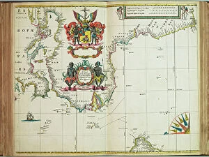
A chart of the seacoasts from the Landsend of England to Cape Bona Esperanca, 1675 (engraving)
7340048 A chart of the seacoasts from the Landsend of England to Cape Bona Esperanca, 1675 (engraving) by Seller, John (1632-97); 45x55.5 cm; National Maritime Museum, London

Background imageMaps Collection: 13828220

13828220

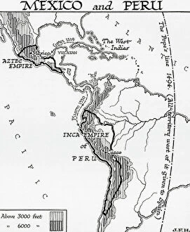
Map of Mexico and Peru, showing the Aztec Empire and the Inca Empire. (print)
7420055 Map of Mexico and Peru, showing the Aztec Empire and the Inca Empire. (print); (add.info.: Map of Mexico and Peru, showing the Aztec Empire and the Inca Empire)

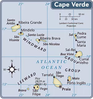
Background imageMaps Collection: Cape Verde country map

Cape Verde country map
2011 edition

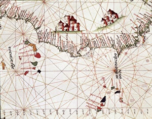
Background imageMaps Collection: Page of a marine draft representing the islands of Cape Verde, the Canary Islands, 1514

Page of a marine draft representing the islands of Cape Verde, the Canary Islands, 1514
LRI4648673 Page of a marine draft representing the islands of Cape Verde, the Canary Islands, 1514 by Unknown Artist, (16th century); Museo de America, Madrid

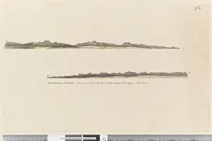
Background imageMaps Collection: Page 3 Profile of the Island of St. Jago, Cape Verde Island

Page 3 Profile of the Island of St. Jago, Cape Verde Island
5670252 Page 3 Profile of the Island of St. Jago, Cape Verde Island. Titled The Island of St Jago where the point D bears WSW distant 3 leagues

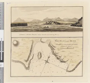
Background imageMaps Collection: Page 3a Chart of Port Praya in the Island of St Jago, Cape Verde Islands

Page 3a Chart of Port Praya in the Island of St Jago, Cape Verde Islands
5670253 Page 3a Chart of Port Praya in the Island of St Jago, Cape Verde Islands. Titled Port Praya in the Island St Jago one of the Cape de Verds sic A scale of 2 to 1/2 a mile / A View of Port

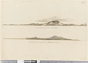
Background imageMaps Collection: Page 1 (a) Profile of the coast of the Isle of Mayo, Cape Verde Islands

Page 1 (a) Profile of the coast of the Isle of Mayo, Cape Verde Islands
5670251 Page 1 (a) Profile of the coast of the Isle of Mayo, Cape Verde Islands. (b) Profile of the coast of Isle of Mayo Cape Verde Islands, looking north west, 1768-75 (pencil)

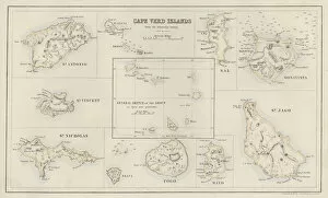
Background imageMaps Collection: Map: Cape Verd Islands, from the Admiralty Survey (colour litho)

Map: Cape Verd Islands, from the Admiralty Survey (colour litho)
6004712 Map: Cape Verd Islands, from the Admiralty Survey (colour litho) by English School, (19th century); Private Collection; (add.info.: Cape Verd Islands, from the Admiralty Survey)

Background imageMaps Collection: Attack on Santiago on 27th November 1585 (engraving)

Attack on Santiago on 27th November 1585 (engraving)
3740307 Attack on Santiago on 27th November 1585 (engraving) by Bry, Theodore de (1528-98); Private Collection; (add.info)

Background imageMaps Collection: Santiago, from Drakes West Indian Voyage 1585 - 86, pub

Santiago, from Drakes West Indian Voyage 1585 - 86, pub
2909617 Santiago, from Drakes West Indian Voyage 1585 - 86, pub. 1589 (hand coloured engraving) by Boazio, Baptista (fl.1588-1606); Private Collection; (add.info)

Background imageMaps Collection: Objects from a Nineteenth Century Captains Desk (photo)

Objects from a Nineteenth Century Captains Desk (photo)
XBP231497 Objects from a Nineteenth Century Captains Desk (photo) by American School, (19th century); Private Collection; Photo eBoltin Picture Library; American, out of copyright

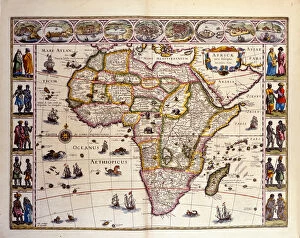
Background imageMaps Collection: Map of Africa from William Blaeus Atlas. At the top are the cities of Tangier, ceuta

Map of Africa from William Blaeus Atlas. At the top are the cities of Tangier, ceuta
GIA4804809 Map of Africa from William Blaeus Atlas. At the top are the cities of Tangier, ceuta, Algiers, Tunis, Alexandria, Alcair, Mozambique, Saint Georges de la Mina, Canary Islands

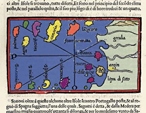
Background imageMaps Collection: Representation of the islands of Cape Verde. Isolario (map of islands

Representation of the islands of Cape Verde. Isolario (map of islands
GIA4784030 Representation of the islands of Cape Verde. Isolario (map of islands) by Benedetto Bordone. Venice 1547 by Italian School

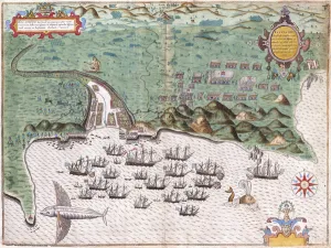
Background imageMaps Collection: View-Plan of Santiago, Cape Verde Islands, Showing Sir Francis Drake

View-Plan of Santiago, Cape Verde Islands, Showing Sir Francis Drake
985736 View-Plan of Santiago, Cape Verde Islands, Showing Sir Francis Drakes Attack on the Spanish Fort on November 17, 1585, c.1588-9 (hand-coloured engraving) by Boazio

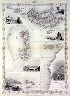
Background imageMaps Collection: Map of the islands in the Atlantic Ocean

Map of the islands in the Atlantic Ocean -- Azores or Western Isles, Madeira, Bermuda, Canary Islands, Cape Verde. Date: 1851

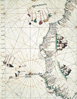
Background imageMaps Collection: Map of the West of African coast with the Islands

Map of the West of African coast with the Islands of Macaronesia, the Canary Isles and Cape Verde. 1514. Miniature Painting. PORTUGAL. Lisbon. Maritime Museum

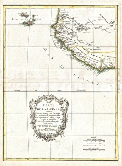
Background imageMaps Collection: 1771, Bonne Map of the Guinea Coast of West Africa and the Cape Verde Islands, Rigobert

1771, Bonne Map of the Guinea Coast of West Africa and the Cape Verde Islands, Rigobert Bonne 1727 - 1794, one of the most important cartographers of the late 18th century

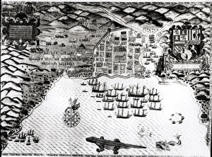
Background imageMaps Collection: Santiago, Cape Verde, 1589 (hand-coloured engraving)

Santiago, Cape Verde, 1589 (hand-coloured engraving)
BAL50935 Santiago, Cape Verde, 1589 (hand-coloured engraving) by Boazio, Baptista (fl.1588-1606); New York Public Library

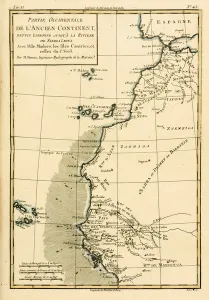
Background imageMaps Collection: West Coast of Africa, from Lisbon to Sierra Leone, from Atlas de Toutes les

West Coast of Africa, from Lisbon to Sierra Leone, from Atlas de Toutes les
KW205855 West Coast of Africa, from Lisbon to Sierra Leone, from Atlas de Toutes les Parties Connues du Globe Terrestre by Guillaume Raynal (1713-96) published Geneva

Background imageMaps Collection: Santiago, Cape Verde, 1589 (hand-coloured engraving)

Santiago, Cape Verde, 1589 (hand-coloured engraving)
XJF137055 Santiago, Cape Verde, 1589 (hand-coloured engraving) by Boazio, Baptista (fl.1588-1606); Private Collection; (add.info)

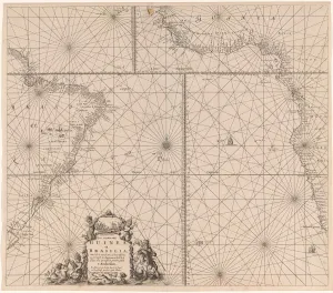
Background imageMaps Collection: Sea chart of the southern part of the Atlantic coasts of Africa and Brazil, Jan Luyken

Sea chart of the southern part of the Atlantic coasts of Africa and Brazil, Jan Luyken, Johannes van Keulen (I), unknown, 1683 - 1799

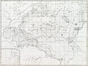
Background imageMaps Collection: Basin of the North Atlantic Ocean, 1854 C016 / 8983

Basin of the North Atlantic Ocean, 1854 C016 / 8983
Basin of the North Atlantic Ocean. 1854 edition of the first printed bathymetric map, showing seabed depths in the North Atlantic. The original data was gathered in the 1830s

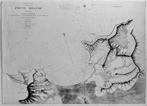
Background imageMaps Collection: Chart of Roadstead, Porto Grande, St. Vincent, Madeira, Port

Chart of Roadstead, Porto Grande, St. Vincent, Madeira, Port
A photograph taken during the voyage of H.M.S. Challenger (1872-1876) funded by the British Government for scientific purposes

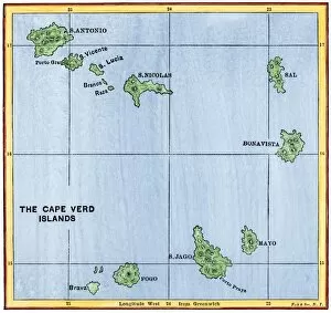
Background imageMaps Collection: Cape Verde Islands map

Cape Verde Islands map
Map of the Cape Verde Islands in the Atlantic. Hand-colored woodcut of a 19th-century illustration


All Professionally Made to Order for Quick Shipping


-

Maps Collection

Maps of Cape Verde Africa are detailed representations of the island nation located off the coast of West Africa. The maps show the country’s nine inhabited islands, as well as its two uninhabited islands. They also depict its many mountain ranges, rivers, and other geographical features. Additionally, they show major cities and towns, airports, ports and harbors, roads and highways, national parks and reserves, lighthouses, beaches and other points of interest. Maps of Cape Verde Africa provide a comprehensive overview for travelers looking to explore this beautiful archipelago in the Atlantic Ocean and are useful for those interested in learning more about the country’s history or culture.
+

Our beautiful pictures are available as Framed Prints, Photos, Wall Art and Photo Gifts

The Maps of Cape Verde Africa collection from Media Storehouse is a stunning compilation of vintage and contemporary maps that depict the archipelago nation off the coast of West Africa. Our collection features a range of maps, including topographical, political, and thematic maps that showcase the geography, history, and culture of Cape Verde. These high-quality prints are available in various sizes and formats such as canvas art prints or framed wall art. They make for an excellent addition to any home or office decor while also serving as educational resources for students and researchers interested in African geography. Whether you're looking to add some color to your living space or want to explore Cape Verde's rich heritage through its cartography, our collection has something for everyone. With its attention to detail and exceptional quality standards, it's no wonder why Media Storehouse is one of the leading providers of wall art prints online.
+

What are Maps of Cape Verde Africa art prints?

Maps of Cape Verde Africa art prints are high-quality reproductions of vintage and contemporary maps that depict the archipelago nation of Cape Verde, located off the west coast of Africa. These prints showcase the unique geography and topography of each island in stunning detail, including their coastlines, mountains, rivers, and cities. These art prints are perfect for anyone interested in history or geography, as we offer a fascinating glimpse into how Cape Verde has evolved over time. They also make great decorative pieces for homes or offices with an African theme or those looking to add a touch of sophistication to their decor. We offer a wide selection of Maps of Cape Verde Africa art prints in various sizes and formats to suit any taste or budget. Whether you're looking for a large canvas print to hang on your wall or a smaller framed print for your desk, we have something for everyone.
+

What Maps of Cape Verde Africa art prints can I buy from Media Storehouse?

We offer a wide range of Maps of Cape Verde Africa art prints that are perfect for anyone looking to add some African-inspired decor to their home or office. These maps feature detailed depictions of the islands and surrounding areas, highlighting key landmarks and geographical features. Some popular options include vintage-style maps that showcase the history and culture of Cape Verde, as well as more modern interpretations that incorporate bold colors and graphic design elements. Whether you're interested in exploring the geography of this beautiful region or simply want to add some visual interest to your space, we have a variety of Maps of Cape Verde Africa art prints to choose from. With high-quality printing techniques and durable materials, these prints are sure to make a lasting impression on any viewer. So why not browse our selection today and find the perfect map print for your needs?
+

How do I buy Maps of Cape Verde Africa art prints?

To buy Maps of Cape Verde Africa art prints from Media Storehouse, you can browse our extensive collection of artwork online. Once you have found the print that you like, simply add it to your cart and proceed to checkout. You will be prompted to enter your shipping and payment information before finalizing your purchase. We offer a wide range of sizes and framing options for their art prints, so you can customize your order to fit your specific needs. Whether you are looking for a small print to hang in your home or a large piece of artwork for an office space, they have something for everyone. Their high-quality printing process ensures that each print is vibrant and true-to-life, capturing all the beauty and detail of the original artwork. With fast shipping times and excellent customer service, buying Maps of Cape Verde Africa art prints from Media Storehouse is easy and hassle-free.
+

How much do Maps of Cape Verde Africa art prints cost?

We offer a wide range of Maps of Cape Verde Africa art prints that are available for purchase. The cost of these prints may vary depending on the size and type of print you choose. We have a variety of options to suit your preferences, including canvas prints, framed prints, and poster prints. Our Maps of Cape Verde Africa art prints are created using high-quality materials to ensure that they last for years to come. These maps showcase the stunning beauty and unique features of this beautiful African country in intricate detail. Whether you're looking for a piece to add some character to your home or office space or searching for a thoughtful gift for someone special, our Maps of Cape Verde Africa art prints are an excellent choice. With their vibrant colors and detailed designs, they're sure to make an impression wherever they're displayed.
+

How will my Maps of Cape Verde Africa art prints be delivered to me?

Your Maps of Cape Verde Africa art prints will be delivered to you in a safe and secure manner. We take great care in packaging your artwork to ensure it arrives at your doorstep in pristine condition. We use high-quality materials such as sturdy cardboard tubes or flat mailers with protective padding to prevent any damage during transit. Our delivery partners are reliable and efficient, ensuring that your order is delivered on time. You can track the progress of your shipment through our online tracking system, which provides real-time updates on the status of your delivery. We understand how important it is for you to receive your artwork promptly and without any issues. That's why we work hard to make sure that every aspect of the shipping process runs smoothly so that you can enjoy your new Maps of Cape Verde Africa art prints as soon as possible.